
Riverton in Salt Lake County, Utah — The American Mountains (Southwest)
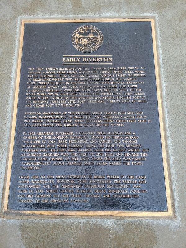
Early Riverton
Photographed by Jeremy Snow, January 2, 2026
1. Early Riverton Marker
Riverton was born of the pioneer spirit that moved men and women independently to reach out and wrestle a living from the harsh, untamed land. Many settlers spent their first year in dug-outs along the Jordan River as did the Yo Nos.
In 1855 Abraham Hunsaker, a convert from Illinois and a member of the Mormon Battalion moved his herds across the river to join Jesse Beckstead and Samuel and Thomas Butterfield who were already using the land for grazing. Abraham was the first man to own land
this page online
From 1850 to 1881 most attempts to bring water to the land were inadequate, however, some succeeded. The fertile soil responded, and the permanent expanding settlement was here to stay. Sheep cattle, alfalfa, beets, minerals, poultry, and dry farming all had their heyday and contributed greatly to the growing economy.
Erected by Sons of Utah Pioneers.
Topics and series. This historical marker is listed in these topic lists: Indigenous Peoples and Communities • Settlements & Settlers. In addition, it is included in the Sons of Utah Pioneers series list. A significant historical year for this entry is 1855.
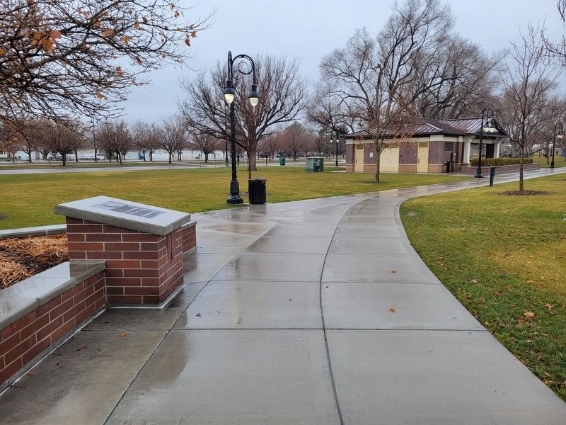
Location. 40° 31.177′ N, 111° 55.913′ W. Marker is in Riverton, Utah, in Salt Lake County. It is on South 1400 West. Marker located on the south end of the Riverton Park. Touch for map. Marker is at or near this postal address: 12700 S 1400 W, Riverton UT 84065, United States of America. Touch for directions.

Regionally,
Photographed by Jeremy Snow, January 2, 2026
2. Early Riverton Marker
Other nearby markers. At least 8 other markers are within 3 miles of this marker, measured as the crow flies: Riverton Tithing Yard Hill (about 500 feet away); a different marker also named Riverton Tithing Yard Hill (about 500 feet away); The Magnificent Dome Church (about 600 feet away); The Tithing Yard (approx. half a mile away); War Memorial (approx. 1.9 miles away); Bluffdale (approx. 1.9 miles away); Wardle Fields Regional Park (approx. 2.2 miles away); Bluffdale Veterans Memorial (approx. 2.3 miles away). Touch for a list and map of all markers in Riverton.
Another marker is no longer nearby. Early Riverton and the Magnificent Dome Church (was about 400 feet away, measured in a direct line but has been permanently removed).
Credits. This page was last revised on January 3, 2026. It was originally submitted on January 2, 2026, by Jeremy Snow of Cedar City, Utah. This page has been viewed 39 times since then. Photos: 1, 2. submitted on January 2, 2026, by Jeremy Snow of Cedar City, Utah. • Andrew Ruppenstein was the editor who published this page.
