
Near Winslow in Navajo County, Arizona — The American Mountains (Southwest)
Winslow – Toreva Highway
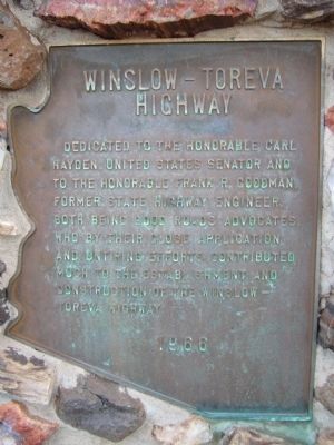
Photographed by Bill Kirchner, September 20, 2010
1. Winslow – Toreva Highway Marker
Erected 1966.
Topics. This historical marker is listed in this topic list: Roads & Vehicles.
Location. Marker has been permanently removed. It was located near 35° 9.138′ N, 110° 28.169′ W. Marker was near Winslow, Arizona, in Navajo County. It was at the intersection of Arizona Route 87 at milepost 360 and Painted Desert Rim Drive, on the left when traveling north on Arizona Route 87. Touch for map. Marker was at or near this postal address: 1646 Painted Desert Rim Dr, Winslow AZ 86047, United States of America.
We have been informed that this marker is no longer there and will not be replaced. This page is an archival view of what was.
Regionally, this marker was in Arizona’s Hopi. It was also in the American Southwest, in the Mountain West, in Colorado

this page online
Other nearby markers. At least 8 other markers are within 11 miles of this location, measured as the crow flies: East Plaza (approx. 10.8 miles away); Central Plaza (approx. 10.9 miles away); Vandalized Kiva (approx. 10.9 miles away); Paayu (approx. 10.9 miles away); Nuvatukya'ovi (approx. 10.9 miles away); Kiva - Underground House (approx. 10.9 miles away); Homol'ovi II (approx. 10.9 miles away); Illegal Digging (approx. 10.9 miles away). Touch for a list and map of all markers in Winslow.
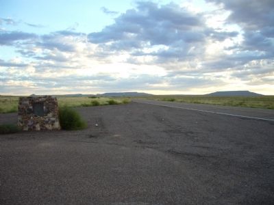
Photographed by Bill Kirchner, September 20, 2010
2. Winslow – Toreva Highway Marker
Credits. This page was last revised on January 5, 2026. It was originally submitted on September 29, 2010, by Bill Kirchner of Tucson, Arizona. This page has been viewed 946 times since then and 40 times this year. Last updated on January 2, 2026, by Jimmy Emerson of Dalton, Georgia. Photos: 1, 2. submitted on September 29, 2010, by Bill Kirchner of Tucson, Arizona. • Devry Becker Jones was the editor who published this page.
