Dumfries in Prince William County, Virginia — The American South (Mid-Atlantic)
History at Dumfries
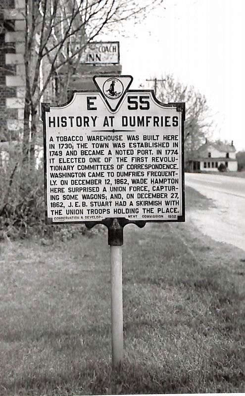
circa 1949
1. History at Dumfries Marker
Erected 1932 by Virginia Conservation and Development Commission. (Marker Number E-55.)
Topics. This historical marker is listed in these topic lists: Settlements & Settlers • War, US Civil. A significant historical date for this entry is December 12, 1862.
Location. Marker has been permanently removed. It was located near 38° 34.131′ N, 77° 19.395′ W. Marker was in Dumfries, Virginia, in Prince William County. It was on Main Street just north of Colonial Street. Touch for map. Marker was at or near this postal address: 17674 Main Street, Dumfries VA 22026, United States of America.
We have been informed that this marker is no longer there and will not be replaced. This page is an archival view of what was.
Regionally, this marker was in the Washington Metropolitan Area, in Northern Virginia, and in the Piedmont. It was also in the American South, specifically in the Upper South, in the Mid-Atlantic, and on the Eastern Seaboard. Globally, it was in the North Atlantic Region, North America, the Western Hemisphere, the Western World, and the Anglosphere. Historically, it found itself in what was once the territory of the Mississippian Culture, one of the original Thirteen Colonies, one of the Confederate States of America, and the Antebellum South.

Other nearby markers. At least 8 other markers are within walking distance of this location: Dumfries - Love’s Tavern (a few steps from this marker);
this page online
Another marker is no longer nearby. Colonial Dumfries - Williams Ordinary (was a few steps from this marker but has been confirmed missing).
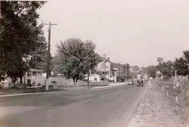
Photographed by J. K. Hillers, circa August 1937
2. History at Dumfries Marker
The marker and Williams Ordinary, then bearing the name of "Stagecoach Inn," are center left in this photograph.
Credits. This page was last revised on January 3, 2026. It was originally submitted on January 3, 2026, by Kevin W. of Stafford, Virginia. This page has been viewed 61 times since then. Photos: 1, 2. submitted on January 3, 2026, by Kevin W. of Stafford, Virginia.
