Dana Point in Orange County, California — The American West (Pacific Coastal)
Moon Tree

Photographed by Adam Margolis, January 3, 2026
1. Moon Tree Marker
Although the Giant Sequoia Moon Tree is small now, it can grow to be between 250 and 300 feet tall with a circumference of over 94 feet.
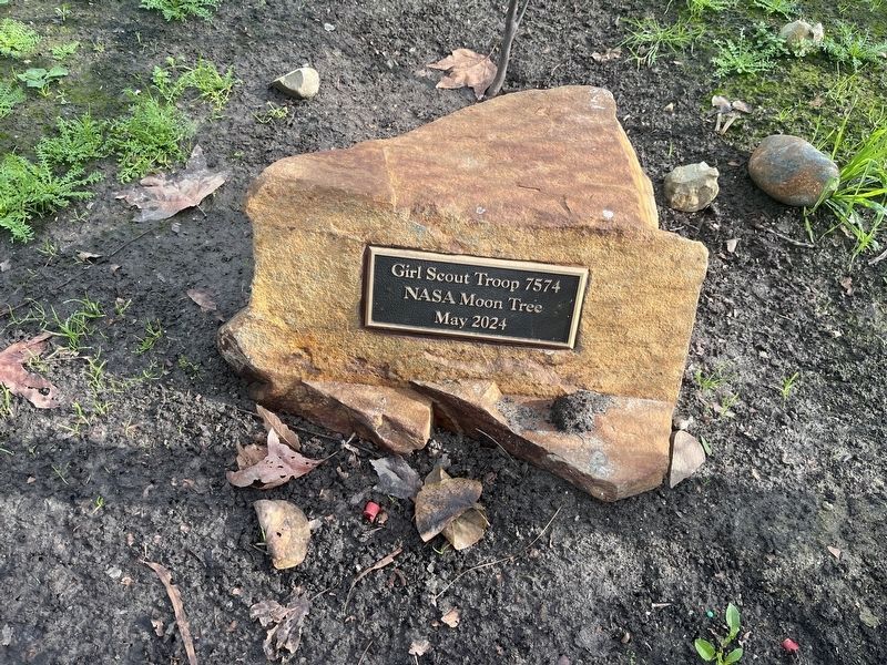
In October of 2023, Girl Scout Troop 7574 partnered with the City of Dana Point and applied for a Moon Tree through NASA. Once their application was selected, the seedling was sent from a USDA nursery in Idaho to Dana Point and planted in May 2024.
Erected 2024.
Topics and series. This historical marker is listed in these topic lists: Air & Space • Horticulture & Forestry • Women. In addition, it is included in the Historic Trees series list. A significant historical month for this entry is May 2024.
Location. 33° 28.862′ N, 117° 42.308′ W. Marker is in Dana Point, California, in Orange County. It is on Antilles
this page online

Regionally, this marker is in Greater Los Angeles and in the Peninsular Ranges. It is also on the American Pacific Coast. Globally, it is in North America, on the Ring of Fire, on the Pacific Rim, in the Western Hemisphere, in the Western World, and in the Anglosphere. Historically, it finds itself in what was once New Spain and also Mexico’s Alta California.
Other nearby markers. At least 8 other markers are within 2 miles of this marker, measured as the crow flies: Telephone Office (approx. one mile away); The History Beneath Your Feet: Concrete Curb and Sidewalk Stamps (approx. 1.1 miles away); Auditorium (approx. 1.1 miles away); Dana Point (approx. 1.2 miles away); Dana Point Inn (approx. 1.2 miles away); a different marker also named Dana Point (approx. 1.2 miles away); Harbor/Pilgrim (approx. 1.2 miles away); Dana Point Elevator (approx. 1.3 miles away). Touch for a list and map of all markers in Dana Point.

Photographed by Adam Margolis, January 3, 2026
2. Moon Tree and plaque
Photographed by Adam Margolis, January 3, 2026
3. Moon Tree plaque
Credits. This page was last revised on January 4, 2026. It was originally submitted on January 3, 2026, by Adam Margolis of Mission Viejo, California. This page has been viewed 91 times since then. Photos: 1, 2, 3. submitted on January 3, 2026, by Adam Margolis of Mission Viejo, California. • Andrew Ruppenstein was the editor who published this page.
