Port Gibson in Claiborne County, Mississippi — The American South (East South Central)
Preservation Efforts
Photographed by Cajun Scrambler, December 28, 2025
1. Preservation Efforts Marker
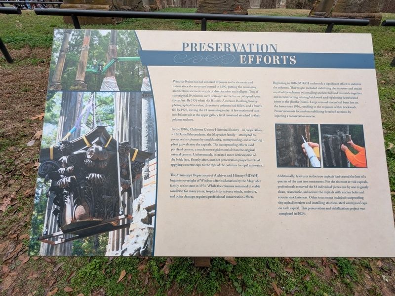
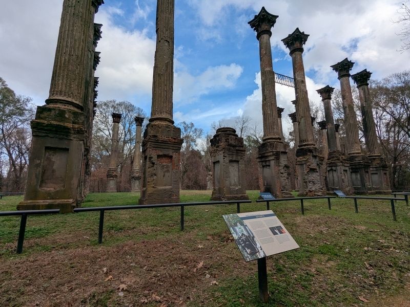
Windsor Ruins has had constant exposure to the elements and nature since the structure burned in 1890, putting the remaining architectural elements at risk of deterioration and collapse. Two of the original 29 columns were destroyed in the fire or collapsed soon thereafter. By 1936 when the Historic American Building Survey photographed the ruins, three more columns had fallen, and a fourth fell by 1970, leaving the 23 remaining today. A few sections of cast iron balustrade at the upper gallery level remained attached to their column anchors.
In the 1970s, Claiborne County Historical Society-in coopération with Daniell descendants, the Magruder family attempted to preserve the columns by sandblasting, waterproofing, and removing plant growth atop the capitals. The waterproofing efforts used portland cement, a much more rigid material than the original natural cement. Unfortunately, it created more deterioration of the brick face. Shortly after, another preservation project involved applying concrete caps to the tops of the columns to repel rainwater.
The Mississippi Department of Archives and History (MDAH) began
this page online
Beginning in 2016, MDAH undertook a significant effort to stabilize the columns. This project included stabilizing the masonry and stucco on all of the columns by installing anchors to bond materials together and reconstructing missing brickwork and repointing deteriorated joints in the plinths (bases). Large areas of stucco had been lost on the bases since 1936, resulting in the exposure of this brickwork. Preservationists focused on stabilizing detached sections by injecting a conservation mortar.
Additionally, fractures in the iron capitals had caused the loss of a quarter of the cast iron ornaments. For the six most at-risk capitals, professionals removed the 84 individual pieces one by one to gently clean, reassemble, and secure the capitals with anchor bolts and countersink fasteners. Other treatments included rustproofing the capital interiors and installing stainless-steel
Photographed by Cajun Scrambler, December 28, 2025
2. Preservation Efforts Marker
Topics. This historical marker is listed in these topic lists: Architecture • Parks & Recreational Areas. A significant historical year for this entry is 1890.
Location. 31° 56.429′ N, 91° 7.784′ W. Marker is in Port Gibson, Mississippi, in Claiborne County. It is on Rodney Road. Touch for map. Marker is at or near this postal address: 15096 Rodney Rd, Port Gibson MS 39150, United States of America. Touch for directions.

Regionally, this marker is in Southwest Mississippi, in Natchez Trace Corridor, and in Greater Jackson. It is also in the American South, specifically in the Deep South, and in the Great River Road Region. Globally, it is in North America, a Gulf of Mexico state, the Western Hemisphere, the Western World, and the Anglosphere. Historically, it finds itself in what was once New Spain, the territory of the Mississippian Culture, one of the Confederate States of America, and the Antebellum South.
Other nearby markers. At least 8 other markers are within 3 miles of this marker, measured as the crow flies: Windsor Laborers (within shouting distance of this marker); Windsor and The Civil War (within shouting distance of this marker); A Luxury Home (within shouting distance of this marker); Windsor Historic Legacy (within shouting distance of this marker); The Land and People Before Windsor (within shouting distance of this marker); Windsor Mounds (approx. 0.4 miles away); Battle of Port Gibson – Grant’s March (approx. 2.4 miles away); Battle of Port Gibson – The Battle (approx. 2.4 miles away). Touch for a list and map of all markers in Port Gibson.
Another marker is no longer nearby. Windsor Ruins (was within shouting distance of this marker but has been replaced with another marker now near it).
Credits. This page was last revised on March 3, 2026. It was originally submitted on January 4, 2026, by Cajun Scrambler of Assumption, Louisiana. This page has been viewed 61 times since then. Photos: 1, 2. submitted on January 4, 2026, by Cajun Scrambler of Assumption, Louisiana.
