Marker Logo
THE HISTORICAL
MARKER DATABASE
“Bite-Size Bits of Local, National, and Global History”
Central Ward in Newark in Essex County, New Jersey — The American Northeast (Mid-Atlantic)
 

Saint John's Church

Historic Site
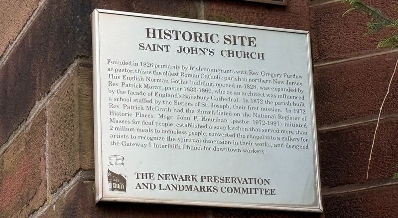
 
 
Saint John's Church Marker image. Click for full size.
Photographed by Devry Becker Jones (CC0), January 2, 2026
1. Saint John's Church Marker
Inscription. Founded in 1826 primarily by Irish immigrants with Rev. Gregory Pardow as pastor, this is the oldest Roman Catholic parish in northern New Jersey. This English Norman Gothic building, opened in 1828, was expanded by Rev. Patrick Moran, pastor 1833-1866, who as an architect was influenced by the facade of England's Salisbury Cathedral. In 1872 the parish built a school staffed by the Sisters of St. Joseph, their first mission. In 1972 Rev. Patrick McGrath had the church listed on the National Register of Historic Places. Msgr. John P. Hourihan (pastor 1972-1997) initiated Masses for deaf people, established a soup kitchen that served more than 2 million meals to homeless people, converted the chapel into a gallery for artists to recognize the spiritual dimension of their works, and designed the Gateway I Interfaith Chapel for downtown workers.
 
Erected by The Newark Preservation and Landmarks Committee.
 
Topics. This historical marker is listed in these topic lists: ArchitectureEducationImmigrationReligion & Religious Structures. A significant historical year for this entry is 1826.
 
Location. 40° 44.289′ N, 74° 9.965′ W.
Paid Advertisement
Click or scan to see
this page online
Marker is in Newark, New Jersey, in Essex County. It is in the Central Ward. It can be reached from McCarter Highway (New Jersey Route 21) south of Center Street, on the right when traveling south. Touch for map. Marker is at or near this postal address: 871 McCarter Hwy, Newark NJ 07102, United States of America. Touch for directions.

Regionally, this marker is in North Jersey and in the New York City Metropolitan Area. It is also in the American Northeast, in the Mid-Atlantic, and on the Eastern Seaboard. Globally, it is in the North Atlantic Region, North America, the Western Hemisphere, the Western World, and the Anglosphere. Historically, it finds itself in what was once New Netherland and also one of the original Thirteen Colonies.

Other nearby markers. At least 8 other markers are within walking distance of this marker: Sisters of Saint Joseph (here, next to this marker); Reverend Monsignor John P. Hourihan (here, next to this marker); World War Memorial (here, next to this marker); St. John's Roman Catholic Church (here, next to this marker); Cudjo Banquante (about 500 feet away, measured in a direct line); Chambers Plaza
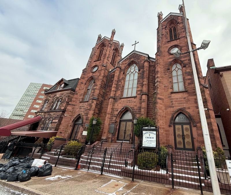
St. John's Roman Catholic Church image. Click for full size.
Photographed by Devry Becker Jones (CC0), January 2, 2026
2. St. John's Roman Catholic Church
(about 700 feet away); The Founders (about 800 feet away); Robert Treat (about 800 feet away). Touch for a list and map of all markers in Newark.
 
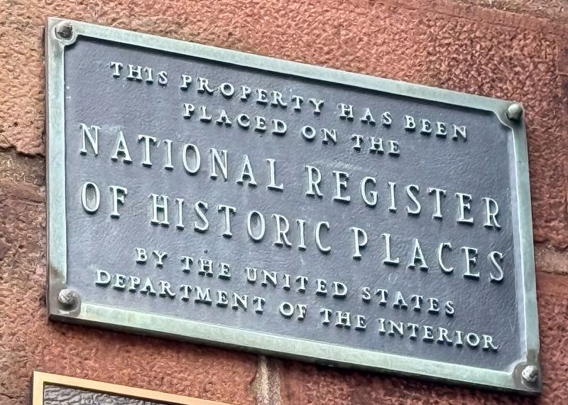
National Register of Historic Places plaque on the church building image. Click for full size.
Photographed by Devry Becker Jones (CC0)
3. National Register of Historic Places plaque on the church building
 
 
Credits. This page was last revised on January 4, 2026. It was originally submitted on January 4, 2026, by Devry Becker Jones of Washington, District of Columbia. This page has been viewed 111 times since then. Photos:   1, 2, 3. submitted on January 4, 2026, by Devry Becker Jones of Washington, District of Columbia.

m=291185

CeraNet Cloud Computing sponsors the Historical Marker Database.
This website earns income from purchases you make after using our links to Amazon.com. We appreciate your support.
Paid Advertisement
Jul. 26, 2026