Mechanicsville in Hanover County, Virginia — The American South (Mid-Atlantic)
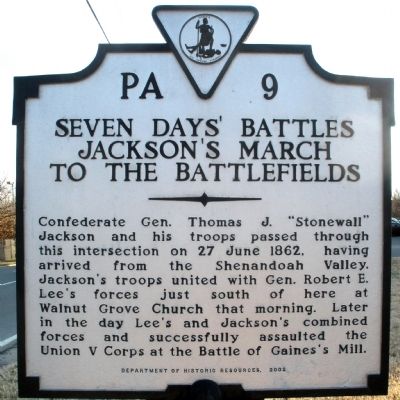
Seven Days' Battles
Jackson's March to the Battlefields
Photographed by Bernard Fisher, January 20, 2009
1. Seven Days' Battles Marker
Erected 2002 by Department of Historic Resources. (Marker Number PA-9.)
Topics and series. This historical marker is listed in this topic list: War, US Civil. In addition, it is included in the Virginia Department of Historic Resources (DHR) series list. A significant historical date for this entry is June 27, 1862.
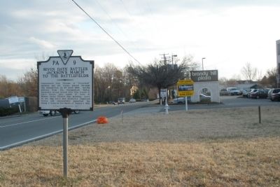
Location. Marker has been reported missing. It was located near 37° 36.661′ N, 77° 20.362′ W. Marker was in Mechanicsville, Virginia, in Hanover County. It was on Lee Davis Road (State Highway 156) 0.1 miles south of Mechanicsville Turnpike (U.S. 360), on the right when traveling south. Touch for map. Marker was in this post office area: Mechanicsville VA 23111, United States of America. Touch for directions.

Regionally,
this page online
Other nearby markers. At least 8 other markers are within 2 miles of this location, measured as the crow flies: Walnut Grove Church (approx. ¾ mile away); a different marker also named Seven Days Battles (approx. 0.8 miles away); "Liberty Hall" (approx. 0.8 miles away); a different marker also named Seven Days Battles (approx. 0.9 miles away); Battle of Cold Harbor (approx. 1.2 miles away); Ellerson's Mill (approx. 1.4 miles away); a different marker also named Seven Days Battles (approx. 1½ miles away); Beaver Dam Creek (approx. 1½ miles away). Touch for a list and map of all markers in Mechanicsville.
Photographed by Bernard Fisher, January 20, 2009
2. Facing south on Lee Davis Rd
Credits. This page was last revised on January 5, 2026. It was originally submitted on January 19, 2009, by Bernard Fisher of Richmond, Virginia. This page has been viewed 1,527 times since then and 62 times this year. Last updated on January 4, 2026, by Evan Dwyer of Richmond, Virginia. Photos: 1, 2. submitted on January 19, 2009, by Bernard Fisher of Richmond, Virginia.
