Valley Creek Estuary Park in Port Angeles in Clallam County, Washington — The American West (Northwest)
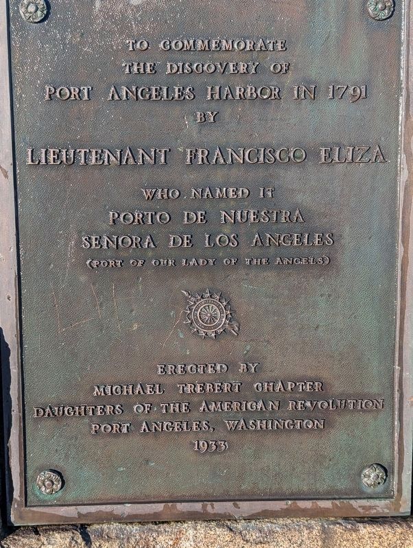
Discovery of Port Angeles Harbor
Courtesy of Michael Trebert Chapter, January 17, 2026
1. Discovery of Port Angeles Harbor Marker
Erected 1934 by Michael Trebert Chapter, National Society Daughters of the American Revolution (NSDAR).
Topics and series. This historical marker is listed in these topic lists: Exploration • Waterways & Vessels. In addition, it is included in the Daughters of the American Revolution (DAR) series list. A significant historical year for this entry is 1791.
Location. 48° 7.292′ N, 123° 26.151′ W. Marker is in Port Angeles, Washington, in Clallam County. It is in Valley Creek Estuary Park. It is on West Front Street west of North Oak Street, on the right when traveling west. This marker is also referred to as the "Upper Lincoln Street marker" by DAR members. Touch for map. Marker is at or near this postal address: 240 W Front St, Port Angeles WA 98362, United States of America. Touch for directions.

Regionally, this marker is in the Olympic Peninsula. It is also on the American Pacific Coast, in the Pacific Northwest, and in the Lewis & Clark
this page online
Other nearby markers. At least 6 other markers are within 5 miles of this marker, measured as the crow flies: President Lincoln Reserved This Building Site (about 700 feet away, measured in a direct line); President Lincoln (approx. 0.4 miles away); Pioneers of Port Angeles (approx. 0.4 miles away); Lincoln Park (approx. 2 miles away); Spanish Explorers (approx. 4.2 miles away); Juan de Fuca (approx. 4.8 miles away).
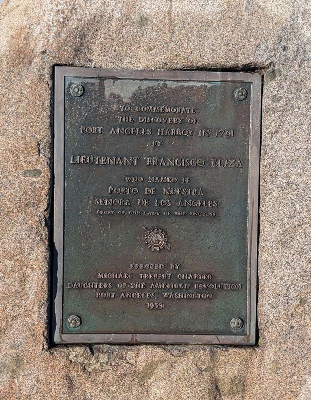
More about this marker. The marker was installed April 15, 1934 and moved after 74 years. The DAR insignia is included on the marker, which consists of a bronze plaque mounted on a granite boulder, originally placed at the corner of Lincoln Street and Lauridsen Boulevard in Port Angeles. Its current location is along the Olympic Discovery Trail.
Regarding Discovery of Port Angeles Harbor. The phrase El Puerto de Nuestra Senora de Los Angeles means Port of Our Lady of the Angels. It was later shortened to Port Angeles. Francisco de Eliza y Reventa (1759–1825) was a Spanish

2. Discovery of Port Angeles Harbor Marker
This is the marker at its old location, before its 2007 move.
The Soroptimists International of Port Angeles (Noon Club) and the Michael Trebert Chapter, NSDAR sought and received the required permission of NSDAR national headquarters to move the marker to its new location. In this four-year project they raised funds for the move and solicited donations of time, materials, and labor.
According to the Peninsula Daily News, “The rededication ceremony will include the Junior ROTC color guard, the singing of the national anthem by Sarah Shea and comments by Luis Fernando Esteban, Spain's honorary vice consul for Washington state... Flagpoles near the marker display replicas of a historical 15-star United States flag from 1791, a Spanish flag from the era of de Eliza's voyages, and DAR and Soroptimist flags.”
Reference: “Ceremony Saturday relocates monument to Port Angeles Harbor's founding,”

3. Discovery of Port Angeles Harbor Marker
At its Valley Creek Estuary Park location in downtown Port Angeles.
Courtesy of Michael Trebert Chapter, January 17, 2026
4. Discovery of Port Angeles Harbor Marker
This photo shows how the tablet is embedded in the rock.
Credits. This page was last revised on February 1, 2026. It was originally submitted on January 4, 2026, by Shirley A Stirling of Lacey, Washington. This page has been viewed 82 times since then. Photos: 1. submitted on January 31, 2026, by Shirley A Stirling of Lacey, Washington. 2. submitted on January 4, 2026, by Shirley A Stirling of Lacey, Washington. 3. submitted on January 5, 2026, by Shirley A Stirling of Lacey, Washington. 4. submitted on January 31, 2026, by Shirley A Stirling of Lacey, Washington. • Devry Becker Jones was the editor who published this page.
