
Jordan Station in Lincoln in Niagara Region, Ontario — Central Canada (North America)
Snure General Store and Toll House
Photographed by Tim Boyd, January 8, 2026
1. Sure General Store and Toll House Marker
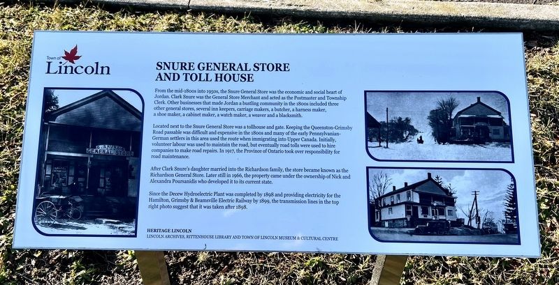
From the mid-1800s into 1950s, the Snure General Store was the economic and social heart of Jordan. Clark Snure was the General Store Merchant and acted as the Postmaster and Township Clerk. Other businesses that made Jordan a bustling community in the 1800s included three other general stores, several inn keepers, carriage makers, a butcher, a harness maker, a shoe maker, a cabinet maker, a watch maker, a weaver and a blacksmith.
Located next to the Saure General Store was a tollhouse and gate. Keeping the Queenston-Grimsby Road passable was difficult and expensive in the 1800s and many of the early Pennsylvanian-German settlers in this area used the route when immigrating into Upper Canada. Initially, volunteer labour was used to maintain the road, but eventually road tolls were used to hire companies to make road repairs. In 1917, the Province of Ontario took over responsibility for road maintenance.
After Clark Snure's daughter married into the Richardson family, the store became known as the Richardson General Store. Later still in 1966, the property came under the ownership of Nick and Alexandra Poursanidis
this page online
Since the Decew Hydroelectric Plant was completed by 1898 and providing electricity for the Hamilton, Grimsby & Beamsville Electric Railway by 1899, the transmission lines in the top right photo suggest that it was taken after 1898.
Erected by Heritage Lincoln.
Topics. This historical marker is listed in these topic lists: Industry & Commerce • Roads & Vehicles. A significant historical year for this entry is 1917.
Location. 43° 8.655′ N, 79° 22.128′ W. Marker is in Lincoln, Ontario, in Niagara Region. It is in Jordan Station. It is at the intersection of Nineteenth Street and King Street, on the right when traveling south on Nineteenth Street. Touch for map. Marker is at or near this postal address: 3720 Nineteenth Street, Lincoln ON L0R 1S0, Canada. Touch for directions.

Regionally, this marker is on Ontario’s Golden Horseshoe and in Niagara Canada. It is also in Central Canada. Globally, it is in North America, the Western Hemisphere, the Western World, and the Anglosphere. Historically, it finds itself in what was once a British colony, the Viceroyalty of

Photographed by Tim Boyd, January 8, 2025
2. Sure General Store and Toll House Marker
Centre of photo
Other nearby markers. At least 8 other markers are within walking distance of this marker: The Jordan House (about 90 meters away, measured in a direct line); Tailor Shop & Emporium (about 90 meters away); Jacob Fry House 1815 (approx. 0.4 kilometers away); The Farr Cottage (approx. 0.4 kilometers away); Jordan Mennonite (Haines) Cemetery circa 1840 (approx. 0.4 kilometers away); First Mennonite Settlement / Le Premier Établissement Mennonite (approx. 0.4 kilometers away); Neutral Nation (approx. 0.4 kilometers away); 1953-2003 In Celebration Of The 50th Anniversary (approx. 0.4 kilometers away). Touch for a list and map of all markers in Lincoln.
Photographed by Tim Boyd, January 8, 2025
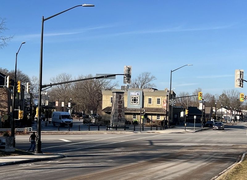
3. Jordan Village (just north of the marker), in 2026
Credits. This page was last revised on January 11, 2026. It was originally submitted on January 9, 2026, by Tim Boyd of Hamilton, Ontario. This page has been viewed 76 times since then. Last updated on January 9, 2026, by Tim Boyd of Hamilton, Ontario. Photos: 1, 2, 3. submitted on January 9, 2026, by Tim Boyd of Hamilton, Ontario. • Devry Becker Jones was the editor who published this page.
