McLean in Fairfax County, Virginia — The American South (Mid-Atlantic)
Robert Gunnell and Gunnell's Chapel
Photographed by Devry Becker Jones (CC0), January 9, 2026
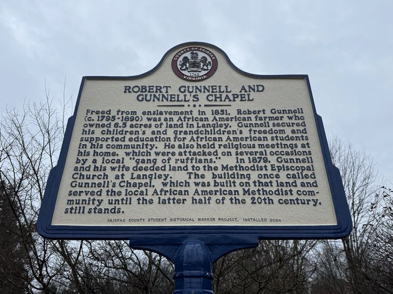
1. Robert Gunnell and Gunnell's Chapel Marker
Freed from enslavement in 1851, Robert Gunnell (c. 1795-1890) was an African American farmer who owned 6.5 acres of land in Langley. Gunnell secured his children's and grandchildren's freedom and supported education for African American students in his community. He also held religious meetings in his home, which were attacked on several occasions by a local "gang of ruffians." In 1879, Gunnell and his wife deeded land to the Methodist Episcopal Church at Langley. The building once called Gunnell's Chapel, which was built on that land and served the local African American Methodist community until the latter half of the 20th century, still stands.
Erected 2024 by Fairfax County Student Historical Marker Project, Fairfax County History Commission.
Topics and series. This historical marker is listed in these topic lists: African Americans • Agriculture • Education • Religion & Religious Structures. In addition, it is included in the Virginia, Fairfax County History Commission series list. A significant historical year for this entry is 1851.
Location. 38° 56.746′ N, 77° 9.361′ W. Marker is in McLean, Virginia,
this page online

Regionally, this marker is in the Washington Metropolitan Area and in Northern Virginia. It is also in the American South, specifically in the Upper South, in the Mid-Atlantic, and on the Eastern Seaboard. Globally, it is in the North Atlantic Region, North America, the Western Hemisphere, the Western World, and the Anglosphere. Historically, it finds itself in what was once the territory of the Mississippian Culture, one of the original Thirteen Colonies, one of the Confederate States of America, and the Antebellum South.
Other nearby markers. At least 8 other markers are within 2 miles of this marker, measured as the crow flies: Langley Fork (about 300 feet away, measured in a direct line); Clemyjontri (about 500 feet away); Who Was Claude Moore? (approx. 0.4 miles away); Salona (approx. 1.1 miles away); Benvenue (approx. 1.2 miles away); McLean (approx.

Photographed by Devry Becker Jones (CC0), January 9, 2026
2. Robert Gunnell and Gunnell's Chapel Marker standing at the entrance to Clemyjontri Park in McLean
Credits. This page was last revised on January 9, 2026. It was originally submitted on January 9, 2026, by Devry Becker Jones of Washington, District of Columbia. This page has been viewed 95 times since then. Photos: 1, 2. submitted on January 9, 2026, by Devry Becker Jones of Washington, District of Columbia.
