Near Walhalla in Oconee County, South Carolina — The American South (South Atlantic)
SW Middle Tunnel
Photographed by Tom Bosse, January 3, 2026
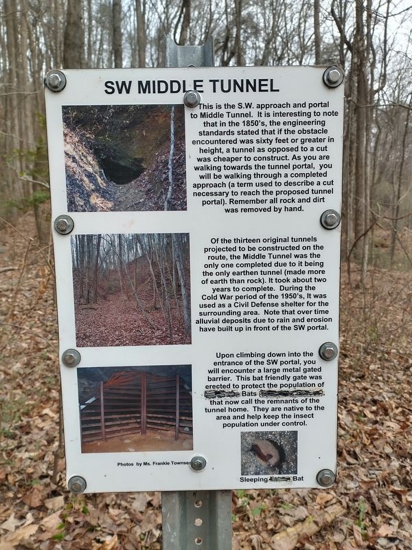
1. SW Middle Tunnel Marker
Of the thirteen original tunnels projected to be constructed on the route, the Middle Tunnel was the only one completed due to it being the only earthen tunnel (made more of earth than rock). It took about two years to complete. During the Cold War period of the 1950's, it was used as a Civil Defense shelter for the surrounding area. Note that over time alluvial deposits due to rain and erosion have built up in front of SW portal.
Upon climbing down into the entrance of the SW portal, you will encounter a large metal gated barrier. This bat friendly gate was erected to protect the population of (illegible) Bats (illegible) that now call the remnants of the tunnel home. They are native to
this page online
(caption) Sleeping (illegible) Bat
Photos by Ms. Frankie Townsend
Topics. This historical marker is listed in these topic lists: Railroads & Streetcars • War, Cold.
Location. 34° 48.482′ N, 83° 6.851′ W. Marker is near Walhalla, South Carolina, in Oconee County. It can be reached from Stumphouse Tunnel Road 0.4 miles east of South Carolina Route 28, on the right when traveling north. This marker is located along the Blue Ridge Railroad Historical Trail within the Stumphouse Mountain Bike Park. Touch for map. Marker is in this post office area: Walhalla SC 29691, United States of America. Touch for directions.

Regionally, this marker is in andspecifically pstate, in the Foothills, in the Golden Corner. It is also in the American South, specifically in the Deep South, in Appalachia, and specifically in Southern Appalachia. Globally, it is in North America, the Western Hemisphere, the Western World, and the Anglosphere. Historically, it finds itself in what was once the original Cherokee Nation, the territory

Photographed by Tom Bosse, January 3, 2026
2. SW Middle Tunnel Marker
Other nearby markers. At least 8 other markers are within walking distance of this marker: Stumphouse Mountain Middle Tunnel (here, next to this marker); NE Middle Tunnel (about 500 feet away, measured in a direct line); Issaqueena Falls (approx. 0.3 miles away); South Carolina National Heritage Corridor (approx. 0.4 miles away); a different marker also named Issaqueena Falls (approx. 0.4 miles away); Stumphouse Mountain Tunnel (approx. half a mile away); Stumphouse Tunnel (approx. 0.6 miles away); Andrew Pickens Ranger District / Oconee County (approx. 0.8 miles away). Touch for a list and map of all markers in Walhalla.
Related markers. Click here for a list of markers that are related to this marker.

Photographed by Tom Bosse, January 3, 2026
3. SW Middle Tunnel Entrance

Photographed by Tom Bosse, January 3, 2026
4. SW Middle Tunnel Entrance

Photographed by Tom Bosse, January 3, 2026
5. SW Middle Tunnel Entrance View from Inside the Tunnel.

Photographed by Tom Bosse, January 3, 2026
6. SW Middle Tunnel
Credits. This page was last revised on January 19, 2026. It was originally submitted on January 10, 2026, by Tom Bosse of Jefferson City, Tennessee. This page has been viewed 45 times since then. Photos: 1, 2, 3, 4, 5, 6. submitted on January 10, 2026, by Tom Bosse of Jefferson City, Tennessee. • Bernard Fisher was the editor who published this page.
