
Near Walhalla in Oconee County, South Carolina — The American South (South Atlantic)
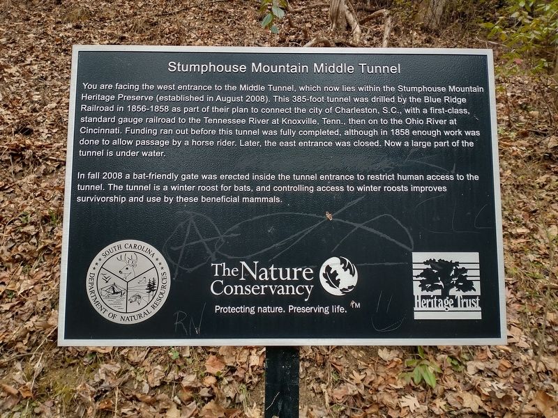
Stumphouse Mountain Middle Tunnel
Photographed by Tom Bosse, January 3, 2026
1. Stumphouse Mountain Middle Tunnel Marker
In fall 2008 a bat-friendy gate was erected inside the tunnel entrance to restrict human access to the tunnel. The tunnel is a winter roost for bats,, and controlling access to winter roosts improves survivorship and use by these beneficial mammals.
Erected by The Nature Conservancy.
Topics. This historical marker is listed in these topic lists: Environment • Railroads & Streetcars. A significant historical year for this entry is 1856.
Location. 34° 48.483′ N, 83° 6.85′ W. Marker is near Walhalla,
this page online

Regionally, this marker is in South Carolina’s and pstate, in the Foothills, in the Golden Corner. It is also in the American South, specifically in the Deep South, in Appalachia, and specifically in Southern Appalachia. Globally, it is in North America, the Western Hemisphere, the Western World, and the Anglosphere. Historically, it finds itself in what was once the original Cherokee Nation, the territory of the Mississippian Culture, one of the original Thirteen Colonies, one of the Confederate States of America, and the Antebellum South.
Other nearby markers. At least 8 other markers are within walking distance of this marker: SW Middle Tunnel (here, next to this marker); NE Middle Tunnel (about 500 feet away, measured in a direct

Photographed by Tom Bosse, January 3, 2026
2. Stumphouse Mountain Middle Tunnel Marker
Related markers. Click here for a list of markers that are related to this marker.

Photographed by Tom Bosse, January 3, 2026
3. Stumphouse Mountain Middle Tunnel Entrance

Photographed by Tom Bosse, January 3, 2026
4. Stumphouse Mountain Middle Tunnel Entrance

Photographed by Tom Bosse, January 3, 2026
5. Stumphouse Mountain Middle Tunnel Entrance as Viewed from Inside the Tunnel.

Photographed by Tom Bosse, January 3, 2026
6. Stumphouse Mountain Middle Tunnel
Credits. This page was last revised on January 19, 2026. It was originally submitted on January 10, 2026, by Tom Bosse of Jefferson City, Tennessee. This page has been viewed 61 times since then. Photos: 1, 2, 3, 4, 5, 6. submitted on January 10, 2026, by Tom Bosse of Jefferson City, Tennessee. • Bernard Fisher was the editor who published this page.
