Franklin in Macon County, North Carolina — The American South (South Atlantic)
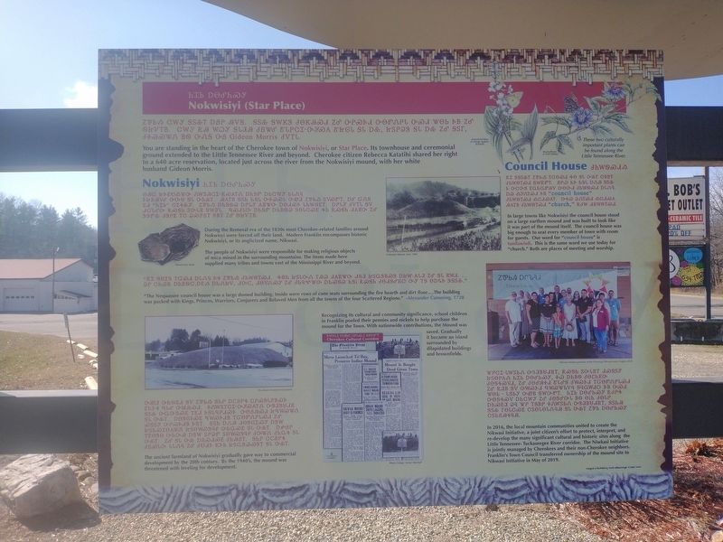
Nokwisiyi (Star Place)
Photographed by Tom Bosse, January 4, 2026
1. Nokwisiyi (Star Place) Marker
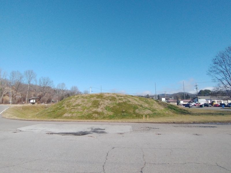
You are standing in the heart of the Cherokee town of Nokwisiyi, or Star Place. Its townhouse and ceremonial ground extended to the Little Tennessee River and beyond. Cherokee citizen Rebecca Katatihi shared her right to a 640 acre reservation, located just across the river from the Nokwisiyi mound, with her white husband Gideon Morris.
Nokwisiyi
During the Removal era of the 1830s most Cherokee-related families around Nokwisiyi were forced off their land. Modern Franklin encompasses historic Nokwisiyi, or its anglicized name, Nikwasi.
The people of Nokwisiyi were responsible for making religious objects of mica mined in the surrounding mountains. The items made here supplied many tribes and towns east of the Mississippi River and beyond.
"The Nequassee council house was a large domed building. Inside were rows of cane seats surrounding the fire hearth and dirt floor....The building was packed with Kings, Princes, Warriors, Conjurers and Beloved Men from all the towns of the four Scattered Regions."- Alexander Cumming, 1728
The ancient farmland of Nokwisiyi gradually gave way to commercial development by
this page online
Recognizing its cultural and community significance, school children in Franklin pooled their pennies and nickels to help purchase the mound for the Town. With nationwide contributions, the Mound was saved. Gradually it became an island surrounded by dilapidated buildings and brownfields.
Council House
In large towns like Nokwisiyi the council house stood on a large earthen mound and was built to look like it was part of the mound itself. The council house was big enough to seat every member of town with room for guests. Our word for "council house" is tunilawisdi. This is the same word we use today for "church". Both are places of meeting and worship.
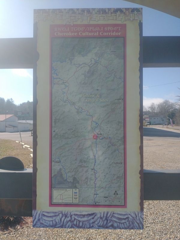
In 2016, the local mountain communities united to create the Nikwasi Initiative, a joint citizen's effort to protect, interpret, and re-develop the many significant cultural and historic sites along the Little Tennessee - Tuckaseegee River corridor. The Nikwasi Initiative is jointly managed by Cherokees and their non-Cherokee neighbors. Franklin's Town Council transferred ownership of the
Photographed by Tom Bosse, January 4, 2026
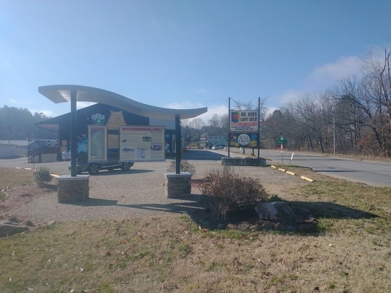
2. Nokwisiyi (Star Place) Marker
Erected 2020 by Nikwasi Initiative; designed and illustrated by David Williams / Wingin' It Works.
Topics. This historical marker is listed in these topic lists: Indigenous Peoples and Communities • Settlements & Settlers. A significant historical month for this entry is May 2019.
Location. 35° 11.117′ N, 83° 22.443′ W. Marker is in Franklin, North Carolina, in Macon County. It is at the intersection of Northeast Main Street (Business U.S. 441) and Nikwasi Lane, on the left when traveling south on Northeast Main Street. Touch for map. Marker is at or near this postal address: 198 NE Main St, Franklin NC 28734, United States of America. Touch for directions.

Regionally, this marker is in North Carolina’s and he Mountains in the Golden Corner. It is also in the American South, specifically in the Upper South, in Appalachia, and specifically in Southern Appalachia. Globally, it is in North America, the Western Hemisphere, the Western World, and the Anglosphere. Historically, it finds itself in what was once the original Cherokee Nation, the territory of the Mississippian
Photographed by Tom Bosse, January 4, 2026
3. Nikwasi Mound
Other nearby markers. At least 8 other markers are within walking distance of this marker: Na'ha or Rebecca Morris (here, next to this marker); Nikwasi (within shouting distance of this marker); Nikwasi Mound (about 300 feet away, measured in a direct line); The Bartram Trail (approx. 0.4 miles away); Main Street Milliners (approx. 0.4 miles away); Built in 1907 (approx. 0.4 miles away); William Bartram Naturalist (approx. half a mile away); The North Carolina Bartram Trail (approx. half a mile away). Touch for a list and map of all markers in Franklin.
Photographed by Tom Bosse, January 4, 2026
4. Cherokee Cultural Cooridor
Credits. This page was last revised on January 11, 2026. It was originally submitted on January 10, 2026, by Tom Bosse of Jefferson City, Tennessee. This page has been viewed 49 times since then. Photos: 1, 2, 3, 4. submitted on January 10, 2026, by Tom Bosse of Jefferson City, Tennessee. • Devry Becker Jones was the editor who published this page.
