Crawford in Delta County, Colorado — The American Mountains (Southwest)
Agriculture
Backbone of the Crawford Community
Photographed by Cosmos Mariner, July 20, 2025
1. Agriculture Marker
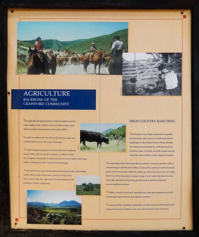
The agricultural opportunities of this beautiful area became reality as the settlers came into this country and staked out their homesteads in the early 1880's.
In order to redeem the land from the desert, water was needed and found in the major drainages.
A major irrigation project was formed by the Fruitland Land, Water and Livestock Company in 1900. In 1910 the company erected the Gould reservoir in Onion Valley with head waters coming from the Crystal Creek drainage.
A rich and diverse agricultural district developed with outstanding cattle, sheep, dairy and poultry raised in large numbers. Even to this day agriculture and ranching are the backbone of this community.
High Country Ranching
The beauty of our high mountains is greatly enhanced by open spaces of well maintained landscape in the valleys below. These productive lands are protected by working livestock ranches, many of which are still owned and operated by descendants of the original families.
The interdependence between the mountains' resources and the valley's ranches began with the first settlers. During the summer months livestock graze in the mountains
this page online
Wildlife, as well as livestock, benefit from water developments and salt and forage improvements provided by ranchers.
Tourism and the ranching community coexist; everyone showing mutual respect necessary to balance the use and renewal of our resources.
Topics. This historical marker is listed in these topic lists: Agriculture • Animals • Industry & Commerce • Settlements & Settlers. A significant historical year for this entry is 1900.
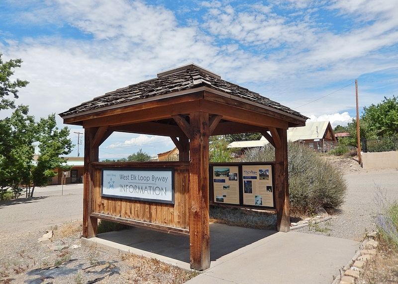
Location. 38° 42.229′ N, 107° 36.633′ W. Marker is in Crawford, Colorado, in Delta County. It is on State Highway 92 just west of F Street, on the right when traveling west. The marker is mounted in the West Elk Loop Byway interpretive kiosk in front of the Crawford Town Hall & Community Center. Touch for map. Marker is at or near this postal address: 425 Colorado Highway 92, Crawford CO 81415, United States of America. Touch for directions.

Regionally, this marker is in the Western
Photographed by Cosmos Mariner, July 20, 2025
2. Agriculture Marker
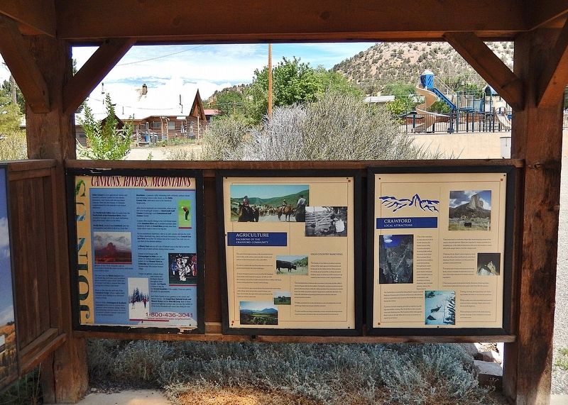
This is the center one of three panels on the north side of the West Elk Loop Byway interpretive kiosk.
Other nearby markers. At least 8 other markers are within 9 miles of this marker, measured as the crow flies: West Elk Loop (here, next to this marker); Crawford State Park (here, next to this marker); Crawford (here, next to this marker); a different marker also named West Elk Loop (approx. 8.4 miles away); Hotchkiss-Crawford Historical Museum (approx. 8.8 miles away); Hotchkiss Methodist Episcopal Church (approx. 8.9 miles away); First Hotchkiss School Bell (approx. 8.9 miles away); Hotchkiss Memorial Hall (approx. 8.9 miles away). Touch for a list and map of all markers in Crawford.
Related markers. Click here for a list of markers that are related to this marker. Crawford Country
Also see . . . A Brief History of the Fruitland Domestic Water Company.
Excerpt: Fruitland Mesa is a large mesa located south of the Smith Fork River(Submitted on January 17, 2026, by Cosmos Mariner of Cape Canaveral, Florida.)that extends to the Black Canyon of the Gunnison River. It is located in both Delta and Montrose Counties. It is a semi-arid, beautiful area located southwest of the town of Crawford and it is home to farmers, ranchers and settlers that enjoy our rural quality of life.Photographed by Cosmos Mariner, July 20, 20253. West Elk Loop Byway Interpretive KioskThe marker is mounted inside the interpretive kiosk.
Since the times when native peoples roamed here and then when the first settlers came in the early 1900’s, those who have lived here have wrestled with the problem of getting water to this mesa.
The Goulds of Aspen built a reservoir south of Fruitland Mesa in Onion Valley at the turn of the last century. Then they built the Fruitland Mesa Ditch (aka Gould Ditch), and by 1910 the farms and ranches on Fruitland Mesa had irrigation water. To this day, Gould Reservoir and the Fruitland Mesa Ditch deliver irrigation water from one end of the mesa to the other.
Credits. This page was last revised on January 17, 2026. It was originally submitted on January 11, 2026, by Cosmos Mariner of Cape Canaveral, Florida. This page has been viewed 73 times since then. Photos: 1, 2, 3. submitted on January 17, 2026, by Cosmos Mariner of Cape Canaveral, Florida.
