Marker Logo
THE HISTORICAL
MARKER DATABASE
“Bite-Size Bits of Local, National, and Global History”
Petit-Montrouge in Paris in Département de Paris, Île-de-France, France — Western Europe
 

Autour des Catacombes
⎯⎯⎯
The Catacombs Neighborhood

Parcours Révolution


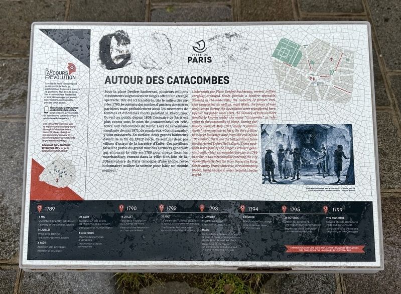
Autour des Catacombes / The Catacombs Neighborhood Marker image. Click for full size.
Photographed by Andrew Ruppenstein, April 27, 2024
1. Autour des Catacombes / The Catacombs Neighborhood Marker
Inscription.  
Sous la place Denfert-Rochereau, plusieurs millions d'ossements soigneusement rangés offrent un étrange spectacle. Ont été ici transférés, dès le milieu des années 1780, le contenu des tombes d'anciens cimetières parisiens mais probablement aussi les ossements de femmes et d'hommes morts pendant la Révolution. Ouvert au public depuis 1809, l'ossuaire de Paris est plus connu sous le nom de «catacombes», en référence aux catacombes de Rome. Lors de la Semaine sanglante de mai 1871, de nombreux «Communards» y sont massacrés. En surface, deux grands bâtiments datent de la fin du XVIIIe siècle. Ce sont les deux pavillons d'octroi de la barrière d'Enfer. Ces pavillons faisaient partie du grand mur des Fermiers généraux qui entourait la ville en 1789 pour mieux taxer les marchandises entrant dans la ville. Non loin de là, l'Observatoire de Paris témoigne d'une utopie révolutionnaire: utiliser la science pour bâtir un monde meilleur.

Underneath the Place Denfert-Rocheredu, several million carefully arranged bones provide a bizarre spectacle. Starting in the mid-1780s, the contents of former Parisian cemeteries, as well as, most likely, the bones of men and women during the Revolution were transferred here. Open to the public since 1809, the ossuary of Paris is more familiarly known under the name "catacombs" in reference to the catacombs óf Rome. During the Bloody week of May 1871 many “Communards” were massacred here. On the surface, two large buildings date from the end of the 18 century; these are the toll pavilions from the Barrière d'Enfer (Hell's Gate). These pavilions were part of the larger Fermiers généraux wall, which surrounded the city in 1789 in order to tax/merchandise entering the city more efficiently. Not far from there, the Paris Observatory bears witness to a revolutionary utopia: using science in order to build a better world.

(timeline not transcribed)

 
Erected by Ville
Paid Advertisement
Click or scan to see
this page online
de Paris.
 
Topics. This historical marker is listed in this topic list: Cemeteries & Burial Sites. A significant historical month for this entry is May 1871.
 
Location. 48° 50.037′ N, 2° 19.94′ E. Marker is in Paris, Île-de-France, in Département de Paris. It is in Petit-Montrouge. It is at the intersection of Avenue du Colonel Henri Rol-Tanguy and Place Denfert-Rochereau, on the right when traveling north on Avenue du Colonel Henri Rol-Tanguy. Touch for map. Marker is at or near this postal address: 1 Avenue du Colonel Henri Rol-Tanguy, Paris, Île-de-France 75014, France. Touch for directions.
Regionally, it is in the North Atlantic Region, Europe, the European Union, Atlantic Europe, the Schengen Area, Western Europe, a coastal Mediterranean country, and the Western World. Historically, it finds itself in what was once a French colony and also the Roman Empire.

Other nearby markers. At least 8 other markers are within walking distance of this marker: Catacombes (here, next to this marker); Square de l’Abbé Migne (1880) (within shouting distance of this marker); Le Lion de Belfort/ The Lion of Belfort (within shouting distance
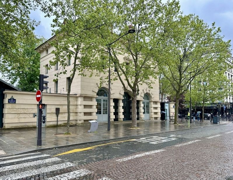
Autour des Catacombes / The Catacombs Neighborhood Marker - wide view image. Click for full size.
Photographed by Andrew Ruppenstein, April 27, 2024
2. Autour des Catacombes / The Catacombs Neighborhood Marker - wide view
The marker is visible here just to the left of the lamppost.

of this marker); Colonel Henri Rol-Tanguy (within shouting distance of this marker); Square Claude Nicolas Ledoux 1894 (about 90 meters away, measured in a direct line); Square Jacques Antoine 1896 (about 90 meters away); Gare de Denfert-Rochereau / Denfert-Rochereau Station (about 120 meters away); Georges Lamarque (about 120 meters away). Touch for a list and map of all markers in Paris.
 
More about this marker. This is one of sixteen (?) neighborhood markers showing the local points of interest in each neighborhood that are relevant to the French Revolution. An English-language app is available for download.
 
Also see . . .  The Catacombs Neighborhood. This page provides the same text as the English-language portion of the marker but with the addition of an interactive map showing the 3 points of interest in the Catacombs neighborhood, along with explanatory text for each point of interest. (Submitted on January 12, 2026.) 
 
 
Credits. This page was last revised on January 12, 2026. It was originally submitted on January 12, 2026, by Andrew Ruppenstein of Lamorinda, California. This page has been viewed 42 times since then. Photos:   1, 2. submitted on January 12, 2026, by Andrew Ruppenstein of Lamorinda, California.

m=291627

CeraNet Cloud Computing sponsors the Historical Marker Database.
This website earns income from purchases you make after using our links to Amazon.com. We appreciate your support.
Paid Advertisement
Jul. 25, 2026