Père-Lachaise in Paris in Département de Paris, Île-de-France, France — Western Europe
Cimetière du Père-Lachaise
⎯⎯⎯
Père-Lachaise Cemetery (1804)
Photographed by Andrew Ruppenstein, April 19, 2024
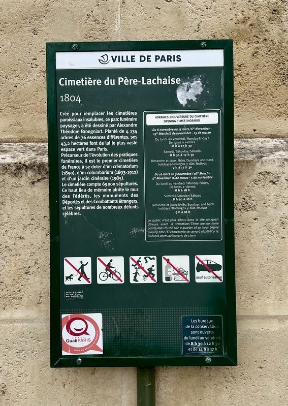
1. Cimetière du Père-Lachaise / Père-Lachaise Cemetery Marker

Précurseur de l'évolution des pratiques funéraires, il est le premier cimetière de France à se doter d'un crématorium (1890), d'un columbarium (1893-1912) et d'un jardin cinéraire (1985).
Le cimetière compte 69000 sépultures. Ce haut lieu de mémoire abrite le mur des Fédérés, les monuments des Déportés et des Combattants étrangers, et les sépultures de nombreux défunts célèbres.
Created to replace unsanitary parish cemeteries, this landscaped cemetery was designed by Alexandre Théodore Brongniart. Planted with 4,134 trees of 76 different species, its 43.2 hectares make it the largest green space in Paris.
A pioneer in the evolution of funeral practices, it was the first cemetery in France to have a crematorium (1890), a columbarium (1893-1912), and a memorial garden (1985).
The cemetery contains 69,000 graves.
this page online
Erected by Ville de Paris.
Topics and series. This historical marker is listed in this topic list: Cemeteries & Burial Sites. In addition, it is included in the Parks and Squares of Paris series list.
Location. 48° 51.598′ N, 2° 23.36′ E. Marker is in Paris, Île-de-France, in Département de Paris. It is in Père-Lachaise. It is at the intersection of Boulevard de Ménilmontant and Rue de la Roquette, on the right on Boulevard de Ménilmontant. Touch for map. Marker is at or near this postal address: 28ter Boulevard de Ménilmontant, Paris, Île-de-France 75020, France. Touch for directions.

Regionally, it is in the North Atlantic Region, Europe, the European Union, Atlantic Europe, the Schengen Area, Western Europe, a coastal Mediterranean country, and the Western World. Historically, it finds itself in what was once a French colony and also the Roman Empire.
Other nearby markers. At least 8 other markers are within
Photographed by Andrew Ruppenstein, April 19, 2024
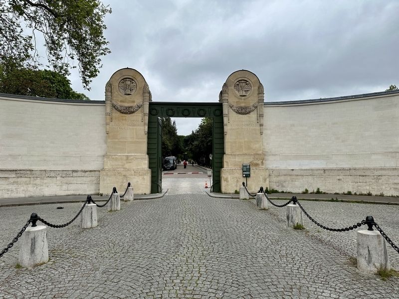
2. Cimetière du Père-Lachaise / Père-Lachaise Cemetery Marker - wide view
The marker is visible here just to the right of the main entrance.
Also see . . . Père Lachaise Cemetery (Wikipedia). Overview:
Père Lachaise Cemetery (formerly Cimetière de l'Est, lit. 'Cemetery of the East') is the largest cemetery in Paris, France, at 44 hectares (110 acres). With more than 3.5 million visitors annually, it is the most visited necropolis in the world.(Submitted on January 13, 2026.)
The Père Lachaise is located in the 20th arrondissement and was the first garden cemetery, as well as the first municipal cemetery in Paris.…
Photographed by Andrew Ruppenstein, April 19, 2024
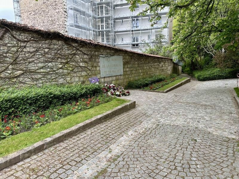
3. Communards’ Wall (mentioned on the marker)
An estimated 166 Communards were executed here on May 28, 1871 during the suppression of the Paris Commune, and buried here at the foot of the wall.
Edmund F. Arras (courtesy Columbus Metropolitan Library, 1913
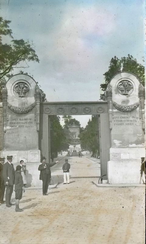
4. Père-Lachaise Cemetery gates (lantern slide)
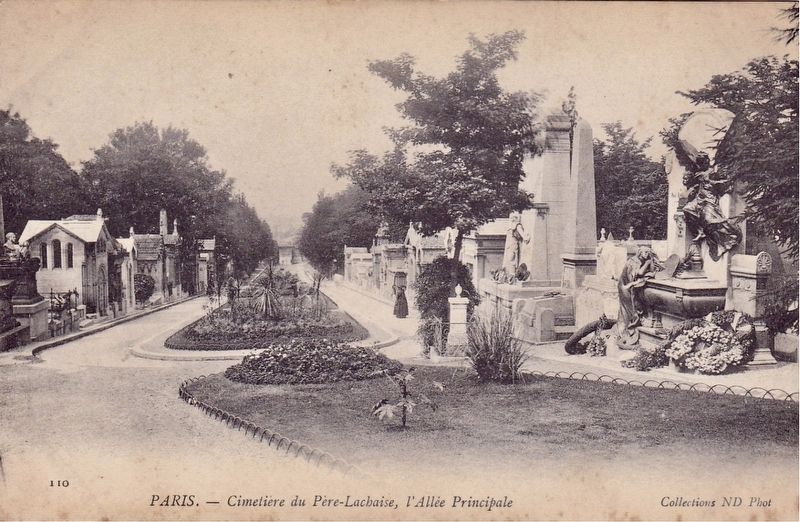
Photographed by Neurdein et Cie, circa 1900
5. Père-Lachaise Cemetery - Allée Principale
Credits. This page was last revised on January 13, 2026. It was originally submitted on January 12, 2026, by Andrew Ruppenstein of Lamorinda, California. This page has been viewed 45 times since then. Photos: 1, 2. submitted on January 12, 2026, by Andrew Ruppenstein of Lamorinda, California. 3, 4, 5. submitted on January 13, 2026, by Andrew Ruppenstein of Lamorinda, California.
