Powderhorn in Gunnison County, Colorado — The American Mountains (Southwest)
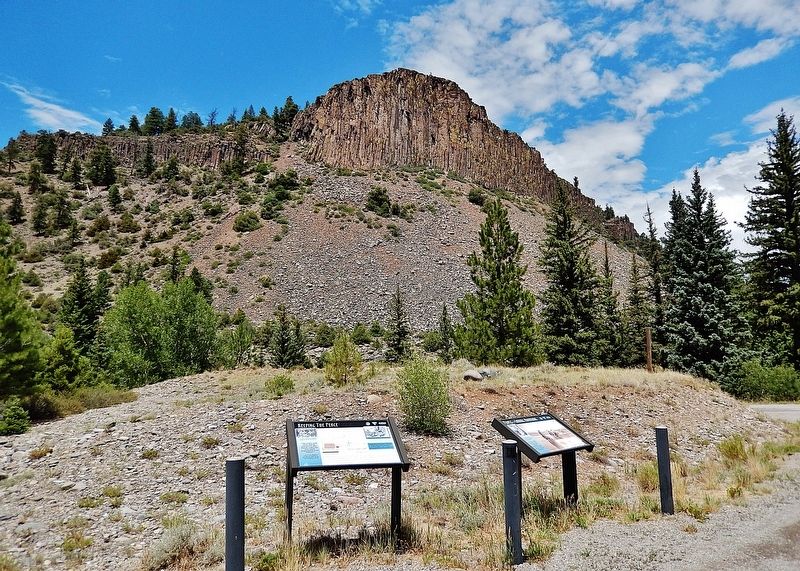
Keeping the Peace

Photographed by Cosmos Mariner, July 21, 2025
1. Keeping the Peace Marker
“The trail is well worn, and the peeled trees show that the valley has been much frequented by (Ute) Indians.”
~ Lt. E. H. Ruffner, Corps of Engineers, Reconnaissance in the Ute Country, 1873
Gold was discovered in the San Juan Mountains in the late 1860s leading to a rush of miners. Tension rose between the miners seeking gold and the Ute Indians who lived and hunted in the mountains. As a result, the U.S. Government negotiated the Brunot Treaty in 1873 with Chief Ouray and the Weminuche Ute.
That same year, the military sent Lt. E. H. Ruffner into the San Juan Mountains to document mining operations in Southern Colorado and evaluate the effectiveness of the Brunot Treaty. Ruffner noted, “While at Camp 47 we were visited by many western Utes, mostly well armed, well mounted, and well dressed; uncommonly clean, smiling and civil; short men, with broad muscular shoulders.”
“At this point we passed the Great Gate, a rift in a spar sweeping around from range to range across the valley.”
~ Lt. E. H. Ruffner, Corps of Engineers, Reconnaissance in the Ute Country, 1873
Erected by Western Colorado Interpretive Association and
this page online
Topics. This historical marker is listed in these topic lists: Indigenous Peoples and Communities • Industry & Commerce • Settlements & Settlers. A significant historical year for this entry is 1873.
Location. 38° 14.753′ N, 107° 15.558′ W. Marker is in Powderhorn, Colorado, in Gunnison County. It is at the intersection of State Highway 149 at milepost 88.9 and BLM Road 149B, on the left when traveling north on State Highway 149. The marker is in a pull-out on the west side of Colorado Highway 149. Touch for map. Marker is in this post office area: Powderhorn CO 81243, United States of America. Touch for directions.

Regionally, this marker is in the Colorado High Rockies. It is also in the American Mountain West. Globally, it is in North America, the Rocky Mountains, the Western Hemisphere, the Western World, and the Anglosphere.
Other nearby markers. At least 7 other markers are within 12 miles of this marker, measured as the crow flies: People of the Shining Mountains (here, next to this marker); Lost in a Blizzard (approx. 3.9 miles away); The Old Spanish Trail

Courtesy Denver Public Library — Western History Department
2. Marker detail: Ute and white representatives in Washington D.C.
Ute Indians and agents in Washington, DC after conclusion of the 1873 Brunot Agreement. Front row, left to right: Guero, Chipeta, Ouray, and Piah; second row: Uriah M. Curtis, James B. Thompson, Charles Adams, and Otto Mears; back row: Washington, Susan (Ouray’s sister), Johnson, Jack, and John.
[Full caption from History Colorado article.]
[Full caption from History Colorado article.]
Also see . . . Brunot Agreement (History Colorado).
Excerpt: Miners first made their way into the San Juan Mountains in 1860–61, but it was not until 1869 that valuable minerals were discovered and not until 1871–72 that mine development took place. The Treaty of 1868 put the San Juan Mountains within a Ute reservation that encompassed almost the entire western third of Colorado. Although off limits to non-Indians, prospectors and miners entered the region. The growing mining activity drew the attention of the Utes, who were unhappy about the incursions but not openly hostile.(Submitted on January 19, 2026, by Cosmos Mariner of Cape Canaveral, Florida.)
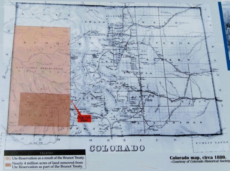
The Brunot Agreement between the Nuche (Ute) and the US government in 1873 led to the development of mining in the San Juan Mountains by taking 3.7 million acres (about 5,780 square miles) from the Ute Reservation in western Colorado. As white encroachment continued over the next decade, tensions escalated and the Uteswere eventually force-marched to Utah in 1881.Colorado Historical Society3. Marker detail: Miners and settlers knowingly trespassed on Ute landsIllustration from Harpers magazine.

Colorado Historical Society
4. Marker detail: Colorado map, circa 1880
[lighter highlight] Ute Reservation as a result of the Brunot Treaty.
[darker highlight inset] Nearly 4 million acres of land removed from Ute Reservation.
[darker highlight inset] Nearly 4 million acres of land removed from Ute Reservation.
Photographed by Cosmos Mariner, July 21, 2025
5. Keeping the Peace Marker
This is the leftmost of two interpretive panels at this location.
Credits. This page was last revised on January 19, 2026. It was originally submitted on January 17, 2026, by Cosmos Mariner of Cape Canaveral, Florida. This page has been viewed 71 times since then. Photos: 1, 2, 3, 4, 5. submitted on January 19, 2026, by Cosmos Mariner of Cape Canaveral, Florida.
