Annaberg Sugar Plantation near Leinster Bay in St. John, Virgin Islands — The Caribbean (The West Indies)
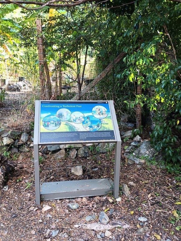
Confronting a Turbulent Past

Photographed by Michael Fischer, January 9, 2026
1. Confronting a Turbulent Past Marker
In 1935, Herman Creque bought the Annaberg Plantation from Carl Francis, the son of George Francis. Creque's heirs sold the property to Laurance Rockefeller's Jackson Hole Preserve in 1954. Two years later, the preserve transferred the iconic Annaberg Plantation to the National Park Service.
Millions of visitors travel to the US Virgin Islands each year, but Annaberg is more than a tourist attraction. Members of the ancestral community use this location to commemorate the lives, cultural traditions, and resilience of their forebears. This plantation and all that it represents continues to evoke strong emotions in residents and visitors alike.
Erected by National Park Service, U.S. Department of the Interior.
Topics. This historical marker is listed in these topic lists: African Americans • Colonial Era • Industry & Commerce • Settlements & Settlers. A significant historical year for this entry is 1935.
Location. 18° 21.772′ N, 64° 43.804′ W. Marker is near Leinster Bay in St. John, Virgin Islands. It is in Annaberg Sugar Plantation. It can be reached from Leinster Bay Trail. Touch for map. Marker
this page online

Regionally, it is one of the Lesser Antilles on the Caribbean Sea, on in the Atlantic Ocean, in North America, in the Western Hemisphere, in the Western World, and in the Anglosphere.
Other nearby markers. At least 8 other markers are within walking distance of this marker: Life After Emancipation (within shouting distance of this marker); The Sugar Factory (within shouting distance of this marker); Producing Sugar (within shouting distance of this marker); History of Annaberg (within shouting distance of this marker); Bake Oven (within shouting distance of this marker); Crushing Cane with Wind (within shouting distance of this marker); Windmill (within shouting distance of this marker); Freedom Across the Narrows (within shouting distance of this marker). Touch for a list and map of all markers in Leinster Bay.
Other markers no longer nearby. Annaberg Historic Trail (was a few steps from this marker but has been permanently removed); Slave Quarters (was within shouting distance of this marker but has been permanently removed);
Photographed by Michael Fischer, January 9, 2026
2. Confronting a Turbulent Past Marker
More about this marker. Annaberg Sugar Plantation is a unit of Virgin Islands National Park.
Also see . . . Annaberg Sugar Plantation. (Submitted on January 17, 2026, by William Fischer, Jr. of Reynoldsburg, Ohio.)
Credits. This page was last revised on January 17, 2026. It was originally submitted on January 17, 2026, by William Fischer, Jr. of Reynoldsburg, Ohio. This page has been viewed 72 times since then. Photos: 1, 2. submitted on January 17, 2026, by William Fischer, Jr. of Reynoldsburg, Ohio.
