Valmeyer in Monroe County, Illinois — The American Midwest (Great Lakes)
1993 Valmeyer Flood Memorial
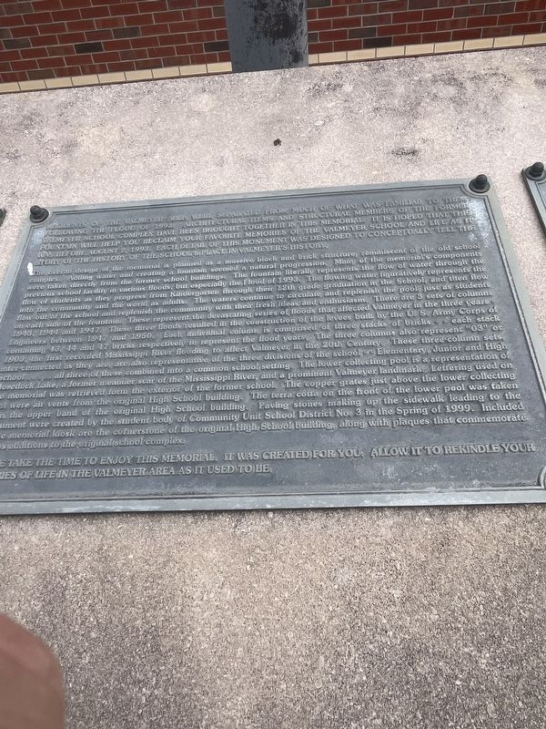
Photographed by Thomas Smith, January 13, 2026
1. 1993 Valmeyer Flood Memorial
Residents of the Valmeyer area were separated from much of what was familiar to them following the flood of 1993, architectural items and structural members of the former Valmeyer School complex have been brough together in this memorial. It is hoped that fountain will help you reclaim your favorite memories of the Valmeyer School and life as it was before August 2 1993. Each detail of this monument was designed to conceptually tell the story of the history of the school's place in Valmeyer history.
The overall design of the memorial is planned as a massive block and brick structure, reminiscent of the old school complex. Adding water and creating a fountain seemed a natural progression. Many of the memorial's components were taken directly from the former school buildings The fountain literally represents the flow of water through the previous school facility in various floods, but especially the Flood of 1993 The flowing water figuratively represents the flow of students as they progress from Kindergarten through their 12th grade graduation in the School, and then flow into the community and the world as adults.
this page online

Photographed by Thomas Smith, January 13, 2026
2. 1993 Valmeyer Flood Memorial
Please take the time to enjoy this memorial . It was created for you. Allow it to rekindle you memories of life in the Valmeyer Area as it used to be.
Topics. This historical marker and memorial is listed in these topic lists: Disasters • Waterways & Vessels. A significant historical date for this entry is August 2, 1993.
Location. 38° 18.606′ N, 90° 16.7′ W. Marker is in Valmeyer, Illinois, in Monroe County. It is on South Cedar Bluff north of Empson Drive, on the right when traveling north. The marker stands in front of Valmeyer High School. Touch for map. Marker is at or near this postal address: 300 S Cedar Bluff, Valmeyer IL 62295, United States of America. Touch for directions.

Regionally, this marker and memorial is in Greater St. Louis. It is also in the American Midwest, in the Lewis & Clark Corridor, in the Corn Belt, and in the Great River Road Region. Globally, it is in North America, the Western Hemisphere, the Western World, and the Anglosphere. Historically, it finds itself in what was once the territory of the Mississippian Culture and also the Northwest Territory.
Other nearby markers. At least 8 other markers are within 2 miles of this marker, measured as the crow flies: Laurie A. Brown (about 400 feet away, measured in a direct line); Valmeyer Community Heritage Society (about 500 feet away); Louis E. Miller (approx. ¼ mile away); M102 Howitzer (approx. ¼ mile away); The Bell and Bell Tower of St. Mary Church (approx. 0.3 miles away); Salt Lick Point (approx. 1.1 miles away); a different marker also named Salt Lick Point (approx. 1.7 miles away); The Floarke Pavilion (approx. 1.9 miles away). Touch for a list and map of all markers in Valmeyer.
Credits. This page was last revised on January 21, 2026. It was originally submitted on January 17, 2026, by Thomas Smith of Waterloo, Ill. This page has been viewed 62 times since then. Photos: 1, 2. submitted on January 17, 2026, by Thomas Smith of Waterloo, Ill. • Devry Becker Jones was the editor who published this page.
