
Appomattox in Appomattox County, Virginia — The American South (Mid-Atlantic)
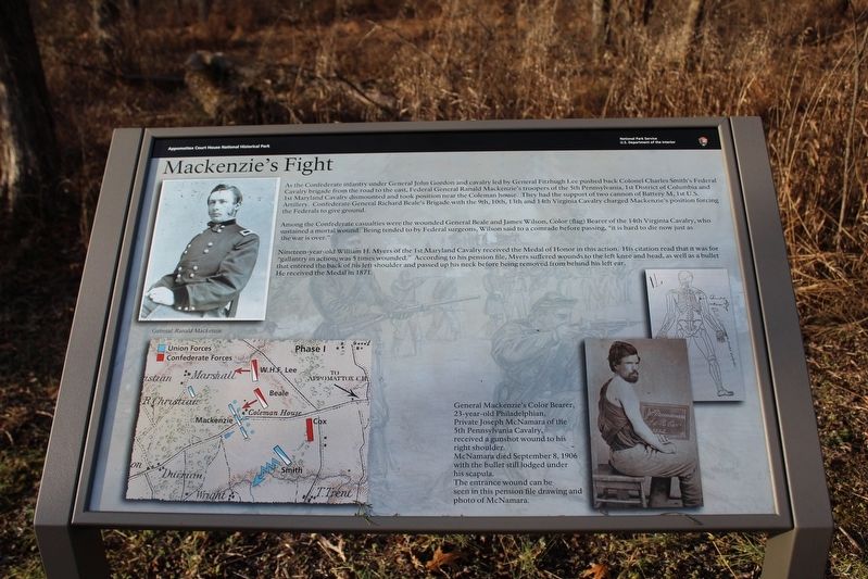
Mackenzie's Fight
| — | Appomattox Court House National Historical Park | — |
Photographed by Evan Dwyer, December 20, 2025
1. Mackenzie's Fight Marker
Among the Confederate casualties were the wounded General Beale and James Wilson, Color (flag) Bearer of the 14th Virginia Cavalry, who sustained a mortal wound. Being tended to by Federal surgeons, Wilson said to a comrade before passing, "it is hard to die now just as the war is over."
Nineteen-year-old William H. Myers of the 1st Maryland Cavalry received the Medal of Honor in this action. His citation read that it was for "gallantry in action; was 5 times wounded." According to his pension file, Myers suffered wounds to the left knee and
this page online
General Mackenzie's Color Bearer, 23-year-old Philadelphian Private Joseph McNamara of the 5th Pennsylvania Cavalry, received a gunshot wound to his right shoulder.
McNamara died September 8, 1906 with the bullet still lodged under his scapula.
The entrance wound can be seen in this pension file drawing and photo of McNamara.
Erected 2025 by National Park Service, U.S. Department of the Interior.
Topics. This historical marker is listed in this topic list: War, US Civil. A significant historical date for this entry is April 9, 1865.
Location. 37° 22.492′ N, 78° 48.968′ W. Marker is in Appomattox, Virginia, in Appomattox County. It can be reached from Gordon Drive 0.1 miles north of Old Courthouse Road (Virginia Route 24), on the left when traveling north. Marker is within Appomattox Court House National Historical Park, on the Coleman House Trail - accessible only on foot from the trail head on Gordon Drive. Touch for map. Marker is in this post office area: Appomattox
Photographed by Evan Dwyer, December 20, 2025
2. Mackenzie's Fight Marker
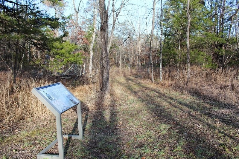
And vicinity of the cavalry fight described upon it. The Coleman House itself sat to the right of the photographer, out of the frame.

Regionally, this marker is in the Piedmont and in Central Virginia. It is also in the American South and specifically in the Upper South. Globally, it is in North America, the Western Hemisphere, the Western World, and the Anglosphere. Historically, it finds itself in what was once the territory of the Mississippian Culture, one of the original Thirteen Colonies, one of the Confederate States of America, and the Antebellum South.
Other nearby markers. At least 8 other markers are within walking distance of this marker: The 24th Corps "Flying Hospital" (within shouting distance of this marker); Fate of the 11th Maine (within shouting distance of this marker); Shattered Home (within shouting distance of this marker); Born enslaved, I died a free woman. (within shouting distance of this marker); "Their doom was sealed" (about 500 feet away, measured in a direct line); “Message of Peace” (about 700 feet away); Battle of Appomattox Station (about 700 feet away); Grant’s Pursuit (about 700 feet away). Touch for a list and map of all markers in Appomattox.
Also see . . . Appomattox Court House National Historical Park. National Park Service (Submitted on January 20, 2026.)
Credits. This page was last revised on January 20, 2026. It was originally submitted on January 20, 2026, by Evan Dwyer of Richmond, Virginia. This page has been viewed 55 times since then. Photos: 1, 2. submitted on January 20, 2026, by Evan Dwyer of Richmond, Virginia. • Bernard Fisher was the editor who published this page.
