
Appomattox in Appomattox County, Virginia — The American South (Mid-Atlantic)
Appomattox River
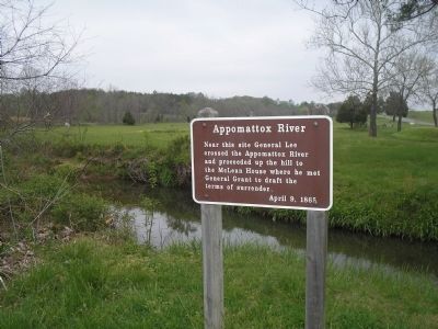
Photographed by Bill Coughlin, April 26, 2007
1. Appomattox River Marker
Near this site General Lee crossed the Appomattox River and proceeded up the hill to the McLean House where he met General Grant to draft the terms of surrender.
April 9, 1865.
Erected by National Park Service, U.S. Department of the Interior.
Topics and series. This historical marker is listed in these topic lists: Peace • War, US Civil. In addition, it is included in the Former U.S. Presidents: #18 Ulysses S. Grant series list. A significant historical month for this entry is April 1975.
Location. Marker has been reported permanently removed. It was located near 37° 22.926′ N, 78° 47.394′ W. Marker was in Appomattox, Virginia, in Appomattox County. It could be reached from Old Courthouse Road (Virginia Route 24) north of George Peers Drive, on the right when traveling south. The marker is in the picnic ground of the Appomattox Court House National Historical Park. Touch for map. Marker was at or near this postal address: 151 Old Courthouse Road, Appomattox VA 24522, United States of America.
We have been informed that this marker is no longer there and will not be replaced. This page is an archival view of what was.
Regionally,
this page online

Other nearby markers. At least 8 other markers are within walking distance of this location: A different marker also named Appomattox River (here, next to this marker); Popularizer of the Banjo (within shouting distance of this marker); African American Banjoists (within shouting distance of this marker); After the Surrender (about 300 feet away, measured in a direct line); Surrender of the Artillery (about 300 feet away); Artillery Park (about 400 feet away); Lee's Apple Tree (about 800 feet away); The Charles Sweeney Cabin (approx. ¼ mile away). Touch for a list and map of all markers in Appomattox.
Also see . . . Appomattox Court House National Historical Park. (Submitted on March 6, 2008, by Bill Coughlin of Woodland Park, New Jersey.)
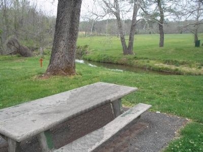
Photographed by Bill Coughlin, April 26, 2007
2. Appomattox Court House National Historical Park Picnic Area
Marker is visible on the left, at the river's edge.
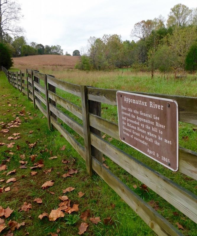
Photographed by Bradley Owen, October 16, 2017
3. Appomattox River Marker
Marker is now mounted on a fence nearby.
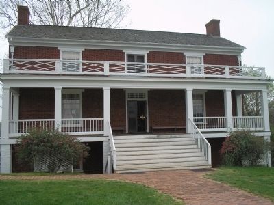
Photographed by Bill Coughlin, April 26, 2007
4. McLean House
Gen. Robert E. Lee met with Gen. Ulysses S. Grant in the McLean House on April 9, 1865 to surrender his army.
Photographed by Craig Swain, April 18, 2010
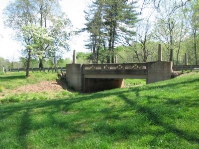
5. Present Day Bridge over the Appomattox
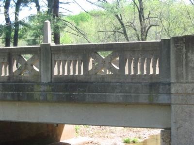
The bridge replaces older structures that once allowed the Richmond-Lynchburg Stage Road to cross the Appomattox. The bridge's railings incorporate elements of the United States and Confederate flags.
Photographed by Craig Swain, April 18, 2010
6. Detail of Bridge Railing
Credits. This page was last revised on January 20, 2026. It was originally submitted on March 6, 2008, by Bill Coughlin of Woodland Park, New Jersey. This page has been viewed 2,148 times since then and 75 times this year. Last updated on January 20, 2026, by Evan Dwyer of Richmond, Virginia. Photos: 1, 2. submitted on March 6, 2008, by Bill Coughlin of Woodland Park, New Jersey. 3. submitted on March 23, 2021, by Bradley Owen of Morgantown, West Virginia. 4. submitted on March 6, 2008, by Bill Coughlin of Woodland Park, New Jersey. 5, 6. submitted on April 25, 2010, by Craig Swain of Leesburg, Virginia. • Bernard Fisher was the editor who published this page.
