Aiken in Aiken County, South Carolina — The American South (South Atlantic)
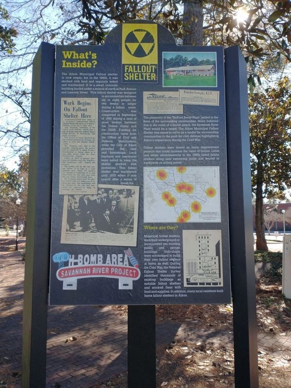
What's Inside?
Fallout Shelter
Photographed by Tom Bosse, December 31, 2023
1. What's Inside? Marker
The Aiken Municipal Fallout Shelter is now empty, but in the late 1960s, it was stocked with food and regularly tested and maintained. It is a small concrete building buried under a mound of earth at Park Avenue and Laurens Street. This fallout out shelter was designed to accommodate between six to eight people for two weeks or longer during a fallout event. Construction was completed in September of 1960 during a time of great tension between the United States and the USSR. Funding for the construction came from the Office of Civil and Defense Mobilization, while the City of Aiken provided the land and furnishings. Local business and merchants were asked to keep the shelter stocked with provisions. This fallout shelter was maintained until 1970 when it was sealed after a series of break-ins.
The proximity of the “Dupont Bomb Plant” added to the fears of the surrounding communities. Many believed that in the event of a Soviet attack, the Savannah River Plant would be a target. The Aiken Municipal Fallout Shelter was meant to serve as a model for surrounding communities in the push for civil defense highlighting Aiken’s
this page online
Fallout Shelters were touted as home improvement projects that could increase the value of homes. Local real estate advertisements in the 1960s listed fallout shelters along side swimming pools and fenced in backyards as selling points.
Where are they?
Municipal fallout shelters were built underground of incorporated into existing public and private buildings. Individuals were encouraged to build their own fallout shelters at home as well. During the Cold War, the National Fallout Shelter Survey identified thousands of existing buildings as suitable fallout shelters and stocked them with food and supplies. In addition, many local residents built home fallout shelters in Aiken.
Topics. This historical marker is listed in these topic lists: Industry & Commerce • Notable Buildings • War, Cold. A significant historical month for this entry is September 1960.
Location. 33° 33.579′ N, 81° 43.388′ W. Marker is in Aiken, South Carolina, in Aiken County. It is on Laurens Street Southwest. Touch for map. Marker is at or near this postal address: Laurens St SW 152, Aiken SC 29801, United States of America. Touch for directions.

Regionally, this marker is in Greater Augusta and in the Midlands. It is also in the American South and specifically in the Deep South. Globally, it is in North America, the Western Hemisphere, the Western World, and the Anglosphere. Historically, it finds itself in what was once the territory of the Mississippian Culture, one of the original Thirteen Colonies, one of the Confederate States of America, and the Antebellum South.
Other nearby markers. At least 8 other markers are within walking distance of this marker: The Cold War and Civil Defense in the Atomic Age (here, next to this marker); The 97% to Survive (here, next to this marker); South Carolina Canal & Rail Road Company (within shouting distance of this marker); Fred B. Cavanaugh (within shouting distance of this marker); Woodmen Of The World (within shouting distance of this marker); Aiken (about 300 feet away, measured in a direct line); The Augusta And Aiken Railway (about 300 feet away); An Early Aiken Park (about 300 feet away). Touch for a list and map of all markers in Aiken.
Another marker is no longer nearby. South Carolina Canal & Rail Road Company (was within shouting distance of this marker but has been replaced with another marker now near it).
Credits. This page was last revised on January 20, 2026. It was originally submitted on January 20, 2026, by Tom Bosse of Jefferson City, Tennessee. This page has been viewed 49 times since then. Photo 1. submitted on January 11, 2024, by Tom Bosse of Jefferson City, Tennessee. • Devry Becker Jones was the editor who published this page.
