
Tybee Island in Chatham County, Georgia — The American South (South Atlantic)
Long Range Artillery Duel
Photographed by Craig Swain, May 5, 2010
1. Long Range Artillery Duel Marker
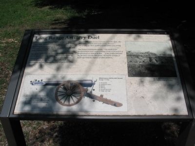
The Battle of Fort Pulaski features the first significant use of rifled artillery in combat. Prior to the battle no one could predict the impact of these new weapons. General Robert E. Lee told Colonel Olmstead, the commander of Fort Pulaski, that federal guns on Tybee Island "will make it very warm for you with shells ... but they cannot breach your walls at that distance." The power of rifled artillery would prove Lee wrong.
The Union commander wrote, "The result of this bombardment must cause a change in the construction of fortifications as radical as that ... of the conflict between the Monitor and the Merrimac. No works of stone or brick can resist the impact of rifled artillery."
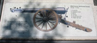
Spiralled grooves on the interior of rifled cannons imparted stabilizing spin to their projectiles. This tight spinning action dramatically improved the range, accuracy and hitting power of artillery.
Rifled Cannon (30-Pounder Parrott)
Range:
this page online
(Key to diagram on lower left)
1 Projectile
2 Expansion skirt
3 Barrel
4 Rifling
5 Elevating Screw
6 Siege carriage
Erected by Fort Pulaski National Monument - National Park Service - U.S. Department of the Interior.
Topics. This historical marker is listed in this topic list: War, US Civil. A significant historical month for this entry is April 1862.
Location. Marker has been reported permanently removed. It was located near 32° 1.003′ N, 80° 52.242′ W. Marker was on Tybee Island, Georgia, in Chatham County. It was at the intersection of Battery Park/Catalina Drive and U.S. 80, on the right when traveling west on Battery Park/Catalina Drive. Located at the entrance to Battery Park community. Touch for map. Marker was in this post office area: Tybee Island GA 31328, United States of America.
We have been informed that this marker is no longer there and will not be replaced. This page is an archival view of what was.
Regionally, this marker was in Georgia’s Coastal Plain, on the Georgia Coast and the Golden Isles, in Greater Savannah, and on the Sea Islands. It was also in the American South, specifically in the Deep South,

Photographed by Bill Coughlin, August 5, 2013
2. Long Range Artillery Duel Marker
Other nearby markers. At least 8 other markers are within 2 miles of this location, measured as the crow flies: Federal Batteries on Tybee Island (about 500 feet away, measured in a direct line); Lazaretto (approx. half a mile away); The Brown Family Home (approx. 1.3 miles away); Original Gilyard Cottage Site (approx. 1.3 miles away); The Breached Wall (approx. 1.3 miles away); 5,275 Shots & Shells in 30 Hours (approx. 1.3 miles away); Shifting Shoreline (approx. 1.3 miles away); A Devastating Bombardment (approx. 1.3 miles away). Touch for a list and map of all markers in Tybee Island.
Other markers no longer nearby. Cockspur Island Lighthouse (was a few steps from this marker but has been permanently removed); A Turning Point In History (was within shouting
Photographed by Craig Swain, May 5, 2010
3. Close Up of Cannon Illustration
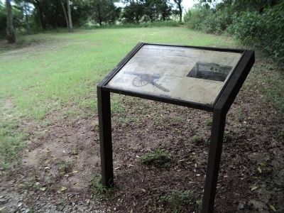
More about this marker. On the upper right is a photo of Fort Pulaski after its walls were breached. By the close of the battle a section of Fort Pulaski's walls lay in ruins.
In the lower center-left is a diagram of a rifled cannon from the Civil War.
Photographed by Craig Swain, May 5, 2010
4. Battery Park Exhibit Area
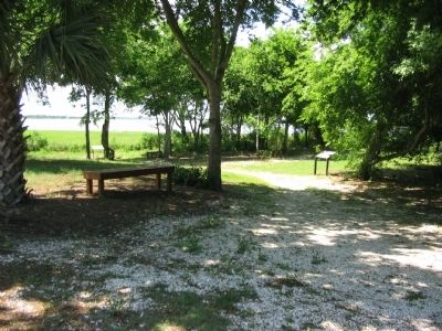
The Battery Park exhibit area is a new addition to Fort Pulaski. Set aside by the developers of Battery Park, with support from the National Park Service and the City of Tybee Island, the site interprets the Federal activities during the siege of Fort Pulaski.
Photographed by Craig Swain, May 5, 2010
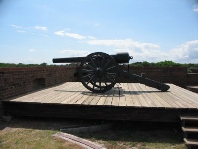
5. 30-pdr Parrott Rifle
One of four original (along with one reproduction) 30-pdr Parrotts at Fort Pulaski. This example is mounted on a siege carriage overlooking the south wall of the fort.
Photographed by Craig Swain, May 5, 2010
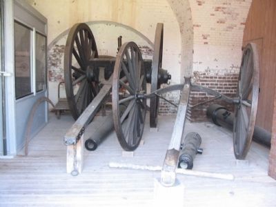
6. Sling Cart and 30-pdr Parrotts
An exhibit at Fort Pulaski. Artillerists used sling carts to maneuver heavy guns into position, particularly where soft ground inhibited movement of the siege carriage. To the left and right of this display are 30-pdr Parrott rifles. These MAY be earmarked for placement in the Battery Park display at a future date. In the center is a 6-pdr Model 1834 Field Gun.
Credits. This page was last revised on January 22, 2026. It was originally submitted on May 9, 2010, by Craig Swain of Leesburg, Virginia. This page has been viewed 1,945 times since then and 47 times this year. Last updated on January 21, 2026, by Edward Troxel of Creal Springs, Illinois. Photos: 1. submitted on May 9, 2010, by Craig Swain of Leesburg, Virginia. 2. submitted on August 8, 2013, by Bill Coughlin of Woodland Park, New Jersey. 3, 4, 5, 6. submitted on May 9, 2010, by Craig Swain of Leesburg, Virginia. • Bernard Fisher was the editor who published this page.
