Tybee Island in Chatham County, Georgia — The American South (South Atlantic)
A Turning Point In History
The Reduction of Fort Pulaski
| — | The Battery | — |

Photographed by Mike Stroud, April 7, 2009
1. A Turning Point In History Marker
No eye except an eye-witness can form any but a faint conception of the Herculean labor by which mortars of eight and one half tons and columbiads...were moved in the dead of night, over a narrow causeway, bordered by swamps on either side, and liable at any moment to be over turned and buried in mud beyond reach."
"Two hundred and fifty men were barely sufficient to move a single piece, on sling carts. They were not allowed to speak above a whisper, and were guided by the notes of a whistle."
Erected by Fort Pulaski National Monument U.S. Dept. of the Interior.
Topics. This historical marker is listed in this topic list: War, US Civil. A significant historical month for this entry is April 1941.
Location. Marker has been reported permanently removed. It was located near 32° 0.97′ N, 80° 52.231′ W. Marker was on Tybee Island, Georgia, in Chatham County. It was on Battery Park/Catalina Drive near US 80/ Ga 26, on the right when traveling north. Touch for map. Marker was in this post office area: Tybee Island GA 31328, United States of America.
We have been informed that this marker is no longer there and will not be replaced. This page is an archival view of what was.
Regionally, this marker was on the Coastal Plain, on the Georgia Coast and the Golden Isles, in Greater Savannah, and on the Sea Islands. It was also in the American South, specifically in the Deep South, and on the Eastern Seaboard. Globally, it was in the North Atlantic Region, North America, the Western Hemisphere, the Western World, and the Anglosphere.

this page online
Other nearby markers. At least 8 other markers are within 2 miles of this location, measured as the crow flies: Federal Batteries on Tybee Island (about 300 feet away, measured in a direct line); Lazaretto (approx. half a mile away); The Brown Family Home (approx. 1.3 miles away); Original Gilyard Cottage Site (approx. 1.3 miles away); 5,275 Shots & Shells in 30 Hours (approx. 1.3 miles away); The Breached Wall (approx. 1.3 miles away); A Devastating Bombardment (approx. 1.3 miles away); Shifting Shoreline (approx. 1.3 miles away). Touch for a list and map of all markers in Tybee Island.
Other markers no longer nearby. Long Range Artillery Duel (was within shouting distance of this marker but has been permanently removed); Cockspur Island Lighthouse (was within shouting distance of this marker but has been permanently removed).
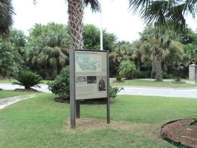
Photographed by Bill Coughlin, August 5, 2013
2. A Turning Point In History Marker
Photographed by A Turning Point In History Marker,
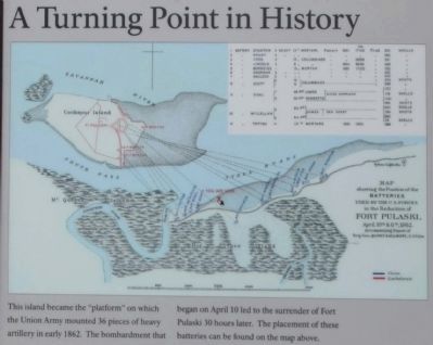
3. Upper picture
Map showing the positions of the batteries
used by U.S. forces in the reduction of
Fort Pulaski April 10 & 11, 1862, a turning
point in U.S. Military History.
Accompanying Report of Brig. Gen. Quincy A. Gillmore, U.S. Vols.
Accompanying Report of Brig. Gen. Quincy A. Gillmore, U.S. Vols.
Photographed by A Turning Point In History Marker
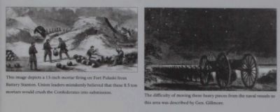
4. (Left picture)
This image depicts a 13-inch mortar firing on Fort Pulaski from Battery Stanton. Union leaders mistakenly believed that these 8.5 ton mortars would crush the Confederates
into submission.
(Center picture) The difficulty of moving these heavy pieces from the naval vessels to this area was described by Gen. Gillmore.
(Center picture) The difficulty of moving these heavy pieces from the naval vessels to this area was described by Gen. Gillmore.

Photographed by A Turning Point In History Marker
5. Brigadier General Quincy Adams Gillmore
The City of Tybee Island, National Park Service
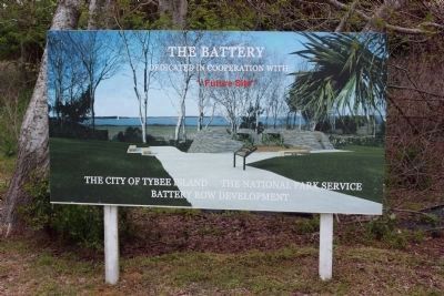
6. A Turning Point In History Marker * Future Site *
Sign showing the projected battery reconstruction site.
Photographed by Craig Swain, May 5, 2010
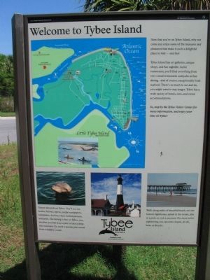
7. Welcome to Tybee Island
One of three sides to the kiosk marker.
Photographed by Craig Swain, May 5, 2010
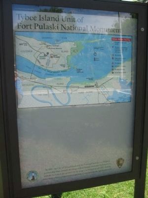
8. Fort Pulaski National Monument Map
Third side of the kiosk.
Credits. This page was last revised on January 22, 2026. It was originally submitted on April 24, 2009, by Mike Stroud of Bluffton, South Carolina. This page has been viewed 1,897 times since then and 47 times this year. Last updated on January 21, 2026, by Edward Troxel of Creal Springs, Illinois. Photos: 1. submitted on April 24, 2009, by Mike Stroud of Bluffton, South Carolina. 2. submitted on December 20, 2013, by Bill Coughlin of Woodland Park, New Jersey. 3, 4, 5, 6. submitted on April 24, 2009, by Mike Stroud of Bluffton, South Carolina. 7, 8. submitted on May 9, 2010, by Craig Swain of Leesburg, Virginia. • Bernard Fisher was the editor who published this page.
