Harpers Ferry in Jefferson County, West Virginia — The American South (Appalachia)
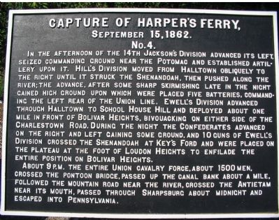
Capture of Harpers Ferry
No. 4
No. 4
In the afternoon of the 14th Jackson's Division advanced its left, seized commanding ground near the Potomac and established Artillery upon it. Hill's Division moved from Halltown obliquely to the right until it struck the Shenandoah, then pushed along the river; the advance, after some sharp skirmishing late in the night gained high ground upon which were placed five Batteries. Commanding the left rear of the Union line. Ewell's Division advanced through Halltown to School House Hill and deployed about one mile on front of Bolivar Heights, bivouacking on either side of the Charlestown Road. During the night the Confederates advanced on the right and left gaining some ground, and 10 guns of Ewell's Division crossed the Shenandoah at Key's Ford and were placed on the plateau at the foot of Loudon Heights to enfilade the entire Position on Bolivar Heights.
About 9 P.M. the entire Union Cavalry force, about 1500 men, crossed the Pontoon Bridge, passed up the canal bank about a mile followed the mountain road near the river, crossed the Antietam near its mouth, passed through Sharpsburg about midnight and escaped into Pennsylvania.
Erected by Antietam Battlefield Board. (Marker Number No. 4.)
Topics and series. This historical marker is listed in this topic list: War, US Civil. In addition, it is included in the Antietam Campaign War Department Markers series list. A significant historical month for this entry is September 1766.
Location. 39° 19.38′ N, 77° 43.744′ W. Marker is in Harpers Ferry, West Virginia, in Jefferson County. Marker is on South Potomac Street, on the right when traveling east. Located on just past the railroad overpass, at the overlook to the juncture of the Potomac and Shenandoah Rivers. Touch for map. Marker is in this post office area: Harpers Ferry WV 25425, United States of America. Touch for directions.
Other nearby markers. At least 8 other markers are within walking distance of this marker. A different marker also named Capture of Harpers Ferry (here, next to this marker); a different marker also named Capture of Harpers Ferry (here, next to this marker); a different marker also named Capture of Harpers Ferry (here, next to this marker); a different marker also named Capture of Harpers Ferry (a few steps from this marker); John Brown Fort (within shouting distance of this marker); Where Three National Trails Meet (within shouting distance of this marker); Early Travel (within shouting distance of this marker); The Race to the Ohio (within shouting distance of this marker). Touch for a list and map of all markers in Harpers Ferry.
Regarding Capture of Harpers Ferry.
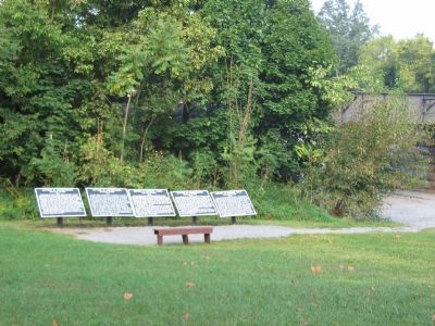
This is one of five tablets at Harpers Ferry describing the action here related to the Battle of Antietam.
Also see . . . 1862 Battle of Harpers Ferry. From the National Parks Service. (Submitted on October 12, 2007, by Craig Swain of Leesburg, Virginia.)

Photographed By Craig Swain, September 22, 2007
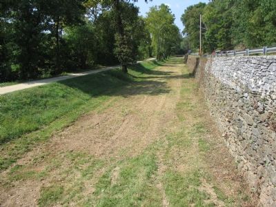
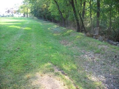
4. Cheasapeake and Ohio Canal Opposite Harpers Ferry
Federal cavalry used the canal tow path (on the left) as an escape route from Harpers Ferry. The cavalry had crossed the Potomac over a pontoon bridge spanning the river parallel to the railroad bridge. The Maryland end of the pontoon bridge was very close to Lock 33 of the C&O Canal.
Credits. This page was last revised on June 16, 2016. It was originally submitted on October 12, 2007, by Craig Swain of Leesburg, Virginia. This page has been viewed 1,435 times since then and 19 times this year. Photos: 1, 2, 3, 4. submitted on October 12, 2007, by Craig Swain of Leesburg, Virginia.


