Near Lookout Mountain in Hamilton County, Tennessee — The American South (East South Central)
"To Maintain A Siege"
| — | Chickamauga-Chatanooga National Military Park | — |
Photographed by Jason Armstrong, October 19, 2023
1. To Maintain A Siege Marker
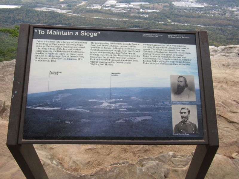
The next morning, Confederate generals Braxton Bragg and James Longstreet met on Lookout Mountain to discuss challenging this Union move. Suddenly a messenger brought word that Federal troops were entering Lookout Valley through Running Water Creek Gap. Determined to see for themselves, the generals came here to Sunset Rock and observed Union reinforcements from Virginia, commanded by General Joseph "Fighting Joe" Hooker.
Wanting to prevent the Union from regaining the valley, Bragg ordered Longstreet to make an assault. The assault was planned from here. The battle of Wauhatchie, fought in the pre-dawn hours of October 29th against an isolated Union division at Wauhatchie Junction, was unsuccessful. The Federals maintained
this page online
Erected by National Park Service U.S. Department of the Interior.
Topics. This historical marker is listed in this topic list: War, US Civil. A significant historical date for this entry is October 29, 1863.
Location. 35° 0.11′ N, 85° 21.302′ W. Marker is near Lookout Mountain, Tennessee, in Hamilton County. It can be reached from West Brow Road north of Linden Way, on the right when traveling south. Touch for map. Marker is in this post office area: Lookout Mountain TN 37350, United States of America. Touch for directions.

Regionally, this marker is in the American South, specifically in the Upper South, in Appalachia, and specifically in Southern Appalachia. Globally, it is in North America, the Western Hemisphere, the Western World, and the Anglosphere. Historically, it finds itself in what was once the original Cherokee Nation, the territory of the Mississippian Culture, one of the Confederate States of America, and the Antebellum South.
Other nearby markers. At least 8 other markers are within walking distance of this
Photographed by Jason Armstrong, October 19, 2023
2. To Maintain A Siege Marker
Also see . . . Chickamauga & Chatanooga National Military Park. National Park Service (Submitted on January 22, 2026.)
Credits. This page was last revised on January 22, 2026. It was originally submitted on January 22, 2026, by Jason Armstrong of Talihina, Oklahoma. This page has been viewed 125 times since then. Photos: 1, 2. submitted on January 22, 2026, by Jason Armstrong of Talihina, Oklahoma. • Bernard Fisher was the editor who published this page.
