Honolulu in Honolulu County, Hawaii — Hawaiian Island Archipelago (Pacific Ocean)
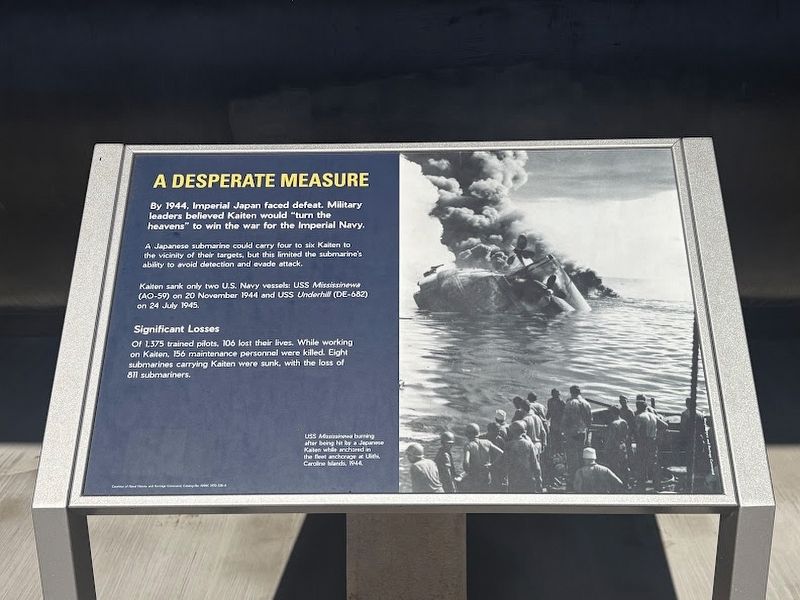
A Desperate Measure
Photographed by Darren Jefferson Clay, November 26, 2025
1. A Desperate Measure Marker
By 1944, Imperial Japan faced defeat. Military leaders believed Kaiten would "turn the heavens" to win the war for the Imperial Navy.
A Japanese submarine could carry four to six Kaiten to the vicinity of their targets, but this limited the submarine's ability to avoid detection and evade attack.
Kaiten sank only two U.S. Navy vessels: USS Mississinewa (AO-59) on 20 November 1944 and USS Underhill (DE-682) on 24 July 1945.
Significant Losses
Of 1375 trained pilots, 106 lost their lives. While working on Kaiten, 156 maintenance personnel were killed. Eight submarines carrying Kaiten were sunk, with the loss of 811 submariners. USS Mississinewa burning after being hit by a Japanese Kaiten while anchored in the fleet anchorage at Ulithi, Caroline Islands, 1944.
Topics. This historical marker is listed in these topic lists: War, World II • Waterways & Vessels. A significant historical date for this entry is November 20, 1944.
Location. 21° 22.138′ N, 157° 56.315′ W. Marker is in Honolulu, Hawaii, in Honolulu County. It can be reached from Arizona Memorial Road west of Kamehameha Highway (Hawaii Highway 99), on the left
this page online

Regionally, this marker is on Hawaii’s Pearl Harbor and Historic West Oahu. Globally, it is in North America, in Polynesia, in the Pacific Ocean, in North Pacific, on the Pacific Rim, in the Western Hemisphere, in the Western World, and in the Anglosphere.
Other nearby markers. At least 8 other markers are within walking distance of this marker: Inside a Kaiten (here, next to this marker); Top Secret Kaiten: Suicide Weapon (here, next to this marker); Mark 27 Torpedo (here, next to this marker); Mark 37 Electric Torpedo (a few steps from this marker); USS Parche (a few steps from this marker); Submarine Rescue Chamber (SRC) (a few steps from this marker); Mark 45 Nuclear Capable Torpedo (a few steps from this marker); Battle Stations Surface! 31 July 1944 (a few steps from this marker). Touch for a list and map of all markers in Honolulu.
Another marker is no longer nearby. Kaiten (was a few steps from this marker but has been replaced with another

Photographed by Darren Jefferson Clay, November 26, 2025
2. A Desperate Measure Marker (marker on left)
Credits. This page was last revised on January 29, 2026. It was originally submitted on January 23, 2026, by Darren Jefferson Clay of Duluth, Georgia. This page has been viewed 33 times since then. Photos: 1, 2. submitted on January 23, 2026, by Darren Jefferson Clay of Duluth, Georgia. • Devry Becker Jones was the editor who published this page.
