Kingston, Ontario — Central Canada (North America)
Roselawn
⎯⎯⎯
La Maison Roselawn
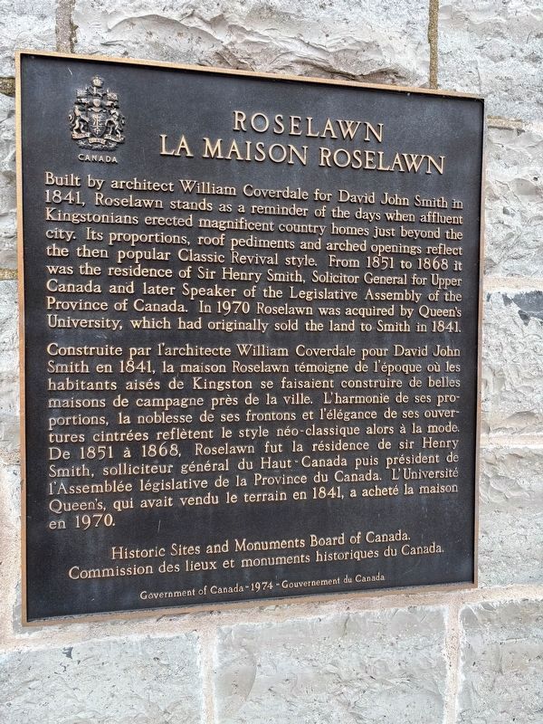
Photo courtesy of Queens University's Donald Gordon Hotel and Conference Centre, with permission
1. Roselawn - La Maison Roselawn - Marker

Built by architect William Coverdale for David John Smith in 1841, Roselawn stands as a reminder of the days when affluent Kingstonians erected magnificent country homes just beyond the city. Its proportions, roof pediments and arched openings reflect the then popular Classic Revival style. From 1851 to 1868 it was the residence of Sir Henry Smith, Solicitor General for Upper Canada and later Speaker of the Legislative Assembly of the Province of Canada. In 1970 Roselawn was acquired by Queen's University, which had originally sold the land to Smith in 1841.
Construite par l'architecte William Coverdale pour David John Smith en 1841, la maison Roselawn témoigne de l'époque où les habitants aisés de Kingston se faisaient construire de belles maisons de campagne près de la ville. L'harmonie de ses proportions, la noblesse de ses frontons et l'élégance de ses ouvertures cintrées reflètent le style néo-classique alors à la mode. De 1851 à 1868, Roselawn fut la résidence de sir Henry Smith, solliciteur général du Haut-Canada puis président de l'Assemblée législative de la Province du Canada. L'Université Queen's,
this page online
Erected 1974 by Historic Sites and Monuments Board of Canada.
Topics and series. This historical marker is listed in these topic lists: Architecture • Notable Buildings. In addition, it is included in the Canada, Historic Sites and Monuments Board series list. A significant historical year for this entry is 1841.
Location. 44° 13.535′ N, 76° 30.601′ W. Marker is in Kingston, Ontario. It is at the intersection of Union St and College St, on the right when traveling west on Union St. Marker is on an outdoor north-facing wall at the back of the original Roselawn building, within the courtyard of Donald Gordon Hotel and Conference Centre. Touch for map. Marker is at or near this postal address: 421 Union St, Kingston ON K7L 4L6, Canada. Touch for directions.

Regionally, this marker is in Eastern Ontario and specifically in Southeastern Ontario. It is also in Central Canada. Globally, it is in North America, on the Great Lakes, in the Western Hemisphere, in the Western World, and in the Anglosphere. Historically, it finds itself in what was once
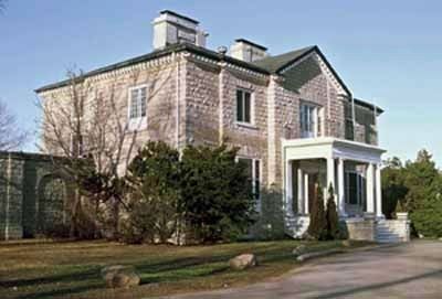
Photo from Government of Canada - Parks Canada, 1993
2. General view
This is the historic building Roselawn, part of the Donald Gordon Hotel and Conference Centre. © Parks Canada/Parcs Canada, 1993. Photo available at Parks Canada website pc.gc.ca . Terms of use at pc.gc.ca/termes-terms#p05
Other nearby markers. At least 8 other markers are within walking distance of this marker: Donald Gordon Centre / Le Centre Donald Gordon (here, next to this marker); Kingston Penitentiary / Le Penitencier de Kingston (approx. half a kilometer away); The Coach House / La Remise (approx. half a kilometer away); Bellevue House / Villa Bellevue (approx. 0.6 kilometers away); 1976 Olympic Cairn (approx. one kilometer away); Queen's University's Royal Charter (approx. 1.1 kilometers away); Professors' Walk (approx. 1.2 kilometers away); University Avenue Beautification (approx. 1.2 kilometers away). Touch for a list and map of all markers in Kingston.
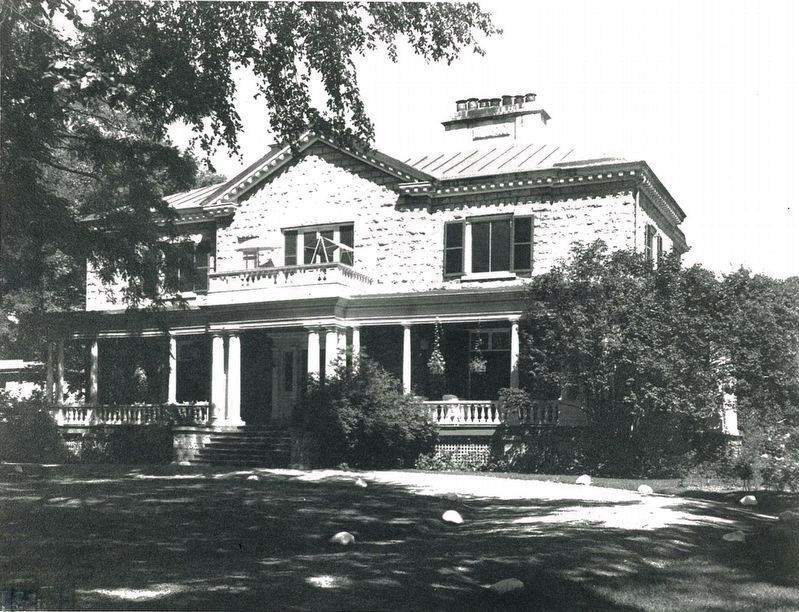
Photo by Queens University's Donald Gordon Hotel and Conference Centre, with permission
3. Vintage photo of the building Roselawn (part of the Donald Gordon Hotel and Conference Centre)
Credits. This page was last revised on August 11, 2026. It was originally submitted on January 24, 2026, by Kevin Westell of St. Catharines, Ontario. This page has been viewed 78 times since then. Photos: 1, 2, 3. submitted on January 24, 2026, by Kevin Westell of St. Catharines, Ontario.
