Midtown - Downtown in Columbia in Richland County, South Carolina — The American South (South Atlantic)
Pump House
Waterworks at Columbia Canal

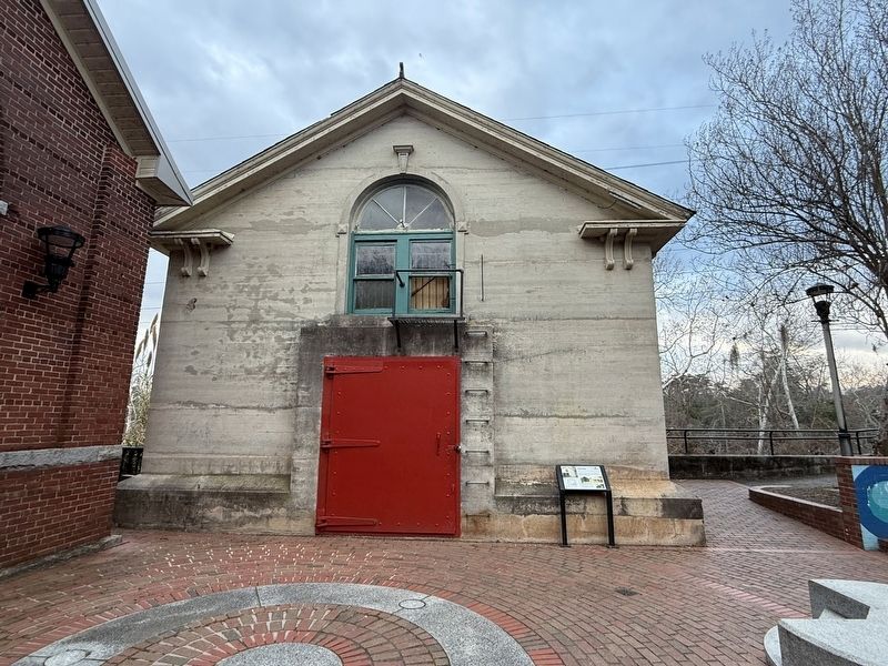
In 1924, the Columbia Waterworks constructed a watertight Pump House beside the Turbine House. Two electric pumps pulled 24 million gallons of raw water per day to the water treatment plant.
Waterproofing was necessary to protect the mechanical equipment inside. The exterior door and lower windows were watertight and could be sealed. An exterior ladder allowed operators exit and re-enter the the building from the top window when flooding occurred.
In 1974, Columbia Waterworks began to pull raw water directly from the Columbia Canal for treatment; both buildings ceased operation.
[Captions:]
1924 Power house drawing showing west side (river side) of building
Pump Houses during flooding, August 18, 1928 (above). Note the arrow on the right side building which reflects a high water mark from earlier; measurements taken at the water plant note that it was two inches short of Columbia's highest flood of record on August 22, 1908.
Erected by City of Columbia.
Topics. This historical marker is listed in these topic lists: Industry & Commerce • Waterways & Vessels. A significant historical date for this entry is August 18, 1928.
Location. 34° 0.158′ N,
this page online

Regionally, this marker is in the Midlands. It is also in the American South and specifically in the Deep South. Globally, it is in North America, the Western Hemisphere, the Western World, and the Anglosphere. Historically, it finds itself in what was once the territory of the Mississippian Culture, one of the original Thirteen Colonies, one of the Confederate States of America, and the Antebellum South.
Other nearby markers. At least 8 other markers are within walking distance of this marker: Hydroelectric Plant (a few steps from this marker); Waterworks (about 300 feet away, measured in a direct line); Riverfront Park (about 300 feet away); Historic Columbia Canal (about 300 feet away); Irish Canal Workers
Photographed by Devry Becker Jones (CC0), January 17, 2026
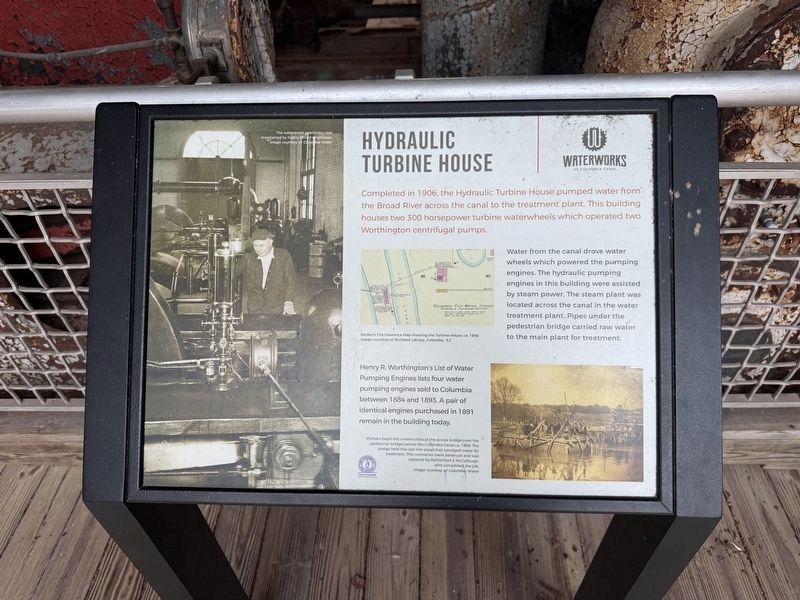
3. This plaque is inside the Hydraulic Turbine House
Hydraulic Turbine House
Waterworks at Columbia Canal
Completed in 1906, the Hydraulic Turbine House pumped water from the Broad River across the canal to the treatment plant. This building houses two 300 horsepower turbine waterwheels which operated Worthington centrifugal pumps.
Water from the canal drove water wheels which powered the pumping engines. The hydraulic pumping engines in this building were assisted by steam power. The steam plant was located across the canal in the water treatment plant. Pipes under the pedestrian bridge carried water to the main plant for treatment.
Henry R. Worthington's List of Water Pumping Engines lists four water pumping engines sold to Columbia between 1884 and 1893. A pair of identical engines purchased in 1891 remain in the building today.
Credits. This page was last revised on January 24, 2026. It was originally submitted on January 24, 2026, by Devry Becker Jones of Washington, District of Columbia. This page has been viewed 36 times since then. Photos: 1, 2, 3. submitted on January 24, 2026, by Devry Becker Jones of Washington, District of Columbia.
