Midtown - Downtown in Columbia in Richland County, South Carolina — The American South (South Atlantic)
A Gateway into a Hidden World
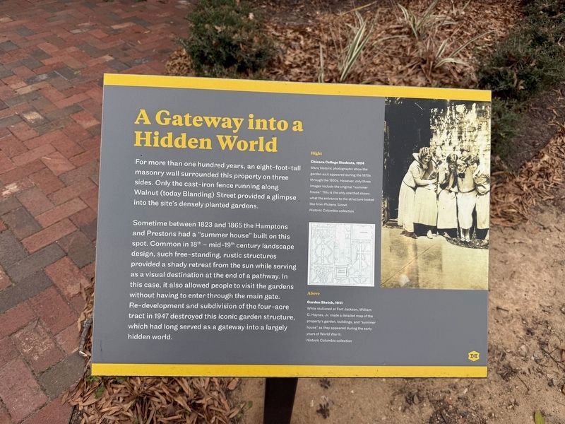
For more than one hundred years, an eight-foot-tall masonry wall surrounded this property on three sides. Only the cast-iron fence running along Walnut (today's Blanding Street) provided a glimpse into the site's densely planted gardens.
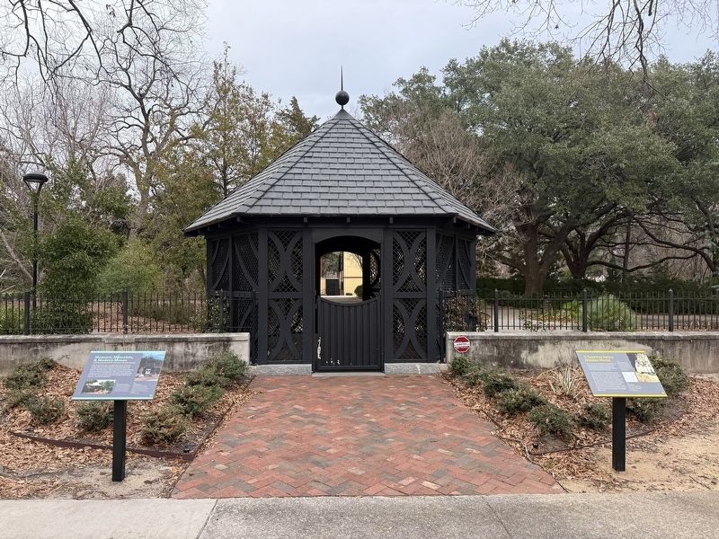
Sometimes between 1823 and 1865 the Hamptons and Prestons had a "summer house" built on this spot. Common in 18th - mid-19th century landscape design, such as free-standing rustic sculptures provided a shady retreat from the sun while serving as a visual destination at the end of a pathway. In this case, it also allowed people to visit the gardens without having to enter through the main gate. Re-development and subdivision of the four-acre tract in 1947 destroyed this iconic garden structure, which had long served as a gateway into a largely hidden world.
[Captions:]
Right
Chicora College Students, 1924
Many historic photographs show the garden as it appeared during the 1870s through the 1930s. However, only three images include the original "summer house." This is the only one that shows what the entrance to the structure looked like from Pickens Street.
Historic Columbia collection
Above
Garden Sketch, 1941
While stationed at Fort Jackson, William G. Haynes, Jr. made a detailed map of the property's garden, buildings, and "summer house" as they appeared during the early years of World War II.
Historic Columbia collection
Erected by Historic
this page online
Topics. This historical marker is listed in these topic lists: Architecture • Education • Horticulture & Forestry • Women. A significant historical year for this entry is 1823.
Location. 34° 0.622′ N, 81° 1.807′ W. Marker is in Columbia, South Carolina, in Richland County. It is in Midtown - Downtown. It can be reached from Pickens Street north of Blanding Street, on the right when traveling north. Touch for map. Marker is at or near this postal address: 1711 Pickens St, Columbia SC 29201, United States of America. Touch for directions.

Regionally, this marker is in the Midlands. It is also in the American South and specifically in the Deep South. Globally, it is in North America, the Western Hemisphere, the Western World, and the Anglosphere. Historically, it finds itself in what was once the territory of the Mississippian Culture, one of the original Thirteen Colonies, one of the Confederate States of America, and the Antebellum South.
Other nearby markers. At least 8 other markers are within walking distance of this marker: Memories, Materials, & Modern Means (here, next to this marker);
Additional keywords. landscape architecture
Credits. This page was last revised on January 24, 2026. It was originally submitted on January 24, 2026, by Devry Becker Jones of Washington, District of Columbia. This page has been viewed 56 times since then. Photos: 1, 2. submitted on January 24, 2026, by Devry Becker Jones of Washington, District of Columbia.
