
Honolulu in Honolulu County, Hawaii — Hawaiian Island Archipelago (Pacific Ocean)
Battle Stations Surface! 31 July 1944
Photographed by Darren Jefferson Clay, November 26, 2025
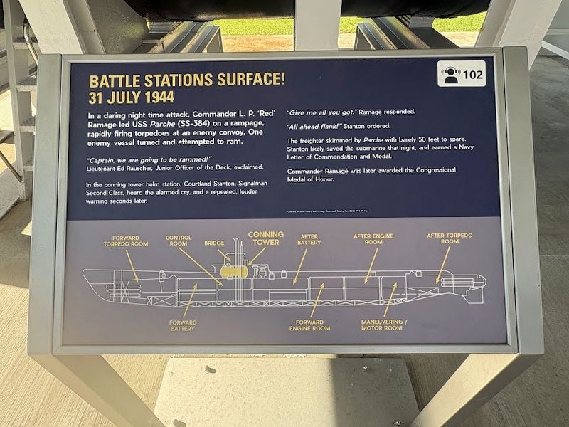
1. Battle Stations Surface! 31 July 1944 Marker
In a daring night time attack, Commander L. P. 'Red' Ramage led USS Parche (SS-384) on a rampage. rapidly firing torpedoes at an enemy convoy. One enemy vessel turned and attempted to ram.
"Captain, we are going to be rammed!" -Lieutenant Ed Rauscher, Junior Officer of the Deck, exclaimed.
In the conning tower helm station. Courtland Stanton, Signalman Second Class, heard the alarmed cry, and a repeated, louder warning seconds later.
"Give me all you got," Ramage responded.
"All ahead flank!" Stanton ordered.
The freighter skimmed by Parche with barely 50 feet to spare. Stanton likely saved the submarine that night, and earned a Navy Letter of Commendation and Medal.
Commander Ramage was later awarded the Congressional Medal of Honor.
Topics. This historical marker is listed in these topic lists: War, World II • Waterways & Vessels. A significant historical date for this entry is July 31, 1944.
Location. 21° 22.137′ N, 157° 56.323′ W. Marker is in Honolulu, Hawaii, in Honolulu County. It can be reached from Arizona Memorial Road west of Kamehameha Highway (Hawaii Route 99), on the left when traveling north.
this page online

Regionally, this marker is on Hawaii’s Pearl Harbor and Historic West Oahu. Globally, it is in North America, Polynesia, the Pacific Ocean, North Pacific, the Pacific Rim, the Western Hemisphere, the Western World, and the Anglosphere.
Other nearby markers. At least 8 other markers are within walking distance of this marker: Mark 14: Early Failures (here, next to this marker); USS Parche (a few steps from this marker); Submarine Propeller USS Darter (SS-576) (a few steps from this marker); Mark 27 Torpedo (a few steps from this marker); Tomahawk Land Attack Missile (TLAM) (a few steps from this marker); A Desperate Measure (a few steps from this marker); 3"/50 Deck Gun (a few steps from this marker); Bofors 40MM Quad Gun (a few steps from this marker). Touch for a list and map of all markers in Honolulu.
Photographed by Darren Jefferson Clay, November 26, 2025
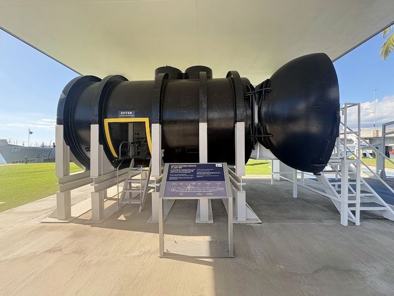
2. Battle Stations Surface! 31 July 1944 Marker
Credits. This page was last revised on January 29, 2026. It was originally submitted on January 24, 2026, by Darren Jefferson Clay of Duluth, Georgia. This page has been viewed 49 times since then. Photos: 1, 2. submitted on January 24, 2026, by Darren Jefferson Clay of Duluth, Georgia. • Devry Becker Jones was the editor who published this page.
