Saluda Riverwalk in Columbia in Richland County, South Carolina — The American South (South Atlantic)
Stark's Ferry
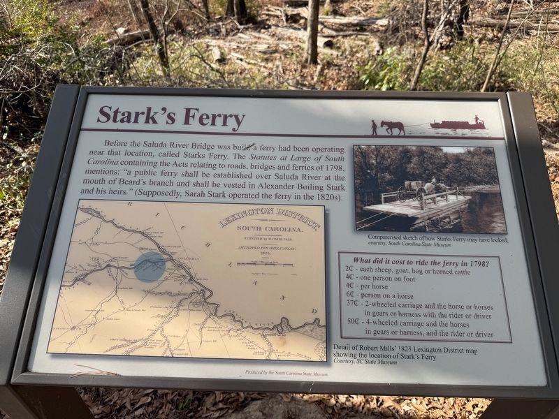
Before the Saluda River Bridge was built, a ferry had been operating near that location, called Starks Ferry. The Statues at Large of South Carolina containing the Acts relating to roads, bridges and ferries of 1798, mentions: "a public ferry shall be established over Saluda River at the mouth of Beard's branch and shall be vested in Alexander Boiling Stark and his heirs." (Supposedly, Sarah Stark operated the ferry in the 1820s).
What did it cost to ride the ferry in 1798? 2¢ - each sheep, goat, hog or horned cattle
4¢ - one person on foot
4¢ - per horse
6¢ - person on a horse
37¢ - 2-wheeled carriage and the horse or horses in gears or harness with the rider or driver
50¢ - 4-wheeled carriage and the horses in gears or harness, and the rider or driver
Erected by South Carolina State Museum.
Topics. This historical marker is listed in this topic list: Waterways & Vessels. A significant historical year for this entry is 1798.
Location. 34° 0.57′ N, 81° 4.605′ W. Marker is in Columbia, South Carolina, in Richland County. It is in Saluda Riverwalk. It can be reached from Candi Lane west of Greystone Boulevard,
this page online

Regionally, this marker is in the Midlands. It is also in the American South and specifically in the Deep South. Globally, it is in North America, the Western Hemisphere, the Western World, and the Anglosphere. Historically, it finds itself in what was once the territory of the Mississippian Culture, one of the original Thirteen Colonies, one of the Confederate States of America, and the Antebellum South.
Other nearby markers. At least 8 other markers are within walking distance of this marker: Riverbanks Zoo and Garden (within shouting distance of this marker); Old Saluda River Bridge (about 300 feet away, measured in a direct line); A Bridge to the Past (about 300 feet away); Riverbanks Park (approx. 0.2 miles away); Aquarium-Reptile Complex (approx. 0.2 miles away); Conservation Around the World (approx. 0.2 miles away); Saluda Factory Ruins (approx. ¼ mile away); Doing Our Part for Penguins (approx. ¼ mile away). Touch for a list and map of

Credits. This page was last revised on August 19, 2026. It was originally submitted on January 24, 2026, by Devry Becker Jones of Washington, District of Columbia. This page has been viewed 45 times since then. Photos: 1, 2. submitted on January 24, 2026, by Devry Becker Jones of Washington, District of Columbia.
