Near Honeybee in McCreary County, Kentucky — The American South (East South Central)
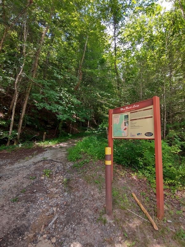
Big Bend Loop
Hiking Trail

Photographed by Tom Bosse, July 12, 2025
1. Big Bend Loop Marker
This trail offers the hiker a relatively easy 4.5 mile loop trough the Cumberland Falls Nature Preserve, which is home to many species of unique and rare plants. The first 1/2 mile of trail follows the original wagon road that brought visitors to the falls from the train station at Parker's Lake. The beginning of the trail takes you past the foundation of the old Cumberland Falls Hotel that opened during the 1920's, unfortunately the hotel burned in 1947. Along the ridge top you will notice several clearings where old homesteads were located. The last two miles of trail follows the Sheltowee Trace Trail along the beautiful Cumberland River before ending at the Gatliff Bridge.
Trail Rules
* Foot travel only.
* No hunting.
* No pets.
* No rappelling or rock climbing.
* No camping or fire building.
* Trail closes at dark.
Trail rating and Safety
* Total length 4.5 miles, easy to moderate.
* Portions of trail are underwater during high river levels.
Erected by Cumberland Falls State Resort Park.
Topics. This historical marker is listed in this topic list: Parks & Recreational Areas. A significant historical year for this entry is 1947.
Location. 36° 50.181′ N,
this page online

Regionally, this marker is in Eastern Kentucky, in the Lake Cumberland Region, and in the Cumberland Plateau. It is also in the American South, specifically in the Upper South, in Appalachia, and specifically in Southern Appalachia. Globally, it is in North America, the Western Hemisphere, the Western World, and the Anglosphere. Historically, it finds itself in what was once the territory of the Mississippian Culture and also the Antebellum South.
Other nearby markers. At least 8 other markers are within 12 miles of this marker, measured as the crow flies: Niagara of the South (within shouting distance of this marker); Cumberland Falls MoonBow (about 800 feet away, measured in a direct line); Cumberland Falls… (approx. 0.2 miles away); CCC at Cumberland Falls / Civilian Conservation Corps (approx. 0.4 miles away); Kiwanis Trail
Photographed by Tom Bosse, July 12, 2025
2. Big Bend Loop Marker
Another marker is no longer nearby. 4-H Craft Center (was approx. 3 miles away but has been confirmed missing).

Photographed by Tom Bosse, July 12, 2025
3. Big Bend Loop Marker
Credits. This page was last revised on January 27, 2026. It was originally submitted on January 26, 2026, by Tom Bosse of Jefferson City, Tennessee. This page has been viewed 69 times since then. Photos: 1, 2, 3. submitted on January 26, 2026, by Tom Bosse of Jefferson City, Tennessee. • James Hulse was the editor who published this page.
