
St. Andrews in Saint Andrews, New Brunswick — The Atlantic Provinces (North America)
St. Croix River
⎯⎯⎯
La Rivière Sainte-Croix
Photographed by Barry Swackhamer, June 10, 2014
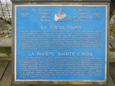
1. St. Croix River / La Rivière Sainte-Croix Marker

From the Chiputneticook Lakes, the waters of the St. Croix River tumble through rolling Appalachian scenery to one of the most historic estuaries in Canada, at Passamaquoddy Bay. Here, French colonization in North America began in 1604 on St. Croix Island. The river was travelled for millennia by native fishermen and traders and as an international border, British Loyalists and others later crossed these waters to contribute to the founding of Canada. Today, the St. Croix’s scenery, historic communities and traditional recreational fishing and canoeing continue to attract many to the region. For these unique features the New Brunswick side of the St. Croix River has been proclaimed a Canadian Heritage River.
this page online
Erected 1991.
Topics and series. This historical marker is listed in this topic list: Waterways & Vessels. In addition, it is included in the Acadian History series list. A significant historical year for this entry is 1604.
Location. 45° 4.391′ N, 67° 3.182′ W. Marker is in St. Andrews, New Brunswick, in Saint Andrews. It can be reached from Water Street close to King Street, on the right when traveling east. Touch for map. Marker is at or near this postal address: 205 Water Street, St Andrews NB E5B 1B4, Canada. Touch for directions.

Regionally, this marker is in Charlotte County and the Fundy Isles. It is also in the Maritimes and in Atlantic Canada. Globally, it is in the North Atlantic Region, North America, the Western Hemisphere, the Western World,
circa 1930
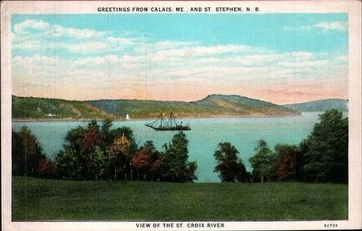
2. View of the St. Croix River
Other nearby markers. At least 8 other markers are within walking distance of this marker: Lest We Forget (within shouting distance of this marker); St. Andrews Historic District (within shouting distance of this marker); Charlotte County Court House (approx. 0.4 kilometers away); Greenock Church / L’Église Greenock (approx. 0.4 kilometers away); The 200 Million Year Wait is Over! (approx. 0.8 kilometers away); War of 1812: Defending St. Andrews (approx. 0.8 kilometers away); Blockhouse 101 (approx. 0.8 kilometers away); Two hundred years and counting (approx. 0.8 kilometers away). Touch for a list and map of all markers in St. Andrews.
Credits. This page was last revised on January 28, 2026. It was originally submitted on September 23, 2014, by Barry Swackhamer of Brentwood, California. This page has been viewed 686 times since then and 36 times this year. Last updated on January 28, 2026, by Carl Gordon Moore Jr. of North East, Maryland. Photos: 1. submitted on September 23, 2014, by Barry Swackhamer of Brentwood, California. 2. submitted on September 28, 2014. • Devry Becker Jones was the editor who published this page.
Editor’s want-list for this marker. Contextual photo of marker and its surroundings . • Can you help?
