Mt. Meigs in Montgomery County, Alabama — The American South (East South Central)
Ulibahali
Photographed by Mark Hilton, December 26, 2025
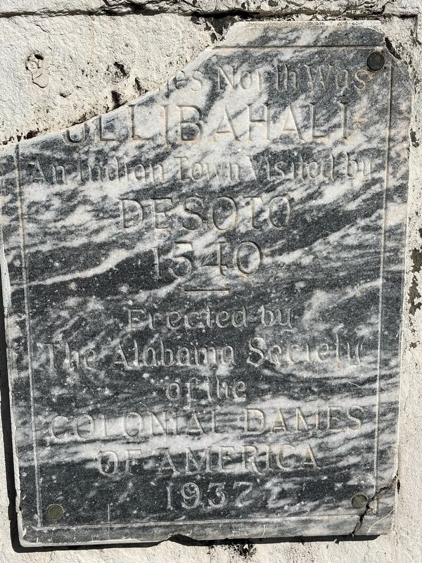
1. Celibahali Marker
Ulibahali
An Indian Town Visited by
DeSoto
1540
Erected 1937 by The Alabama Society of the Colonial Dames of America.
Topics and series. This historical marker is listed in these topic lists: Exploration • Indigenous Peoples and Communities. In addition, it is included in the The Colonial Dames of America series list. A significant historical year for this entry is 1540.
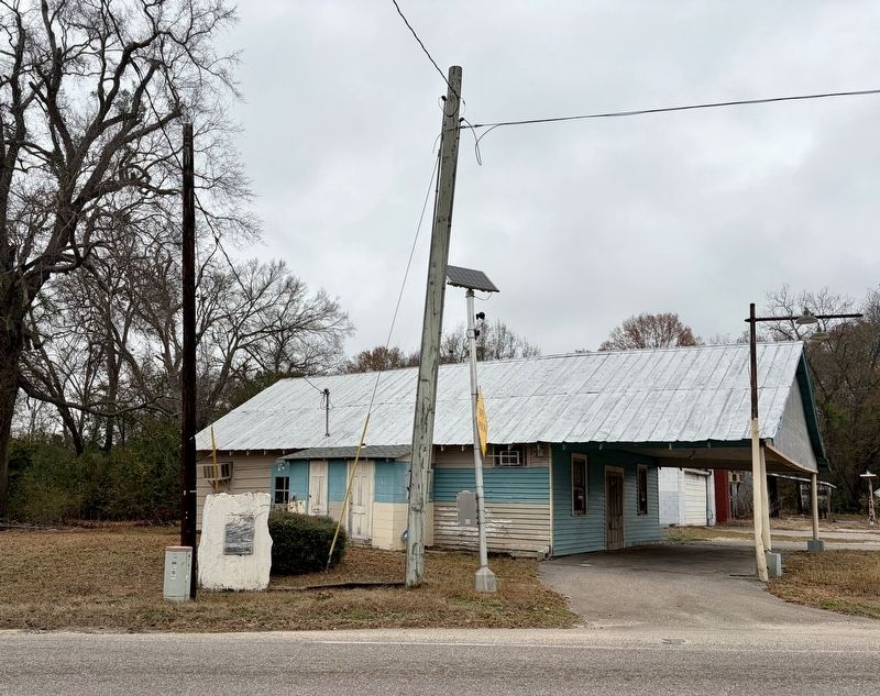
Location. 32° 21.754′ N, 86° 6.126′ W. Marker is in Mt. Meigs, Alabama, in Montgomery County. It is at the intersection of Wares Ferry Road and U.S. 80, on the right when traveling north on Wares Ferry Road. Touch for map. Marker is at or near this postal address: 11115 US-80, Pike Road AL 36064, United States of America. Touch for directions.

Regionally, this marker is in the Tri-Counties River Region. It is also in the American South, specifically in the Deep South, and in the Black Belt. Globally, it is in North America, a Gulf of Mexico state, the Western Hemisphere, the Western World, and the Anglosphere. Historically, it finds itself in what was once the territory of the Mississippian Culture,
this page online
Other nearby markers. At least 8 other markers are within 4 miles of this marker, measured as the crow flies: Antioch Baptist Church (approx. half a mile away); Georgia Washington School (approx. 0.6 miles away); Grace Episcopal Church (approx. 0.7 miles away); Ray Cemetery (approx. 2.4 miles away); The Oaks Plantation (approx. 3.4 miles away); Lucas Tavern (approx. 3½ miles away); Taylor Field (approx. 3.8 miles away); Augusta and the Old Augusta Cemetery (approx. 3.8 miles away).
Another marker is no longer nearby. Chantilly Plantation (was approx. 1.2 miles away but has been permanently removed).
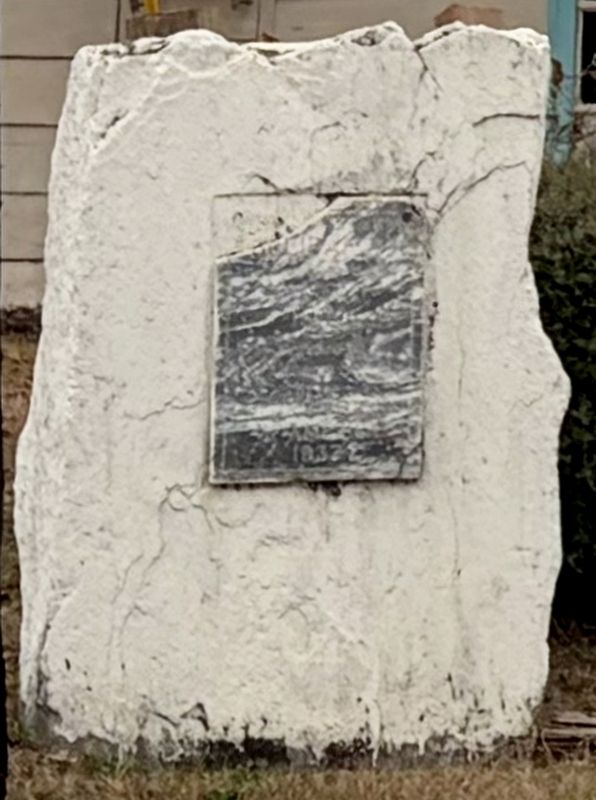
More about this marker. Top left hand corner of marker is broken off, thus the number of miles north is unknown. Email with the Alabama Society of the Colonial Dames of America was not returned.
Regarding Ulibahali. Ulibahali, a town of the Creek Indian chiefdom, was visited by Hernando de Soto in August 1540 during his expedition through Alabama. De Soto and his army arrived at Ulibahali on August 31, 1540, after departing from the town of Coosa. The
Photographed by Mark Hilton, December 26, 2025
2. Celibahali Marker
Ulibahali served as a significant stop on de Soto’s journey westward from Georgia into Alabama. The town was part of a larger network of Native American chiefdoms that de Soto encountered during his search for gold and resources. After resting and regrouping in Ulibahali, de Soto continued his expedition to Talisi, near what is now Montgomery, and eventually to the site of the Battle of Mabila in October 1540.
Archaeologists and historians continue to study the region, with some evidence suggesting that Ulibahali may be associated with the broader Creek Indian agricultural complex that flourished in the area during the 16th century. While the exact archaeological site of Ulibahali remains uncertain, its historical significance is well-documented in Spanish expedition records and modern scholarship.
De Soto was on a four-year, 4,000-mile, violent expedition across the American Southeast, having landed in Tampa Bay, Florida, in 1539.
Photographed by Mark Hilton, December 26, 2025
3. Celibahali Marker
Credits. This page was last revised on January 28, 2026. It was originally submitted on January 28, 2026, by Mark Hilton of Montgomery, Alabama. This page has been viewed 111 times since then. Photos: 1, 2, 3. submitted on January 28, 2026, by Mark Hilton of Montgomery, Alabama.
