
Steinau an der Straße in Main-Kinzig-Kreis, Hesse, Germany — Central Europe
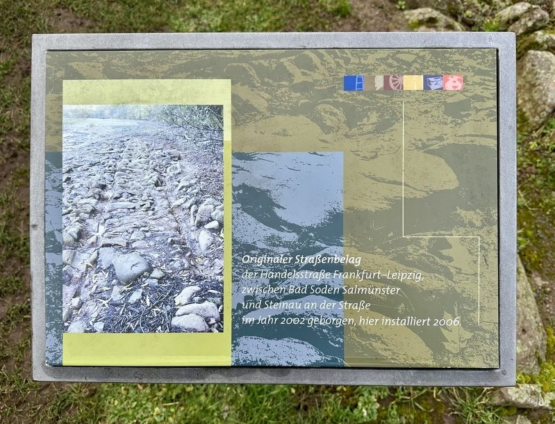
Originaler Straßenbelag
⎯⎯⎯
Original Road Surface
Photographed by Andrew Ruppenstein, January 31, 2025
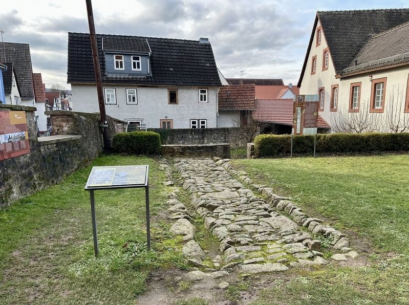
1. Originaler Straßenbelag / Original Road Surface Marker

Topics. This historical marker is listed in this topic list: Roads & Vehicles. A significant historical year for this entry is 2002.
Location. 50° 18.758′ N, 9° 27.611′ E. Marker is in Steinau an der Straße, Hessen (Hesse), in Main-Kinzig-Kreis. It is on Brüder-Grimm-Straße, on the right when traveling west. The marker is located on the grounds of the Brothers Grimm House Museum. Touch for map. Marker is at or near this postal address: Brüder-Grimm-Straße 80, Steinau an der Straße HE 36396, Germany. Touch for directions.

Regionally, it is in Europe, the European Union, Atlantic Europe, Central Europe, the Schengen Area, Western Europe, and the Western World. Historically, it finds itself in what was once the Roman Empire, the Holy Roman Empire, and the former West Germany.
Other nearby markers. At
this page online
Also see . . . Die alte Handelsstraße Frankfurt - Leipzig (ViaRegia.org, in German). Excerpt (in translation):
The Old Trade Route Frankfurt - Leipzig(Submitted on January 29, 2026.)
The Short and the Long Hessian roads—these two important old Hessian roads—served as the main trade routes connecting the trade fair cities of Leipzig and Frankfurt am Main throughout the 16th and 17th centuries, and partly into the 18th. It was only with the construction of paved roads beginning in the 18th century that the Kinzig Valley Road gained its later significance.
As early as 1569, thepeople of Leipzig commented on these two roads: "If one wants to travel from Leipzig to Frankfurt, there are two proper roads through the Hessian countryside, which we and our ancestors before us have used for a long time, well beyond living memory. One goes through the 'Short Hessian roads' to Eisenach, Hersfeld, Alsfeld, and Grünberg; the other through the 'Long Hessian roads' to Eisenach or Kreuzburg, Kappel, Spangenberg, Treysa, Kirchhain, and Gießen."Photographed by Andrew Ruppenstein, January 31, 20252. Originaler Straßenbelag / Original Road Surface and marker
Credits. This page was last revised on January 29, 2026. It was originally submitted on January 29, 2026, by Andrew Ruppenstein of Lamorinda, California. This page has been viewed 19 times since then. Photos: 1, 2. submitted on January 29, 2026, by Andrew Ruppenstein of Lamorinda, California.
