Sioux Falls in Minnehaha County, South Dakota — The American Midwest (Upper Plains)
The Dakota War of 1862
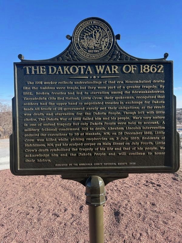
Photographed by Isaac B Engbers, January 30, 2026
1. The Dakota War of 1862 Marker
The 1991 marker reflects understandings of that era. Noncombatant deaths like the Amidons were tragic, but they were part of a greater tragedy. By 1862, broken treaties had led to starvation among the Bdewankantonwan. Taoyateduta (His Red Nation), Little Crow, their spokesman, recognized that settlers had the upper hand so negotiated treaties in exchange for Dakota lands. All levels of US government rarely met their obligations, so the result was death and starvation for the Dakota People. Though left with little choice, The Dakota War of 1862 failed him and his people. War's very nature is one of mutual tragedy but only Dakota People were held to account. A military tribunal condemned 303 to death. Abraham Lincoln's intervention reduced the executions to 38 at Mankato, MN, on 26 December 1862. Little Crow was killed while picking raspberries on 3 July 1863. Residents of Hutchinson, MN, put his scalped corpse on Main Street on July Fourth. Little Crow's death symbolized the tragedy of his life and that of his people. We acknowledge him and the Dakota People and will continue to honor their history.
Erected 2025
this page online
Topics. This historical marker is listed in this topic list: Wars, US Indian. A significant historical date for this entry is July 3, 1863.
Location. 43° 34.451′ N, 96° 42.711′ W. Marker is in Sioux Falls, South Dakota, in Minnehaha County. It is on North Drive north of East Maple Street. Touch for map. Marker is at or near this postal address: 2402 North Dr, Sioux Falls SD 57104, United States of America. Touch for directions.

Regionally, this marker is in East River. It is also in the American Midwest, in the Lewis & Clark Corridor, in the Corn Belt, on the prairies, and on the Northern Plains. Globally, it is in North America, the Western Hemisphere, the Western World, and the Anglosphere. Historically, it finds itself in what was once Rupert’s Land and also the Louisiana Purchase.
Other nearby markers. At least 8 other markers are within 2 miles of this marker, measured as the crow flies: Memorial to the Pioneers of Minnehaha County (a few steps from this marker); The Amidon Affair (a few steps from this marker); Amidon Graves Mystery (about 600 feet away, measured in a direct line); Magma (approx. 0.4 miles away); Albert M. Mansor (approx. 0.7 miles away); First Concrete State Highway (approx. 0.8 miles away); Frederick Manfred’s “Siouxland” (approx. 1.2 miles away); The Dubuque House (approx. 1.2 miles away). Touch for a list and map of all markers in Sioux Falls.
Credits. This page was last revised on February 2, 2026. It was originally submitted on January 30, 2026, by Isaac B Engbers of Sioux Falls, South Dakota. This page has been viewed 125 times since then. Photo 1. submitted on January 30, 2026, by Isaac B Engbers of Sioux Falls, South Dakota. • J. Makali Bruton was the editor who published this page.
Editor’s want-list for this marker. A photo of the marker's reverse. • A wide view photo of the marker and the surrounding area together in context. • Can you help?
