
Near Petersburg in Prince George County, Virginia — The American South (Mid-Atlantic)
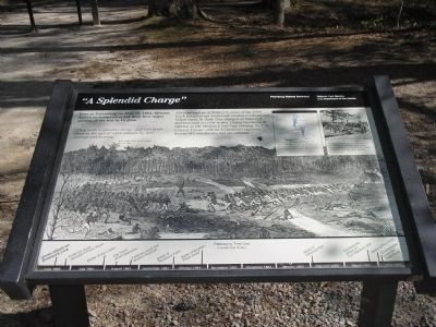
“A Splendid Charge”
Petersburg National Battlefield
| — | National Park Service, U.S. Department of the Interior | — |
Photographed by Bill Coughlin, April 23, 2007
1. "A Splendid Charge" Marker
“They made a splendid charge…and won great favor in the eyes of white soldiers by their courage and bravery.”
- Wilbur Fiske, 2nd Vermont Infantry June 19, 1864
After the capture of Battery 5, some of the 3,500 black troops swept southward, routing Confederates before them. At dusk, they charged on Battery 9 and swarmed over the works. During two hours of fighting on the Dimmock Line that evening, the U.S. Colored Troops (official designation) captured dozens of Confederates and six cannons.
Erected by National Park Service, U.S. Department of the Interior.
Topics. This historical marker is listed in these topic lists: African Americans • War, US Civil. A significant historical month for this entry is June 1876.
Location. 37° 13.959′ N, 77° 21.284′ W. Marker is near Petersburg, Virginia, in Prince George County. It is on Siege Road, on the left when traveling south. Marker is in Petersburg National Battlefield. It is located at Tour Stop 3. Touch for map. Marker is in this post office area: Fort
this page online

Regionally, this marker is in Coastal Virginia. It is also in the American South, specifically in the Upper South, in the Tidewater, and on the Eastern Seaboard. Globally, it is in the North Atlantic Region, North America, the Western Hemisphere, the Western World, and the Anglosphere. Historically, it finds itself in what was once the territory of the Mississippian Culture, one of the original Thirteen Colonies, one of the Confederate States of America, and the Antebellum South.
Other nearby markers. At least 8 other markers are within walking distance of this marker: A different marker also named Infantry Earthworks (a few steps from this marker); Monotonous Toil (a few steps from this marker); U.S. Colored Troops (within shouting distance of this marker); Battery 8 of the Dimmock Line (approx. 0.3 miles away); Spring Used By The 209th Regt. Penn Vols. (approx. 0.4 miles away); The United States Military Railroad (approx. 0.4 miles away); Dividing Point (approx. half a mile away); Training for War on Hallowed Ground (approx. half a mile away). Touch for a list and map
Photographed by Bill Coughlin, April 23, 2007
2. Markers at Battery 9
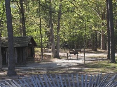
Black troops of Hink's Division captured this position, Confederate Battery 9, during the fighting on June 15, 1864.
Other markers no longer nearby. Infantry Earthworks (was a few steps from this marker but has been replaced with another marker now near it); Prince George Court House Road (was a few steps from this marker but has been permanently removed).
More about this marker. The background of the marker is a sketch of the Union attack of the Dimmock Line.
The upper right of the marker contains a battle map and a war-time photo of soldiers on the Petersburg Lines. The map has a caption The Union advance on Batteries 8 and 9 stood on this spot, at the intersection of the Prince George Court House and Jordon Point Roads. The caption under the photo states African-American troops performed important services during the Siege of Petersburg. On April 3, 1865, lack troops would be among the first Union soldiers to enter the fallen capital of Richmond.
Like many other markers in Petersburg National Battlefield, the bottom of this marker contains a Petersburg Time Line. The Union attack on Dimmock Line is the first event noted.
Also see . . .
1. Petersburg National Battlefield. National Park Service.
Photographed by Bill Coughlin, April 23, 2007
3. Cannon at Battery 9
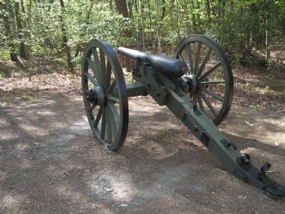
The location of the marker was the site of Confederate Battery 9. It was taken by the Union on the first day of fighting along the Dimmock Line.
2. The Siege of Petersburg. (Submitted on April 13, 2008, by Bill Coughlin of Woodland Park, New Jersey.)
Credits. This page was last revised on February 1, 2026. It was originally submitted on April 13, 2008, by Bill Coughlin of Woodland Park, New Jersey. This page has been viewed 1,812 times since then and 32 times this year. Last updated on February 1, 2026, by Evan Dwyer of Richmond, Virginia. Photos: 1, 2, 3. submitted on April 13, 2008, by Bill Coughlin of Woodland Park, New Jersey. • Devry Becker Jones was the editor who published this page.
