
Bay City in Matagorda County, Texas — The American South (West South Central)
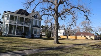
D.P. and Louise Moore House

Photographed by Dave W, January 31, 2026
1. D.P. and Louise Moore House Marker
Dolph Phenias (D.P.) Moore (1852-1928) moved to Matagorda County in 1869. He married Louise Wendel in 1879 and together they reared ten children. A successful merchant, rancher, and landowner, Moore sold the land on which the town of Bay City was platted in 1894. He moved his family to Bay City that year. Local contractors Hatchett & Large built this 15-room Queen Anne style house for the Moores in 1902. A prominent civic leader, Moore was instrumental in bringing railroads to Bay City and in the development of the area's rice industry. He donated land for Cedarvale Cemetery and Park.
Erected 1995 by Texas Historical Commission. (Marker Number 1145.)
Topics. This historical marker is listed in these topic lists: Agriculture • Industry & Commerce • Railroads & Streetcars • Settlements & Settlers. A significant historical year for this entry is 1902.
Location. 28° 58.766′ N, 95° 58.289′ W. Marker is in Bay City, Texas, in Matagorda County. It is at the intersection of Avenue East and 4th Street, on the right when traveling south on Avenue East. Touch for map. Marker is at or near this postal address: 2404 Avenue E, Bay City TX 77414, United States of America. Touch for directions.

Regionally, this marker is in the American South and on the Gulf Coast. Globally, it is in North America, a Gulf of Mexico state, the Western Hemisphere, the Western World, and the Anglosphere. Historically, it finds itself in what was once New Spain, the Republic of Texas, one of the Confederate States of America, and the Antebellum South.
Other nearby markers. At least 8 other markers are within walking distance of this marker: First Baptist Church of Bay City (about 600 feet away, measured in a direct line); Kilbride-Barkley House (about 700 feet away); St. Mark's Episcopal Church
this page online
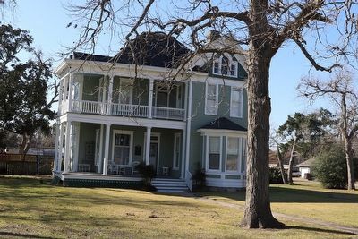
Photographed by Dave W, January 31, 2026
2. D.P. and Louise Moore House Marker
Marker seen here just left of the front door.
Photographed by Dave W, January 31, 2026
3. D.P. and Louise Moore House Marker
Looking north along the sidewalk.
Credits. This page was last revised on February 2, 2026. It was originally submitted on February 2, 2026, by Dave W of Co, Colorado. This page has been viewed 72 times since then. Photos: 1, 2, 3. submitted on February 2, 2026, by Dave W of Co, Colorado. • James Hulse was the editor who published this page.
