Markham in Matagorda County, Texas — The American South (West South Central)
Pilgrim Rest Baptist Church
Photographed by Dave W, January 31, 2026
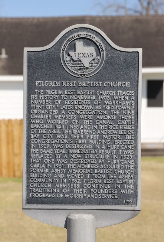
1. Pilgrim Rest Baptist Church Marker
The Pilgrim Rest Baptist Church traces its history to November 1903, when a number of residents of Markham's "Tent City" later known as "Red Town," organized a congregation. Nine charter members were among those who worked on the canal, cattle ranches, rail lines and in the rice fields in the area. The Reverend Andrew Lee of Bay City was their first pastor. The congregation's first building, erected in 1909, was destroyed in a hurricane the same year. Immediately rebuilt, it was replaced by a new structure in 1923; that one was destroyed by Hurricane Carla in 1961. The members acquired the former Ashby Memorial Baptist Church building and moved it from the Ashby community in 1962. Pilgrim Rest Baptist Church members continue in the traditions of their founders with programs of worship and service.
Erected 1999 by Texas Historical Commission. (Marker Number 12068.)
Topics. This historical marker is listed in these topic lists: Agriculture • Railroads & Streetcars • Religion & Religious Structures • Settlements & Settlers. A significant historical month for this entry is November 1903.
Location. 28° 58.044′ N, 96° 3.861′ W. Marker is in Markham, Texas, in Matagorda County. It is at the intersection of Avenue B and 9th Street, on the left when traveling south on Avenue B. Touch for map. Marker is at or near this postal address: 394 Ave B, Markham TX 77456, United States of America. Touch for directions.

Regionally, this marker is in the American South and on the Gulf Coast. Globally, it is in North America, a Gulf of Mexico state, the Western Hemisphere, the Western World, and the Anglosphere. Historically, it finds itself in what was once New Spain, the Republic of Texas, one of the Confederate States of America, and the Antebellum South.
Other nearby markers. At least 8 other markers
this page online
Photographed by Dave W, January 31, 2026
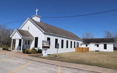
2. Pilgrim Rest Baptist Church Marker
Credits. This page was last revised on February 3, 2026. It was originally submitted on February 2, 2026, by Dave W of Co, Colorado. This page has been viewed 57 times since then. Photos: 1, 2. submitted on February 2, 2026, by Dave W of Co, Colorado. • James Hulse was the editor who published this page.
