
Islamorada in Monroe County, Florida — The American South (South Atlantic)
Yateras
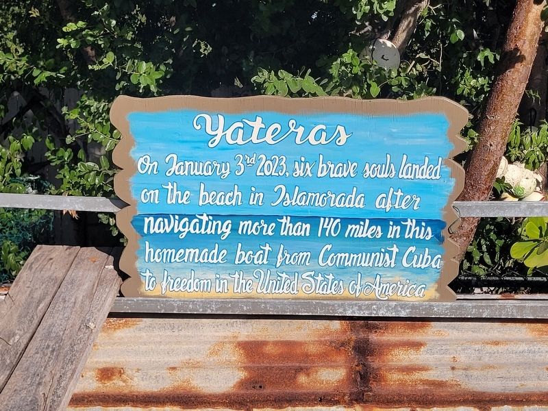
Photographed by James Hulse, January 10, 2026
1. Yateras Marker
Topics. This historical marker is listed in this topic list: Waterways & Vessels. A significant historical date for this entry is January 3, 2023.
Location. 24° 57.55′ N, 80° 34.289′ W. Marker is in Islamorada, Florida, in Monroe County. It is at the intersection of Overseas Highway (U.S. 1) and Gimpy Gulch Drive, on the right when traveling west on Overseas Highway. Touch for map. Marker is at or near this postal address: 86700 Overseas Hwy, Islamorada FL 33036, United States of America. Touch for directions.

Regionally, this marker is on the Florida Keys. It is also in the American South and on the Gulf Coast. Globally, it is in the North Atlantic Region, North America, a Gulf of Mexico state, the Western Hemisphere, the Western World, and the Anglosphere. Historically, it finds itself in what was once New Spain, the territory of the Mississippian Culture, one of the Confederate States of America, and the Antebellum South.
this page online
Other nearby markers. At least 8 other markers are within 5 miles of this marker, measured as the crow flies: Betsy the Lobster - History (a few steps from this marker); Plantation Key (about 700 feet away, measured in a direct line); Indian Wells (approx. 3.1 miles away); Yellow Submarine / Recompression Chamber (approx. 3.6 miles away); British Cannon circa 1600's (approx. 3.6 miles away); Site of Islamorada Railway Station (approx. 3.9 miles away); Lights of the Florida Keys (approx. 4.1 miles away); Indian Key (approx. 4.1 miles away). Touch for a list and map of all markers in Islamorada.
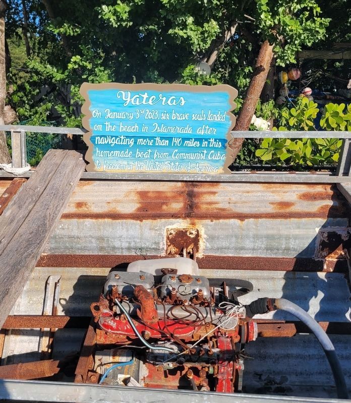
Photographed by James Hulse, January 10, 2026
2. Yateras Marker
The view of the small engine in the homemade boat.
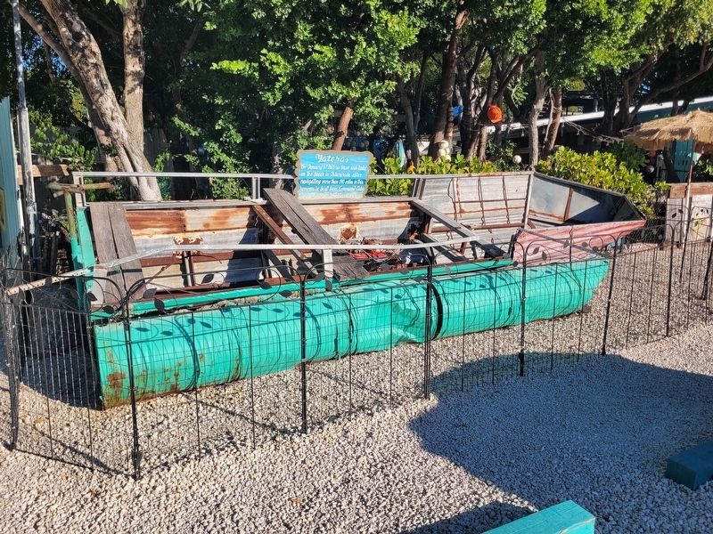
Photographed by James Hulse, January 10, 2026
3. Yateras Homemade Boat
Credits. This page was last revised on February 6, 2026. It was originally submitted on February 5, 2026, by James Hulse of Medina, Texas. This page has been viewed 37 times since then. Photos: 1, 2, 3. submitted on February 6, 2026, by James Hulse of Medina, Texas.
