
Telluride in San Miguel County, Colorado — The American Mountains (Southwest)
Flushing Out the Gold
Photographed by Cosmos Mariner, July 18, 2025
1. Flushing Out the Gold Marker
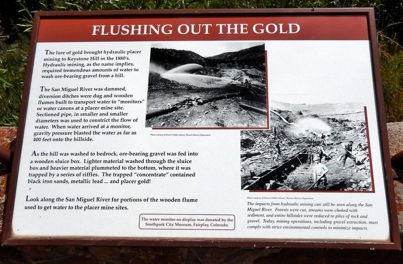
The lure of gold brought hydraulic placer mining to Keystone Hill in the 1880's. Hydraulic mining, as the name implies, required tremendous amounts of water to wash ore-bearing gravel from a hill.
The San Miguel River was dammed, diversion ditches were dug and wooden flumes built to transport water to “monitors” or water canons at a placer mine site. Sectioned pipe, in smaller and smaller diameters was used to constrict the flow of water. When water arrived at a monitor, gravity pressure blasted the water as far as 400 feet onto the hillside.
As the hill was washed to bedrock, ore-bearing gravel was fed into a wooden sluice box. Lighter material washed through the sluice box and heavier material plummeted to the bottom, where it was trapped by a series of riffles. The trapped “concentrate” contained black iron sands, metallic lead… and placer gold!
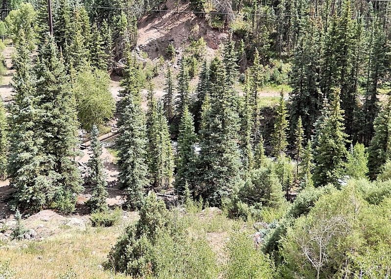
Look along the San Miguel River for portions of the wooden flume used to get water to the placer mine sites.
The water monitor on display was donated by the Southpark City Museum, Fairplay, Colorado.
Topics. This historical marker is listed in these topic lists: Environment
this page online
Location. 37° 56.924′ N, 107° 52.904′ W. Marker is in Telluride, Colorado, in San Miguel County. It is on State Highway 145 0.2 miles west of Nimbus Drive, on the left when traveling west. The marker is at the Keystone Hill Interpretive Site Overlook. Touch for map. Marker is in this post office area: Telluride CO 81435, United States of America. Touch for directions.

Regionally, this marker is in the Western Slope. It is also in the American Mountain West, on the Colorado Plateau, and at the Four Corners. Globally, it is in North America, the Rocky Mountains, the Western Hemisphere, the Western World, and the Anglosphere. Historically, it finds itself in what was once Mexico’s Alta California.
Other nearby markers. At least 8 other markers are within 4 miles of this marker, measured as the crow flies: Hear that Lonesome Whistle Blow (here, next to this marker); San Miguel Valley Bank Robbery (here, next to this marker); a different marker also named San Miguel Valley Bank Robbery (here, next to this marker); Tomboy Mine Office

Courtesy Denver Public Library, Western History Department
2. Marker detail: Hydraulic Placer Mining
The impacts from hydraulic mining can still be seen along the San Miguel River. Forests were cut, streams were choked with sediment, and entire hillsides were reduced to piles of rock and gravel. Today, mining operations, including gravel extraction, must comply with strict environmental controls to minimize impacts.
Also see . . . Telluride History (Western Mining History).
Excerpt: In the summer of 1874 Lon and Wm. Remine located what is now known as the Keystone placer. In 1874, after Lon had built his dugout, he was joined by John Eddy and a man by the name of Roache, who also built a dugout nearby, and the three spent the winter of 1874 in the park. Mountain sheep were plentiful during the winter along the bluffs of the river and fishing in the stream was good.(Submitted on February 9, 2026, by Cosmos Mariner of Cape Canaveral, Florida.)
More men came in during the year 1875, and prospecting along the gravel banks of tributaries of the river was quite brisk during the summer of 1875. In the fall and winter of '75 and '76, the news of the good gold prospects was carried to outside points, and in the spring of 76 the rush was quite considerable, bringing in many adventuresome men from Del Norte, Rosita and other mining camps of the state.
While the Keystoneplacer mine is not in the USGS database, it is almost certainly near the spot now known as Keystone Hill, where highway 145 splits and the spur heads east to Telluride.Courtesy Denver Public Library, Western History Department3. Marker detail: Hydraulic Placer Mining


Photographed by Cosmos Mariner, July 18, 2025
4. Flushing Out the Gold Marker
Looking southwest from the Keystone Hill Interpretive Site Overlook.
Photographed by Cosmos Mariner, July 18, 2025
5. Wooden Flume and Water Monitor Ruins
Wooden flume and water monitor ruins are visible alongside the San Miguel River – well below this interpretive lookout.
Credits. This page was last revised on February 9, 2026. It was originally submitted on February 6, 2026, by Cosmos Mariner of Cape Canaveral, Florida. This page has been viewed 54 times since then. Photos: 1, 2, 3, 4, 5. submitted on February 9, 2026, by Cosmos Mariner of Cape Canaveral, Florida.
