
Highland in Lake County, Indiana — The American Midwest (Great Lakes)
CommuniTree Tree Planting
Photographed by Daniel Barriball, February 7, 2026
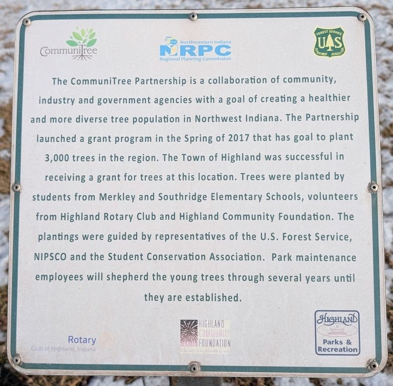
1. CommuniTree Tree Planting Marker
The CommuniTree Partnership is a collaboration of community, industry and government agencies with a goal of creating a healthier and more diverse tree population in Northwest Indiana. The Partnership launched a grant program in the Spring of 2017 that has goal to plant 3,000 trees in the region. The Town of Highland was successful in receiving a grant for trees at this location. Trees were planted by students from Merkley and Southridge Elementary Schools, volunteers from Highland Rotary Club and Highland Community Foundation. The plantings were guided by representatives of the U.S. Forest Service, NIPSCO and the Student Conservation Association. Park maintenance employees will shepherd the young trees through several years until they are established.
Erected 2017 by CommuniTree, Northwestern Indiana Regional Planning Commission, US Forest Service, Rotary Club of Highland, Highland Community Foundation, Highland Parks & Recreation.
Topics and series. This historical marker is listed in these topic lists: Charity & Public Work • Horticulture & Forestry • Parks & Recreational Areas. In addition, it
this page online
Location. 41° 34.029′ N, 87° 27.687′ W. Marker is in Highland, Indiana, in Lake County. It is on Kennedy Avenue north of 81st Street, on the right when traveling north. Touch for map. Marker is at or near this postal address: 8077 Kennedy Ave, Highland IN 46322, United States of America. Touch for directions.

Regionally, this marker is in Northwest Indiana and in the Calumet Region. It is also in the American Midwest and in the Corn Belt. Globally, it is in North America, on the Great Lakes, in the Western Hemisphere, in the Western World, and in the Anglosphere. Historically, it finds itself in what was once the territory of the Mississippian Culture and also the Northwest Territory.
Other nearby markers. At least 8 other markers are within 2 miles of this marker, measured as the crow flies: Hammond Optimist Club (approx. ¼ mile away); Dune Wall (approx. ¼ mile away); Metasequoia (Dawn Redwood) (approx. 0.9 miles away); The Hoosier Flag Lady (approx. 0.9 miles away); Highway of Flags Servicemen's Memorial (approx. one mile
Photographed by Daniel Barriball, February 7, 2026
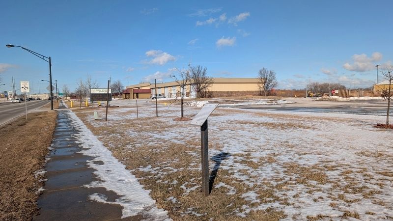
2. CommuniTree Tree Planting Marker in context
Also see . . . CommuniTree Partnership. Rotary/ESRAG official website A brief account of the tree planting described in the marker. (Submitted on February 7, 2026, by Daniel Barriball of Chesterton, Indiana.)
Credits. This page was last revised on February 9, 2026. It was originally submitted on February 7, 2026, by Daniel Barriball of Chesterton, Indiana. This page has been viewed 53 times since then. Photos: 1, 2. submitted on February 7, 2026, by Daniel Barriball of Chesterton, Indiana. • Devry Becker Jones was the editor who published this page.
