
Williamsport in Columbiana County, Ohio — The American Midwest (Great Lakes)
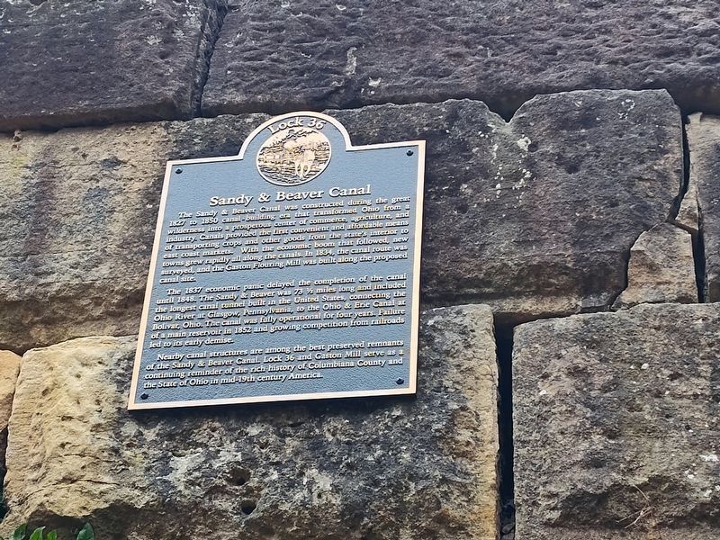
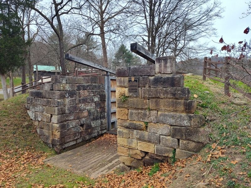
Lock 36
Sandy & Beaver Canal
Photographed by Craig Doda, November 15, 2025
1. Lock 36 Marker
The Sandy & Beaver Canal was constructed during the great 1827 to 1850 canal building era that transformed Ohio from a wilderness into a prosperous center of commerce, agriculture, and industry. Canals provided the first convenient and affordable means of transporting crops and other goods from the state's interior to east coast markets. With the economic boom that followed, new towns grew rapidly all along the canals. In 1834, the canal route was surveyed, and the Gaston Flouring Mill was built along the proposed canal site.
The 1837 economic panic delayed the completion of the canal until 1848. The Sandy & Beaver was 73 ½ miles long and included the longest canal tunnel built in the United States, connecting the Ohio River at Glasgow, Pennsylvania, to the Ohio & Erie Canal at Bolivar, Ohio. The canal was fully operational for four years. Failure of a main reservoir in 1852 and growing competition from railroads led to its early demise.
Nearby canal structures are among the best preserved remnants of the Sandy & Beaver Canal Lock 36 and Gaston Mill serve as a continuing reminder of the rich history of Columbiana
this page online
Topics and series. This historical marker is listed in these topic lists: Industry & Commerce • Waterways & Vessels. In addition, it is included in the Ohio and Erie Canal series list. A significant historical year for this entry is 1827.
Location. 40° 43.633′ N, 80° 36.707′ W. Marker is in Williamsport, Ohio, in Columbiana County. It is on Echo Dell Road (County Road 929) south of Leslie Road, on the right when traveling south. Touch for map. Marker is at or near this postal address: 12013 Echo Dell Rd, East Liverpool OH 43920, United States of America. Touch for directions.

Regionally, this marker is in Ohio’s Mahoning Valley. It is also in the American Midwest, in the Ohio River Valley, in Appalachia, and specifically in Northern Appalachia. Globally, it is in North America, the Western Hemisphere, the Western World, and the Anglosphere. Historically, it finds itself in what was once the Viceroyalty of New France, the Haudenosaunee (Iroquois) Confederacy, the territory of the Mississippian Culture, and the Northwest Territory.
Other nearby markers. At
Photographed by Craig Doda, November 15, 2025
2. Lock 36 Marker
Credits. This page was last revised on February 9, 2026. It was originally submitted on February 8, 2026, by Craig Doda of Napoleon, Ohio. This page has been viewed 50 times since then. Photos: 1, 2. submitted on February 8, 2026, by Craig Doda of Napoleon, Ohio. • Devry Becker Jones was the editor who published this page.
