
Portsmouth, Virginia — The American South (Mid-Atlantic)
Gaskins Silversmith Shop
James Gaskins, Portsmouth Silversmith (1756 - 1827)
| — | Path of History Portsmouth, VA | — |
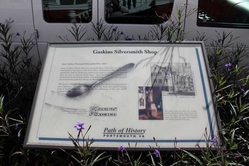
Photographed by Evan Dwyer, October 18, 2025
1. Gaskins Silversmith Shop Marker
The house is of English Basement style, providing three floors from ground level and a basement. The small street adjacent to the home was named Gaskins Lane in honor of the silversmith during the celebration of the city's 250th birthday in 2002.
(captions)
Maker's marks used by James Gaskins. A mark was stamped on many of the silver objects he produced.
This photo shows the former site of James Gaskins' silversmith shop, which stood to the rear of his home. By the 1950's (when this photo was taken) the forge and foundation were all that remained of his shop.
Gaskins' House, c. 1940 Photos courtesy of Portsmouth Public Library
Topics. This historical marker is
this page online
Location. 36° 50.306′ N, 76° 18.024′ W. Marker is in Portsmouth, Virginia. It is on North Street east of Court Street, on the right when traveling west. Touch for map. Marker is at or near this postal address: 316 North Street, Portsmouth VA 23704, United States of America. Touch for directions.

Regionally, this marker is in Virginia’s Hampton Roads, specifically in Coastal Virginia, and in the Hampton Roads Metropolitan Area. It is also in the American South, specifically in the Upper South, in the Tidewater, and on the Eastern Seaboard. Globally, it is in the North Atlantic Region, North America, the Western Hemisphere, the Western World, and the Anglosphere. Historically, it finds itself in what was once the territory of the Mississippian Culture, one of the original Thirteen Colonies, one of the Confederate States of America, and the Antebellum South.
Other nearby markers. At least 8 other markers are within walking distance of this marker: Elks Lodge (within shouting distance of this marker); Pre-Fabricated Houses (about 300 feet away, measured in a direct line); Ball House (about 500 feet away); Watts House (about 500 feet away); The Yellow Fever of 1855 (about 500 feet away); Glasgow Street Park (about 500 feet away); a different marker also named Glasgow Street Park (about 600 feet away); Francis Grice 1789 - 1865 (about 600 feet away). Touch for a list and map of all markers in Portsmouth.
Credits. This page was last revised on February 11, 2026. It was originally submitted on February 10, 2026, by Evan Dwyer of Richmond, Virginia. This page has been viewed 58 times since then. Photo 1. submitted on February 10, 2026, by Evan Dwyer of Richmond, Virginia. • Bernard Fisher was the editor who published this page.
