Norfolk Naval Shipyard in Portsmouth, Virginia — The American South (Mid-Atlantic)
Assisting Mariners with Navigation
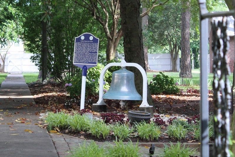
1. Assisting Mariners with Navigation Marker
Photographed from the gate using an iphone zoom function.
Depending on location and installation, lighthouse bells generally ranged in size from 200 to 4,000 pounds. Cast in 1889 by a Baltimore foundry, this 1,365 pound bell served in an East Coast lighthouse. In the early days, the lighthouse keeper or an assistant rang the bell by hand. However, by the late 1800s , the Lighthouse Service automated bell striking using machinery governed by clockwork. This bell is inscribed with the letters "USLHE" indicating that it was produced for the United States Lighthouse Establishment,
this page online
Topics and series. This historical marker is listed in these topic lists: Communications • Waterways & Vessels. In addition, it is included in the Historic Bells series list.
Location. 36° 49.602′ N, 76° 17.839′ W. Marker is in Portsmouth, Virginia. It is in Norfolk Naval Shipyard. It can be reached from Lincoln Street 0.1 miles east of 3rd Street. This marker is WITHIN the secured perimeter of Norfolk Naval Shipyard at Quarters B. However, it can be seen by public passerby from the sidewalk through the access gate to the Quarters B yard. There is no closer permissible access to visitors than the gate. Touch for map. Marker is at or near this postal address: 212 Barron Street, Portsmouth VA 23709, United States of America. Touch for directions.

Regionally, this marker is in Hampton Roads, specifically in Coastal Virginia, and in the Hampton Roads Metropolitan Area. It is also in the American South, specifically in the Upper South, in the Tidewater, and on the Eastern Seaboard. Globally,

Photographed by Evan Dwyer, June 2, 2024
2. Quarters B
To see this marker, the only option (unless you're a resident of, or a guest to, Quarters B) is to look through the barred old door in the fenceline at left. The marker and bell are about 30' inside the gate on the sidewalk and clearly visible.
Other nearby markers. At least 8 other markers are within walking distance of this marker: Norfolk Naval Shipyard (within shouting distance of this marker); a different marker also named Norfolk Naval Shipyard (within shouting distance of this marker); a different marker also named Norfolk Naval Shipyard (about 300 feet away, measured in a direct line); a different marker also named Norfolk Naval Shipyard (about 300 feet away); a different marker also named Norfolk Naval Shipyard (about 300 feet away); a different marker also named Norfolk Naval Shipyard (about 300 feet away); a different marker also named Norfolk Naval Shipyard (about 400 feet away); Historical Marker (about 400 feet away). Touch for a list and map of all markers in Portsmouth.
Credits. This page was last revised on February 19, 2026. It was originally submitted on February 10, 2026, by Evan Dwyer of Richmond, Virginia. This page has been viewed 49 times since then. Photos: 1, 2. submitted on February 10, 2026, by Evan Dwyer of Richmond, Virginia. • Andrew Ruppenstein was the editor who published this page.
Editor’s want-list for this marker. Better photo of the marker • Can you help?
