Buena Vista in Chaffee County, Colorado — The American Mountains (Southwest)
Mountain Getaways
| — | Collegiate Peaks Scenic and Historic Byway | — |
Photographed by Cosmos Mariner, July 22, 2025
1. Mountain Getaways Marker
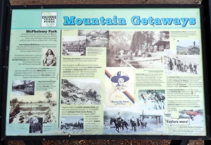
The beauty and majesty of the landscape intrigued locals and visitors from Buena Vista's earliest days.
Early newspapers touted everything from the scenery to the local hot springs, encouraging outdoor recreation and tourism via stagecoach, rail, and eventually automobile. Even in the 1800s families scrambled up the peaks for a picnic, attired in their Sunday best rather than today's high-tech sporting gear.
Elegant carriages took scenic mountain drives, and early autos braved primitive roads. U.S. 24 through BV, now the Collegiate Peaks Scenic Byway, was built in 1932 and paved in 1937. Following WW II, many discovered the off-road adventure of 4-wheel “jeeping” in army surplus vehicles, and high-country 4-wheeling was born.
Summer camps introduced young people to rigorous mountain life. In 1923 Mrs. Byrd Fuqua of St. Louis began a camp for “over-privileged boys” at her Byrd Colony on Chalk Creek. Round-Up Lodge, founded in 1926 by Dr. Marquard, a St. Louis dentist, became Young Life's Frontier Ranch in 1951. Marquard's personal hunting lodge and an adjacent ranch became the Adventure Unlimited youth camps in the mid-1950s.
this page online
The Collegiate Peaks drew scientific explorers from eastern Ivy League colleges. Mount Harvard was named by surveyor and geology Professor J.D. Whitney to honor Harvard University, which funded one of the first survey parties. Today, Chaffee County's 15 “fourteeners” — peaks over 14,000 feet in elevation — attract “peak baggers” from around the globe.
The Buena Vista Pack Burro race, held every August during Gold Rush Days, celebrates the burro’s contribution to the area's mining heritage. Competitors run 13.5 miles with burros loaded with 33 pounds of mining gear, including a gold pan, pick and shovel on the pack saddle.
The Arkansas River offers excellent fishing, quiet solitude or high adventure. The river is one of the most popular whitewater rafting destinations in the United States. BV's river trails offer views of six challenging playholes where kayakers hone their skills.
McPhelemy Park
McPhelemy Park has hosted community events for more than 100 years. It was part of a ranch first owned by Frank Loan and later sold to James McPhelemy. McPhelemy donated some of his land to the city of Buena Vista in 1878-1879.
Irish immigrant
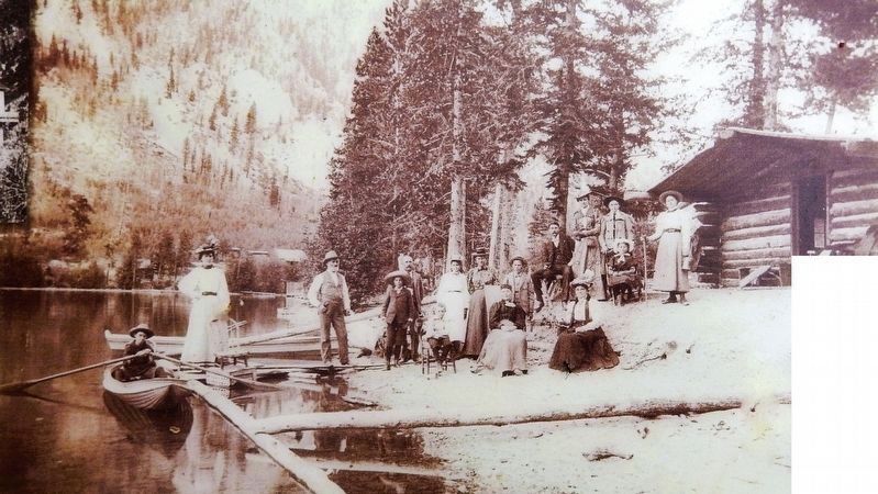
2. Marker detail: Cottonwood Colony Cabins
On Cottonwood Lake, built originally by miners, provided a cool summer get-away for vacationers from the Front Range and distant states, as well as for locals.
The McPhelemy family built a 3-room log cabin and extended their hospitality to all. Ute Chief Colorow was a frequent visitor — he was known to be fond of Mrs. McPhelemy's sweet biscuits.
James McPhelemy was postmaster early on, when the community was named Mahonville, and later was postmaster of Buena Vista. A one-room cabin was built on the McPhelemy ranch for the growing town's first school in 1878. Daughter Alice McPhelemy was the first teacher.
The Buena Vista Community House in McPhelemy Park occupied the site of today's restored historic depot. The adjacent Town Lake was formed when the Cottonwood Creek dam was built in the 1890s.
[photo captions]
• Hot springs are plentiful in the area.
• Mt Princeton Hot Springs and Heywood Hot Springs in Chalk Creek Canyon and Cottonwood Hot Springs on the Cottonwood Pass Road drew tourists from across the country.
• 1899 mountain climbers dressed up for their ascent to Mt. Princeton’s Maxwell Basin.
• Cottonwood Colony Cabins
•
Photographed by Cosmos Mariner, July 22, 2025
3. Mountain Getaways Marker
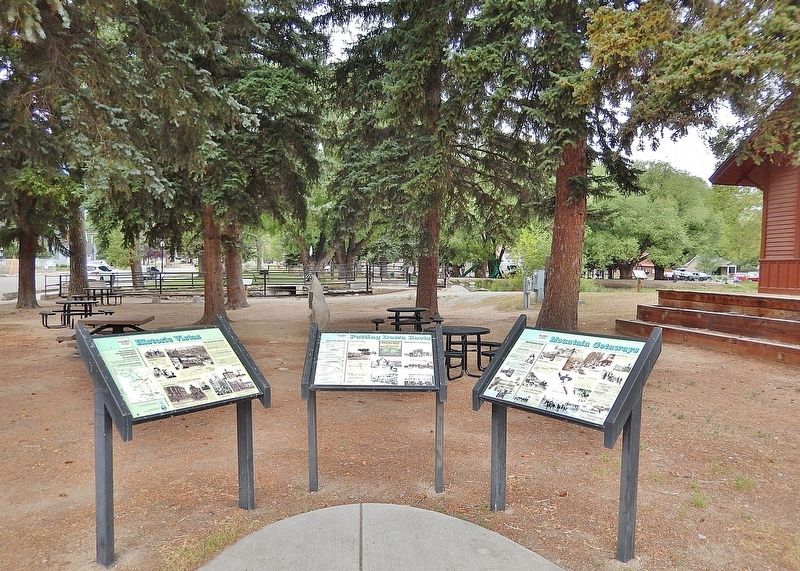
Looking west from US Highway 24 across the south end of McPhelemy Park. The Historic Buena Vista Railroad Depot is partially visible in the right background. This marker is the rightmost of three interpretive panels at this location.
• The Buena Vista Community House
• Mary McPhelemy, a daughter of James McPhelemy, in 1952
Be sure to visit the Buena Vista Chamber of Commerce Visitor Center and the Buena Vista Heritage Museum in the venerable courthouse building on East Main Street.
Topics. This historical marker is listed in these topic lists: Education • Industry & Commerce • Parks & Recreational Areas • Settlements & Settlers. A significant historical year for this entry is 1864.
Location. 38° 50.517′ N, 106° 7.975′ W. Marker is in Buena Vista, Colorado, in Chaffee County. It is at the intersection of U.S. 24 and West Main Street, on the right when traveling south on U.S. 24. The marker is beside the sidewalk, at the southeast corner of McPhelemy Park. Touch for map. Marker is at or near this postal address: 220 US Highway 24 North, Buena Vista CO 81211, United States of America. Touch for directions.

Regionally, this marker is in the Arkansas River Valley, in the Colorado High Rockies and on the Continental Divide. It is also in the American Mountain West. Globally, it is in North America, the Rocky Mountains, the Western Hemisphere, the Western World, and the Anglosphere.
Other nearby markers. At least 8 other markers are within walking distance of this marker: Putting Down Roots (here, next to this marker); Historic Vistas (here, next to this marker); William Joseph Walsh (a few steps from this marker); World War I Memorial (within shouting distance of this marker); Grace Church (about 400 feet away, measured in a direct line); Town Hall (about 400 feet away); Historic St. Rose of Lima Catholic Church (approx. ¼ mile away); Chaffee County Jail (approx. 0.3 miles away). Touch for a list and map of all markers in Buena Vista.
Credits. This page was last revised on February 12, 2026. It was originally submitted on February 11, 2026, by Cosmos Mariner of Cape Canaveral, Florida. This page has been viewed 94 times since then. Photos: 1, 2, 3. submitted on February 11, 2026, by Cosmos Mariner of Cape Canaveral, Florida.
