Near Groesbeck in Limestone County, Texas — The American South (West South Central)
Cox Cemetery

Photographed by James Hulse, February 10, 2026
1. Cox Cemetery Marker
Grave markers indicate that military veterans, including some from the Civil War, and members of the Masonic Lodge and the Order of the Eastern Star, are among those buried here. In addition to Cox, early area family names associated with the cemetery include Hastings, Herod, White, Wright, Henderson, Glover, Yarbrough, Hunter, Brown, Lewis, Roberts and Unfried.
The graveyard today is maintained by a community cemetery association. Since the 1880s, area residents have held an annual memorial, which gives descendants and relatives opportunities to reunite and to celebrate families, friends, neighbors and the area's rich history.
Erected 2002
this page online
Topics. This historical marker is listed in this topic list: Cemeteries & Burial Sites. A significant historical month for this entry is February 1870.
Location. 31° 24.521′ N, 96° 25.294′ W. Marker is near Groesbeck, Texas, in Limestone County. It is on Farm to Market Road 3371 0.2 miles east of E Navasota (Farm to Market Road 937), on the left when traveling east. Touch for map. Marker is in this post office area: Groesbeck TX 76642, United States of America. Touch for directions.

Regionally, this marker is in the Prairies & Lakes Region. It is also in the American South. Globally, it is in North America, a Gulf of Mexico state, the Western Hemisphere, the Western World, and the Anglosphere. Historically, it finds itself in what was once New Spain, the Republic of Texas, one of the Confederate States of America, and the Antebellum South.
Other nearby markers. At least 8 other markers are within 6 miles of this marker, measured as the crow flies: Old Union Community (approx. 0.9 miles away); Site of Old Potter's Shop (approx. 3.2 miles away); Site of Oletha Common School (approx.

Photographed by James Hulse, February 10, 2026
2. Cox Cemetery Marker

Photographed by James Hulse, February 10, 2026
3. Cox Cemetery Marker - 2nd Plaque on the ground
Photographed by James Hulse, February 10, 2026
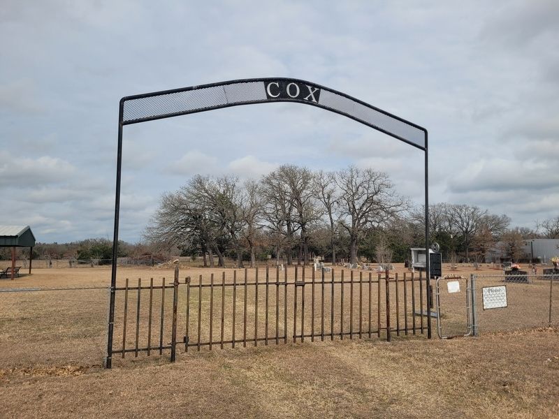
4. Cox Cemetery Marker
The view of the entrance to the cemetery.
Credits. This page was last revised on February 13, 2026. It was originally submitted on February 12, 2026, by James Hulse of Medina, Texas. This page has been viewed 58 times since then. Photos: 1, 2, 3, 4. submitted on February 13, 2026, by James Hulse of Medina, Texas.
