Mille Lacs Kathio State Park near Onamia in Mille Lacs County, Minnesota — The American Midwest (Upper Plains)
Logging the Pines
Late 1800s - Early 1900s
| — | Kathio Landmark Trail: The Forest through Time | — |
Photographed by McGhiever, May 29, 2025
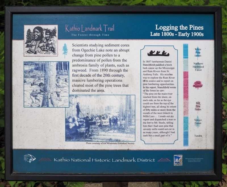
1. Logging the Pines Marker
Scientists studying sediment cores from Ogechie Lake note an abrupt change from pollen to a predominance of pollen from the ambrosia family of plants, such as ragweed. From 1890 through the first decade of the 20th century, massive lumbering operations cleared most of the pine trees that dominated the area.
In 1847 lumberman Daniel Stanchfield paddled a birch bark canoe up the Mississippi and Rum Rivers from St. Anthony Falls. His mission was to explore the Rum River to its source and to report on pine lumbering opportunities. In his report, Stanchfield wrote of the forest he saw:
"The pine on the main river reached from the shore, on each side, as far as the eye could see form the top of the highest tree, all along its extent of fifty miles or more from the mouth of the west branch to Mille Lacs … I made out my report and dispatched a man to the fort to Mr. Steele, telling him that I had seen pine that seventy mills could not cut in as many years, although I had seen but a small part of it."
• White Pine Forest
• Northern Hardwood Forest
• Oak Savanna
• Red Pine Forest
• Spruce Forest
• Tundra
Erected 2013
this page online
Topics. This historical marker is listed in these topic lists: Environment • Exploration • Horticulture & Forestry. A significant historical year for this entry is 1890.
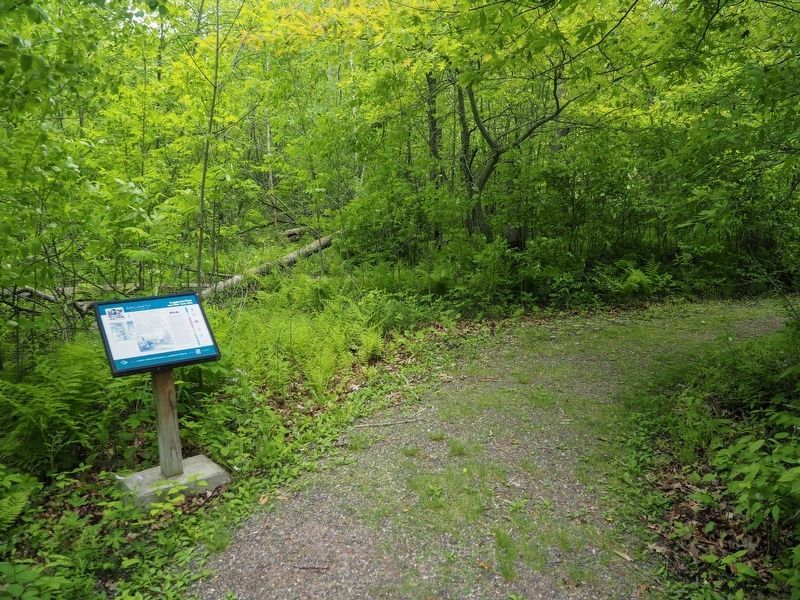
Location. 46° 8.838′ N, 93° 46.237′ W. Marker is near Onamia, Minnesota, in Mille Lacs County. It is in Mille Lacs Kathio State Park. It can be reached from no nearby street. The marker is on the east loop of the Kathio Landmark Trail. Touch for map. Marker is in this post office area: Onamia MN 56359, United States of America. Touch for directions.

Regionally, this marker is in Central Minnesota. It is also in the American Midwest and in the Corn Belt. Globally, it is in North America, the Western Hemisphere, the Western World, and the Anglosphere. Historically, it finds itself in what was once Rupert’s Land, the territory of the Mississippian Culture, and the Northwest Territory.
Other nearby markers. At least 8 other markers are within walking distance of this marker: A Living Laboratory (a few steps from this marker); Ogechie Lake (within shouting distance of this marker); White Pine Forest
Photographed by McGhiever, May 29, 2025
2. Logging the Pines Marker on the Kathio Landmark Trail
Credits. This page was last revised on February 15, 2026. It was originally submitted on February 15, 2026, by McGhiever of Minneapolis, Minnesota. This page has been viewed 32 times since then. Photos: 1, 2. submitted on February 15, 2026, by McGhiever of Minneapolis, Minnesota.
