Warwick in Newport News, Virginia — The American South (Mid-Atlantic)
Skirmish at Waters Creek
Photographed by Bernard Fisher, July 31, 2010
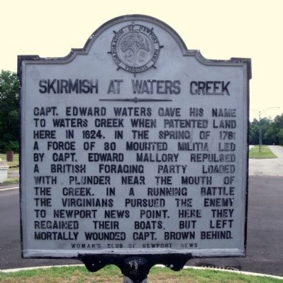
1. Skirmish At Waters Creek Marker
Capt. Edward Waters gave his name to Waters Creek when patented land here in 1624. In the spring of 1781 a force of 30 mounted militia led by Capt. Edward Mallory repulsed a British foraging party loaded with plunder near the mouth of the creek. In a running battle the Virginians pursued the enemy to Newport News Point. Here they regained their boats, but left mortally wounded Capt. Brown behind.
Erected by Woman's Club of Newport News.
Topics and series. This historical marker is listed in these topic lists: Colonial Era • War, US Revolutionary. In addition, it is included in the Virginia, Corporation of Newport News series list. A significant historical year for this entry is 1624.
Location. Marker is missing. It was located near 37° 2.46′ N, 76° 29.201′ W. Marker was in Newport News, Virginia. It was in Warwick. It was on Museum Drive 0.3 miles west of Boundary Road, in the median. Touch for map. Marker was in this post office area: Newport News VA 23606, United States of America. Touch for directions.

Regionally, this marker was on Virginia’s Peninsula, in Hampton Roads, in Coastal Virginia, and in
this page online
Other nearby markers. At least 8 other markers are within walking distance of this location: Skirmish at Cedar Lane (within shouting distance of this marker); Capture of the 'Patriot' (about 600 feet away, measured in a direct line); The Longleaf Pine (approx. 0.2 miles away); Lt. Col. Charles D. Dreux (approx. 0.7 miles away); Admiralty Pattern Anchor (approx. 0.9 miles away); USS Monitor: America's First Ironclad (approx. 0.9 miles away); Sloop La Nube (approx. 0.9 miles away); US Navy Admiralty Pattern Anchor (approx. one mile away). Touch for a list and map of all markers in Newport News.
Other markers no longer nearby. Walking Beam and A-Frame
Photographed by Bernard Fisher, July 31, 2010
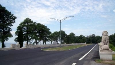
2. Museum Drive at Lions Bridge
More about this marker. Following repairs to Lion's Bridge, this marker has not been re-installed.
Credits. This page was last revised on February 16, 2026. It was originally submitted on August 3, 2010, by Bernard Fisher of Richmond, Virginia. This page has been viewed 1,398 times since then and 51 times this year. Last updated on February 15, 2026, by Evan Dwyer of Richmond, Virginia. Photos: 1, 2. submitted on August 3, 2010, by Bernard Fisher of Richmond, Virginia. • Devry Becker Jones was the editor who published this page.
